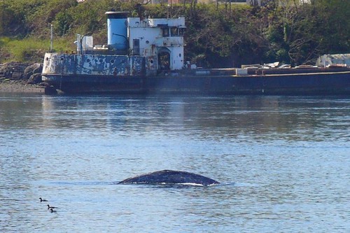
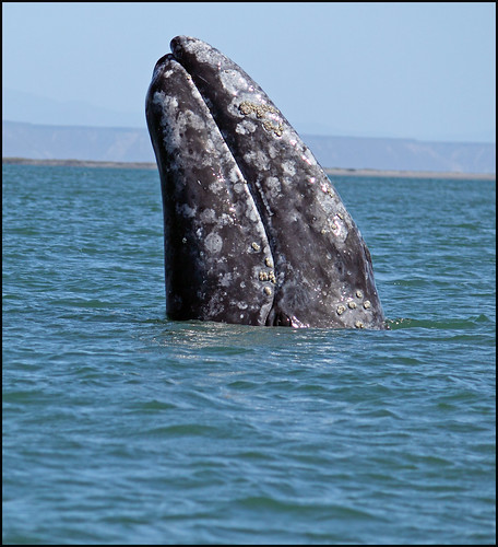
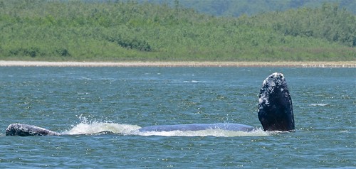
The annual gray whale migration is under way with many sightings of gray whales entering Strait of Juan de Fuca, between the Olympic Peninsula, Washington and British Columbia, Canada. Whale watchers will have plenty of opportunities in March/April to see gray whales just off shore around sandy bottom beaches. Gray Whales are baleen whales that migrate between feeding and breeding grounds annually. They can weigh upwards of 35 tons and reach a length of 50 feet. Gray whales feed mainly on crustaceans by turning on their side (usually the right side resulting in blindness of the right eye in many mature whales) and scooping up soft sediments from the seafloor. Then the gray whale uses it large tongue to press up against its baleen or whale bone, pushing out the water leaving shrimp and crustaceans behind to swallow.
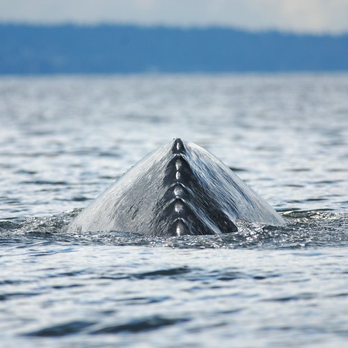
How to spot Gray Whales? Because gray whales have a relatively flat profile in the water without a dorsal fin, having 6 to 12 crenulations "knuckels" instead, it can be more difficult to see them swimming in the deep waters of the puget sound. The feeding grounds for gray whales are in shallow waters between 5 and 20 feet in depth. This brings them in fairly close to beaches around the puget sound such as Edmonds, Kingston, Hoods Canal, Bremerton, Mukilteo and Everett and around many of the San Juan Islands. In calm wind conditions you may be able to spot a gray whale exhaling after its dive. They have two blowholes on top of their head, which creates a distinctive V-shaped blow out at the surface.
While scooping up sediment on their side often you can see the left flipper exposed and the fluke thrashing in the water propelling the whale forward.
Dorsal Knuckles of a Gray Whale, Whidbey Island Minette Layne
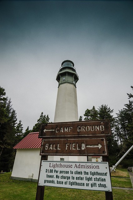
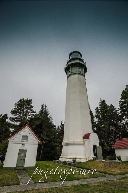
The Grays Harbor Inlet is one of the few along Washington State's coastline to allow ocean going vessels to enter without having to sail up a difficult river or channel. The towns of Hoquiam, Westport and Aberdeen saw increased growth and revenue from the booming timber industry in the late 1800s. By 1880s a number of ships had wreck near the entrance to Grays harbor and local representatives headed to Washington to ask law makers for funds to construct a lighthouse to aid in navigation and protect their lumbar industry.
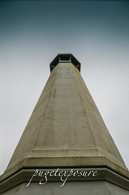
After 14 years of funding issues and construction delays the 107 foot brick and mortar lighthouse was built on a tract of land 400 feet from the break water. Over the past 100 years storms and sediment accretion from the jetty protruding from the entrance to Grays Harbor have deposited nearly 3000 feet of sand in front of the lighthouse. Currently Grays Harbor Lighthouse sits 4 blocks from the ocean hidden amongst the trees with only its light tower rising above the tree line.
There are 135 metal stair bolted to the brick interior which take depending on your fitness level about 10 minutes to ascend.
There is no fee to lighthouse grounds or gift shop but it will cost you $5 and some sweat to get to the top of the lighthouse.
Garys Harbor Lighthouse with fog signal building Photograph courtesy University Washington
Please Support Puget Exposure
We love to bring you guys the updates to best and greatest photography locations in and around Seattle and the greater Puget Sound area, photography tips and gear related stuff. However, we can’t keep doing that unless we have your continued support. If you would like to purchase any of images featured in an article, please do so by clicking HERE or on the Post Cards and Prints tab above in the header. You can also make secure donation to the travel fund via PayPal. If you frequently shop on Amazon.com, by clicking on the Amazon links listed below you can continue to browse Amazon and any purchase you make will give us a small portion of the sale to continue to run this website.
Banner Links for PEP
Gear Used:
Washington State travel, Washington State travel, Washington Destinations, Photography, Photography spots, best things to do in Seattle, Best things to in Washington State, Washington Tourism Alliance, Washington State Tourism board, recommendations, recommendations for things to see in washington state, things to do in washington state, things to do in seattle, things to do in Tacoma washington, Washington Photographers, Washington nikon shooters, best seattle photography, washington exploration, experience washington, what to do while visiting seattle, seattle top attractions, seattle food, Space Needle, Explore Washington State, Puget Exposure Photography, Puget Exposure, Road Trips through Washington State, Weird Washington, King County, Snohomish County, Seattle, Everett, Tacoma, Kent, Redmond, Kirkland, Washington Sunrises where and when, Washington State Weather, Grays Harbor, Grays Harbor Lighthouse, Washington State Tallest Lighthouse, Westport, Washington, Lighthouses
Long Beach Peninsula was established into a resort area in the 1880s by Henry Harrison Tinker who invested monies into land claims, built hotels and infrastructure to attract vacationers from the Portland area to western Washington's coast. People would board a ship in Portland, Oregon and float down the Columbia River to the Port of Ilwaco and would ride on horse drawn wagons up to "Tinkerville" now called Long Beach. In 1889 the Ilwaco Railway and Navigation Company laid a narrow gauge railroad that ran up the whole peninsula which was in service until 1930 when automobiles and the push for a national highway system arrived in western Washington.
The 28 mile long peninsula lies between the Pacific Ocean and Willapa Bay is known for its abundant seafood harvest including the largest salmon run in the world, razor clams, halibut, cod and oysters. Half of the oysters harvested in the State of Washington come from the Long Beach Peninsula.
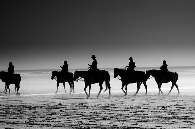
The soft yellow sand and warm summer temperatures attracted thousands of visitors to make the 8 hour ship/train voyage to Long Beach back in the late 1880s. Today people still converge on Long Beach for its resort town feel. Although there are no longer horse drawn wagons making their way up and down the beach you can still bring your own horse or take a guided horse back ride on the beach. Restaurants, museums, gift shops and kite shops keep downtown Long Beach bustling in the summer months.
There are around 1,300 people that live year round in Long Beach but during the summer months population numbers swell as tourists, vacationers and vacation home owners arrive in great numbers.
There are many fishing, food, and kite flying festivals that are held at Long Beach every year.
Although the temperatures can reach the mid 80s in the summer the pacific ocean is still very for swimmers but the wide beaches and boardwalk make beach walking easy and fun.
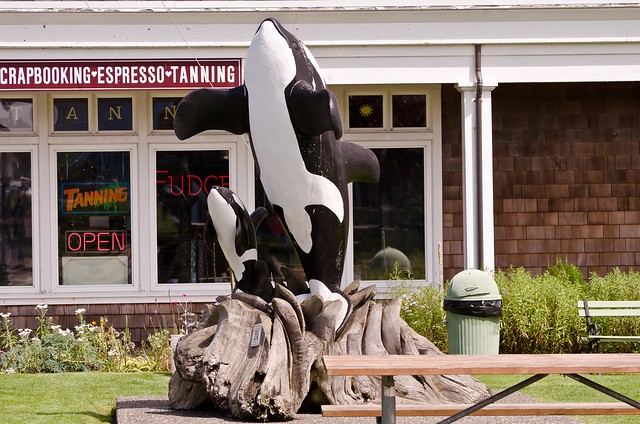
Orca Statue downtown Long Beach
former "World's Largest Frying Pan" cast for the Razor Clam festival in 1941
Jake the Alligator Man Mural in Fish Alley
Evening Beach Trot
Please Support Puget Exposure
We love to bring you guys the updates to best and greatest photography locations in and around Seattle and the greater Puget Sound area, photography tips and gear related stuff. However, we can’t keep doing that unless we have your continued support. If you would like to purchase any of images featured in an article, please do so by clicking HERE or on the Post Cards and Prints tab above in the header. You can also make secure donation to the travel fund via PayPal. If you frequently shop on Amazon.com, by clicking on the Amazon links listed below you can continue to browse Amazon and any purchase you make will give us a small portion of the sale to continue to run this website.
Banner Links for PEP
Gear Used:
Washington State travel, Washington State travel, Washington Destinations, Photography, Photography spots, best things to do in Seattle, Best things to in Washington State, Washington Tourism Alliance, Washington State Tourism board, recommendations, recommendations for things to see in washington state, things to do in washington state, things to do in seattle, things to do in Tacoma washington, Washington Photographers, Washington nikon shooters, best seattle photography, washington exploration, experience washington, what to do while visiting seattle, seattle top attractions, seattle food, Space Needle, Explore Washington State, Puget Exposure Photography, Puget Exposure, Road Trips through Washington State, Weird Washington, King County, Snohomish County, Seattle, Everett, Tacoma, Kent, Redmond, Kirkland, Washington Sunrises where and when, Washington State Weather, Long Beach Washington, history of long beach, jake the snake fish, meet jake
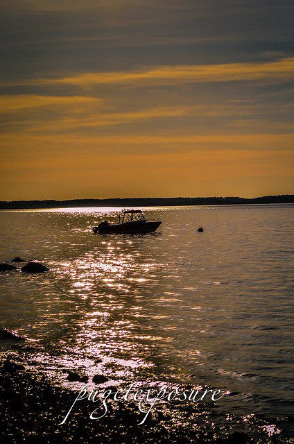
Located on the north west corner of Camano Island, west Utsalady Bay, the Maple Grove Boat Ramp offers salt water access to boaters and kayakers. There are 5 parking stalls for vehicles and 15 for trailers. Be careful you park in the appropriate parking place or you might get towed especially during fishing season. As with any beach along the Puget Sound tidal flows will increase or decrease the size of the beach. There are stairs that lead you from the parking lot down to the rocky beach. The beach during low tide is about 400 yards wide.
Maple Grove is about 10 minutes from English Boom Reserve and offers open western views to Oak Harbor, Whidbey Island, Crescent Bay and Skagit Bay.
This is one of the few areas to have public access to salt water on the north end of Camano Island. Much of the western and northern shoreline are private property or belong to gated communities that prohibit the public from the beach.
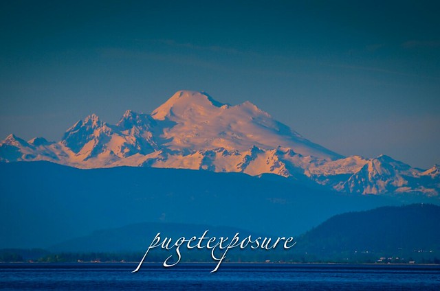
Maple Grove offers views of Mount Bakers south western slope, Whidbey Island, Skagit Bay and Crescent Harbor.
Western Slope of Mount Baker during sunset "Golden Hour"
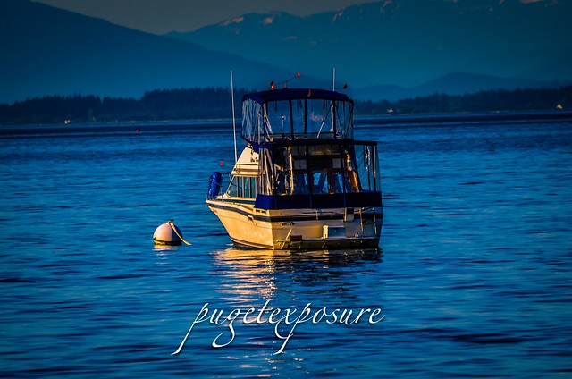
mooring buoy off of Maple Grove
Sun Glare looking over at Oak Harbor, Whidbey Island
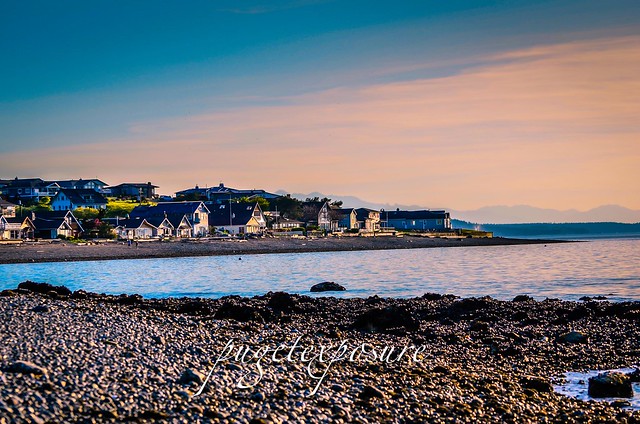
Maple Grove Residences
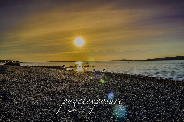
Sunset Sunburst over Whidbey Island, WA
Gear Used:
Washington State travel, Washington State travel, Washington Destinations, Photography, Photography spost, best things to do in Seattle, Best things to in Washington State, Washington Tourism Alliance, Washington State Tourism board, recommendations, recommendations for things to see in washington state, things to do in washington state, things to do in seattle, things to do in Tacoma washington, Washington Photographers, Washington nikon shooters, best seattle photography, washington exploration, experience washington, what to do while visiting seattle, seattle top attractions, seattle food, Camano Island Washington, Camano Island Public Beaches, Kayaking on Camano Island, Camano Island Public Boat Ramps, Maple Grove Boat Ramp, North end of Camano Island, Camano Island Photographers, Camano Island Photography, Boating in Skagit Bay, Boating in Crescent Bay, Fishing on Camano Island
Amenities
• Picnic/BBQ
• Trails
• Viewpoint
• Playground
• Tennis
• Restrooms
• Fishing
• Saltwater access
• Off-leash area (North beach only; turn right at foot of trestle and go past creek)
Park hours6 a.m.-10 p.m. April 1-Oct. 31
6 a.m.-8 p.m. Nov. 1-March 31
It is beautiful here!!! If you park in the upper parking lot by the
playground, you can walk through a beautiful forest on a trail with
built in stairs and bridges while the creek babbles away on the side of
the trail. After you reach the area to access the beach, you walk
across a sky bridge over some railroad tracks which ends on a tall
platform overlooking a very large beach and a beautiful view of the
Puget Sound and islands. About 11 sets of winding steps take you down
to the sand where you can either go left or right. Either way, there is
usually plenty of beach for everyone and it isn't all packed the way
most other beaches are. It is fairly peaceful and relaxing. BNSF at
commuter trains go by and it is nice to either walk the beach or just
sit and look at the water. As with most puget sound
beaches the open area depends on current tide conditions. This beach can
go from 10 feet during high tide to a couple a hundred of feet during
low tide. Before heading to Howarth Park its important to know the current tide levels. During High Tide there is no access to the offleash area.
Washington State travel, Washington State travel, Washington Destinations, Photography, Photography spost, best things to do in Seattle, Best things to in Washington State, Washington Tourism Alliance, Washington State Tourism board, recommendations, recommendations for things to see in washington state, things to do in washington state, things to do in seattle, things to do in Tacoma washington, Washington Photographers, Washington nikon shooters, best seattle photography, washington exploration, experience washington, what to do while visiting seattle, seattle top attractions, seattle food, Howarth Park in Everett Washington, Everett, Everett Washington, City of Everett Photography, Beaches near Mukilteo Washington, Beaches near Everett Washington, Puget Sound Beaches, sunset locations near Everett Washington, low tide photography ideas, Howarth Park Off Leash area, Howarth Park Everett Washington, Howarth Park Mukilteo, City Mukilteo, Mukilteo Off Leash Dog areas, Posession sound, Naval Air Station Everett
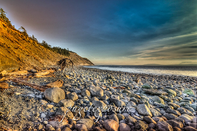
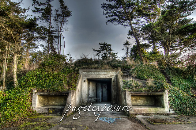
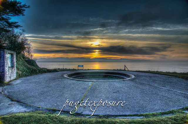
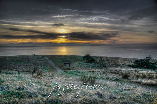
Fort Ebey was originally commissioned by the United States Army in 1942 as military artillery Battery 248. Battery 248 featured 2 rapid fire 6-inch shell cannons, earth covered concrete support structure and fire control post. An SCR-296A radar facility was located south of the battery.
Fort Ebey was part of the United States Army Coastal and Harbor Defense Strategy during World War II.
From 1942 until 1946 Fort Ebey served along with the "triangle of fire" Fort Casey, Fort Worden and Fort Flagler guarding the entrance to Puget Sound and
the Bremerton Navy Yard as well as the cities of Seattle, Tacoma and
the State Capitol at Olympia.
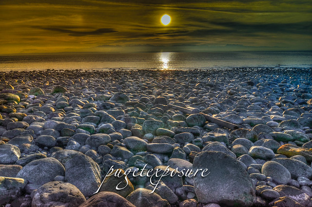
Today Fort Ebey State Park features 3 miles of saltwater shoreline (low tide) and a 645-acre camp ground with many hiking trails, freshwater lake for fishing. Discover Pass Fee Required
Bowman Bay is located just north of the Deception Pass Bridge off of Highway on Fidalgo Island. The bay is separated from Lottie Bay to the south by a small and growing sand bar but it still is subject to tidal changes. Check current tidal conditions before your arrival to predict access to the shoreline.
Until the late 1800s, this calm-watered cove was the site of a large
Samish village, one of several that existed near Deception Pass.
Evidence of their presence in the area remains in the form of thick
groves of Nootka rose that grow atop iron-rich shell middens.
Before receiving its modern name, Bowman Bay was known as
“Reservation Bay” due to the period in which it was a military
reservation. In the early 1900s, Bowman Bay was one of several
modern-day park areas set aside for military use. The area was
eventually renamed in honor of Amos Bowman, who was one of the first
white settlers on Fidalgo Island. Nearby Anacortes is amalgamation of
“Anna Curtis,” Bowman’s wife. At the turn of the century, Bowman had a
wooden dock built at the bay in hopes that it would become a major port,
but Bowman’s dream was never realized.
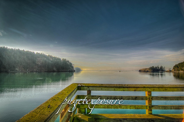
Looking out towards the Puget Sound from Bowman Pier
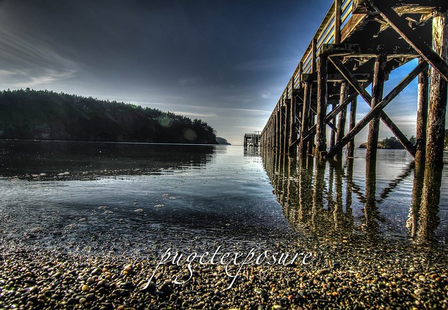
Low Tide at Bowman Bay
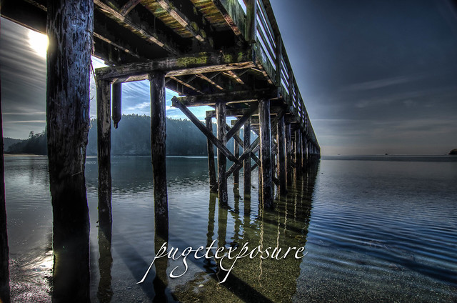
Another low angle view of Bowman Pier
Gear Used:
Washington State travel, Washington State travel, Washington Destinations, Photography, Photography spost, best things to do in Seattle, Best things to in Washington State, Washington Tourism Alliance, Washington State Tourism boared, recommendations, recommendations for things to see in washington state, things to do in washington state, things to do in seattle, things to do in Tacoma washington, Washington Photographers, Washington nikon shooters, best seattle photography, washington exploration, experience washington, what to do while visiting seattle, seattle top attractions, seattle food