


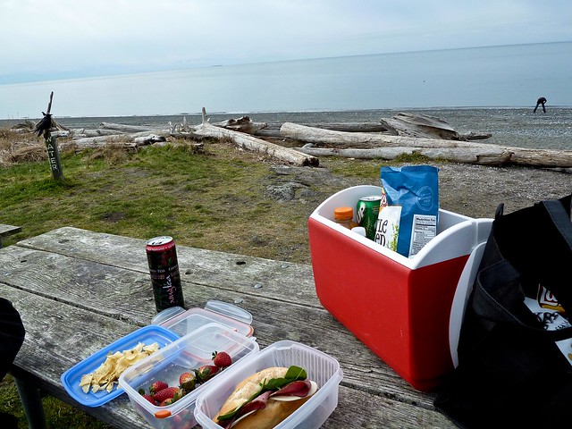
West Beach
Deception Pass State Park,
41020 State Route 20,
Oak Harbor, Washington 98277
MAP IT
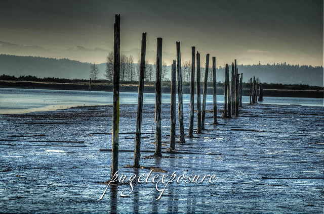
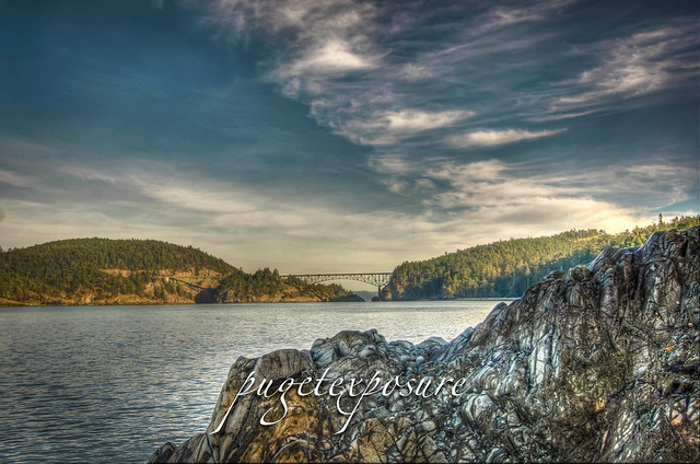
On weekends and on warm summer days the second most popular attraction with in Deception Pass Park aside from the Bridge is West Beach. West Beach is a long, gravelly shoreline dotted with boulders and driftwood and as excellent views of the Olympic Mountains, the San Juan Islands, and even Victoria on a clear day. Keeping an eye on the changes in tide levels is important if you want to take a stroll around the large boulders to the north and look back at the cut and Deception Pass Bridge.
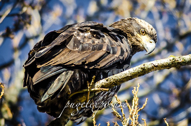
You can see a variety of wildlife from Killer Whales, Sea Otters to Bald Eagles, Herons and Hawks playing in the waters and tree line around West Beach.
From the West Beach parking lot you can access the 3000ft long Pacific Northwest Sand Dune Interpretive Trail which runs between the freshwater Cranberry Lake and the Pacific Ocean.
The Sand Dune Interpretive Trail at the south end of West Beach features a variety of habitats ranging from dunes to marsh land.
West Beach has restrooms located in the upper parking lot area and a seasonal concession stand near the start of the Sand Dune trail offering cool drinks and snacks during the summer months.
Deception Pass State Park is located 10 miles and 20 minutes from downtown Anacortes along Hwy 20 towards Oak Harbor. A 4,134-acre marine and camping park with 77,000 feet of saltwater shoreline, Deception Pass State Park offers 33,900 feet of freshwater shoreline on three lakes and 35 miles of trails, this park has national park size and quality.
Known for breath-taking views, old growth forests and abundant wildlife, its topography features rugged cliffs that drop to meet the swirling waters of Deception Pass.
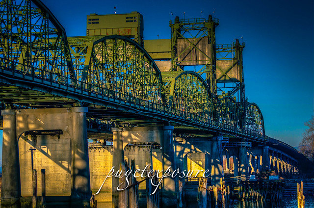
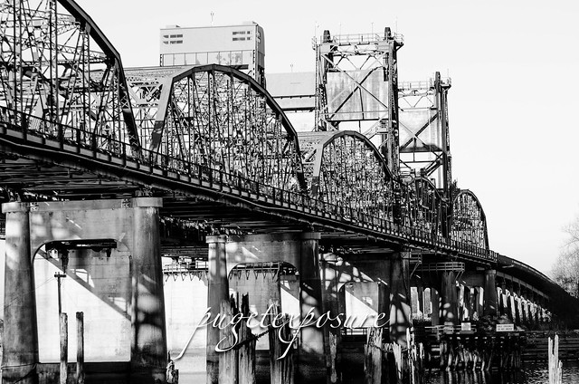
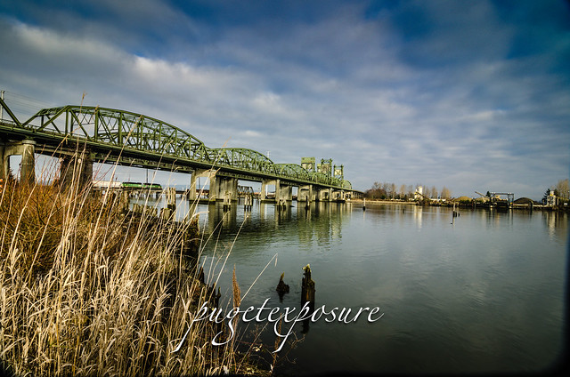
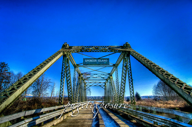
The main feature of the park is the 180 foot tall Deception Pass Bridge, which was completed in 1935. The quarter mile long bridge spans two cuts in between Fidalgo and Whidbey Island. When the bridge first opened in 1935 on average 700 cars crossed between Whidbey Island and the Mainland. Today over 20,000 cars and trucks cross the bridge daily.
There are vehicle parking lots both north and south of the bridge. The parking lot on the south end of the bridge is accessible from North & South Bound HWY 20 , but the north lot is only accessible from northbound HWY 20.
There is a 3 foot wide pedestrian walkway that you can walk out on to get a birds eye view of the waters below. On either side there are paths to get a lower view off the bridge, but the terrain is unstable so solid footing and safety is a first priority. The tidal surges passing through deception pass can exceed 10 knots.
All images are copyrighted by © Pugetexposure Photography. Do NOT use my images on blogs, personal or professional websites, or any other digital media without my explicit permission.
Gear Used:


 Washington State travel, Washington State travel, Washington Destinations, Photography, Photography spost, best things to do in Seattle, Best things to in Washington State, Washington Tourism Alliance, Washington State Tourism boared, recommendations, recommendations for things to see in washington state, things to do in washington state, things to do in seattle, things to do in Tacoma washington, Washington Photographers, Washington nikon shooters, best seattle photography, washington exploration, experience washington, what to do while visiting seattle, seattle top attractions, seattle food, Fidalgo Island, Where is Deception Pass, Where is Deception Pass Bride, Photos of Deception Pass Bridge, explore deception pass bridge, anacrotes washington, Travel photography in Washington state, amazing landscape photography
Deception Pass State Park,
41020 State Route 20,
Oak Harbor, Washington 98277
MAP IT
On weekends and on warm summer days the second most popular attraction with in Deception Pass Park aside from the Bridge is West Beach. West Beach is a long, gravelly shoreline dotted with boulders and driftwood and as excellent views of the Olympic Mountains, the San Juan Islands, and even Victoria on a clear day. Keeping an eye on the changes in tide levels is important if you want to take a stroll around the large boulders to the north and look back at the cut and Deception Pass Bridge.
You can see a variety of wildlife from Killer Whales, Sea Otters to Bald Eagles, Herons and Hawks playing in the waters and tree line around West Beach.
From the West Beach parking lot you can access the 3000ft long Pacific Northwest Sand Dune Interpretive Trail which runs between the freshwater Cranberry Lake and the Pacific Ocean.
The Sand Dune Interpretive Trail at the south end of West Beach features a variety of habitats ranging from dunes to marsh land.
West Beach has restrooms located in the upper parking lot area and a seasonal concession stand near the start of the Sand Dune trail offering cool drinks and snacks during the summer months.
 |
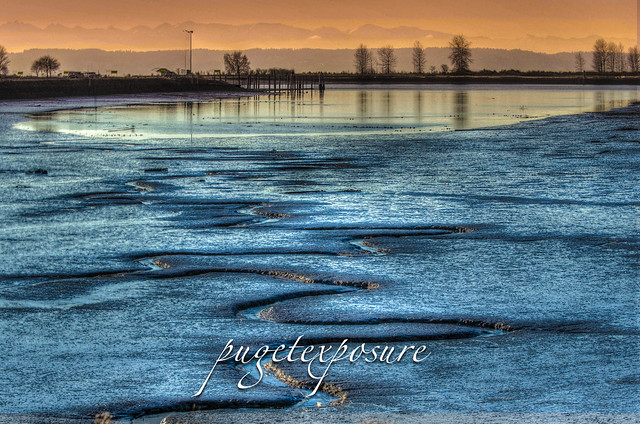
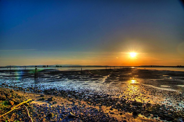
| Photo Credit: West Beach Sunset by Jim Lundgren |
Deception Pass State Park is located 10 miles and 20 minutes from downtown Anacortes along Hwy 20 towards Oak Harbor. A 4,134-acre marine and camping park with 77,000 feet of saltwater shoreline, Deception Pass State Park offers 33,900 feet of freshwater shoreline on three lakes and 35 miles of trails, this park has national park size and quality.
Known for breath-taking views, old growth forests and abundant wildlife, its topography features rugged cliffs that drop to meet the swirling waters of Deception Pass.
The main feature of the park is the 180 foot tall Deception Pass Bridge, which was completed in 1935. The quarter mile long bridge spans two cuts in between Fidalgo and Whidbey Island. When the bridge first opened in 1935 on average 700 cars crossed between Whidbey Island and the Mainland. Today over 20,000 cars and trucks cross the bridge daily.
There are vehicle parking lots both north and south of the bridge. The parking lot on the south end of the bridge is accessible from North & South Bound HWY 20 , but the north lot is only accessible from northbound HWY 20.
There is a 3 foot wide pedestrian walkway that you can walk out on to get a birds eye view of the waters below. On either side there are paths to get a lower view off the bridge, but the terrain is unstable so solid footing and safety is a first priority. The tidal surges passing through deception pass can exceed 10 knots.
Gear Used:
Washington State travel, Washington State travel, Washington Destinations, Photography, Photography spost, best things to do in Seattle, Best things to in Washington State, Washington Tourism Alliance, Washington State Tourism boared, recommendations, recommendations for things to see in washington state, things to do in washington state, things to do in seattle, things to do in Tacoma washington, Washington Photographers, Washington nikon shooters, best seattle photography, washington exploration, experience washington, what to do while visiting seattle, seattle top attractions, seattle food, Fidalgo Island, Where is Deception Pass, Where is Deception Pass Bride, Photos of Deception Pass Bridge, explore deception pass bridge, anacrotes washington, Travel photography in Washington state, amazing landscape photography