Lime Kiln Lighthouse

Lime Kiln Lighthouse on the west side of San Juan Island, Washington

Lime Kiln Lighthouse on the west side of San Juan Island, Washington

Lime Kiln Lighthouse on the west side of San Juan Island, Washington

Lime Kiln Lighthouse on the west side of San Juan Island, Washington

Lime Kiln Lighthouse on the west side of San Juan Island, Washington

Showing posts with label bird spotting. Show all posts

Monday, February 3, 2014

No. 237 Lake Cassidy, Centennial Trail

Lake Cassidy lies 3 miles east of Marysville and is just a few minutes east of Highway 9. The lake covers over 123 acres of water and is a popular year round lake for fishing rainbow trout, largemouth bass, yellow perch, black crappie and brown bullhead catfish. This variety of fish attracts many species of wildlife to its shores. Hawks, Eagles, Heron and Bear can be scene all around the lake. On the east side of the lake there is a 2 mile section of the Centennial trail that leads to a boardwalk and dock that reach out into the waters of Lake Cassidy.
There are two options parking to start this 2 mile section.
1.4 miles North of the lake is the Getchell Road Trail head at 8318 Westlund Road
and a 0.6 miles to the south  10000 block of 105 Ave NE 


Lake Cassidy, Snohomish
Lake Cassidy Interpretive Center
Lake Cassidy, Snohomish
East Shore of Lake Cassidy 
Lake Cassidy, Snohomish
Boardwalk
Lake Cassidy, Snohomish
Mature American Bald Eagle near the Interpretive Center 


Washington State travel, Washington State travel, Washington Destinations, Photography, Photography spost, best things to do in Seattle, Best things to in Washington State, Washington Tourism Alliance, Washington State Tourism board, recommendations, recommendations for things to see in washington state, things to do in washington state, things to do in seattle, things to do in Tacoma washington, Washington Photographers, Washington nikon shooters, best seattle photography, washington exploration, experience washington, what to do while visiting seattle, seattle top attractions, seattle foodLake Cassidy marysville, marysville, wildlife photography in marysville, centennial trail information, snohomish county parks, walking in washington

Saturday, January 25, 2014

No. 235 Smith Island Trail, Everett

Spencer Island
 4th St SE Everett, WA 98205
 MAP IT
 Smith Island Trail : 2.6 miles
 Terrain: Soft, unstable ground, gravel and bridges


Smith Island Trail

Spencer Island lies in the heart of the Snohomish River Estuary, an ecosystem formed by mixing a freshwater system (the Snohomish River) and a saltwater system (Port Gardner Bay). It is one of the best places in the Snohomish River Estuary to view waterfowl and shorebirds such as ducks, heron, hawks and bald eagles. If you watch your steps you might see some small and larger mammals such as river otters and deer. On clear days the snow capped tops of the cascade mountain range and Mount Baker are visible to the east and to the north. The island is co-owned by Snohomish County and the Washington Department of Fish and Wildlife. Snohomish County owns the south half of the island, while WDFW owns the north half. There is limited parking available for Spencer Island visitors and you have two main options. Park underneath to I-5 overpass by the Langus Riverfront trail or continue driving on the gravel road for another 1000 feet and you will see a small parking lot off to the right. Both sites have limited parking and when it is hunting season or a nice day expect them to fill up fast. Continue east along the gravel levy road for a 1/4 mile, cross over Jackknife bridge. Once on the other side depending on the tide and water level you can access a short boardwalk that offers up some nice views of the cascades and the teaming wildlife. The roof of an old abandoned barn is still visible. The barn came crashing down in a 2006 windstorm. There is a sign posted on the bridge that points which areas are county and state owned and where hunting is permitted. To start out on the 2.6 mile Smith Island Trail head south from Jackknife Bridge. The trail runs atop of a levy that surrounds Spencer Island. To make the loop stay to the right and this will take you along the southern end of the island and back north along the Ebey Slough to the Cross Island Trail which is your return. The trail for the most part is unimproved and soft and squishy from the natural vegetation. The Cross Island Trail is better maintained and has more gravel. After recent rainfall expect the trail to be very muddy and slippery.


Spencer Island Boardwalk
SSpencer Island Boardwalk 
Spencer Island Boardwalk Smith Island Trail Steamboat Slough Cross Island Bridge Blue Heron Spencer Island Blue Heron Spencer Island

Saturday, November 2, 2013

No. 228 Birds of Skagit Valley Basin

It is time for another seasonal change. The fall colored leaves are falling to the ground and piling up in the driveway, the days are shorter and days increasingly colder and windy. Also traffic in and around shopping areas is increasing for the holiday shopping rush.
But us humans are not the only ones getting ready for a season change. Wildlife must prepare itself for the long winter as well. Around your home and in your neighborhood you may have noticed more squirrel activity and also some increased sighting of birds.
Washington State is an important stop for migrating bird species flying south for the winter. 
The Skagit Valley Basin lies along the Pacific Flyaway path for migrating birds flying south to California and Mexico for the winter and return north for the breeding grounds in Canada and Alaska. 

Spend some time around La Conner, Anacortes, Mount Vernon and Burlington farm lands and you will start to see more and more numbers of hawks, eagles, owls and other birds of prey as they arrive in Washington State.
Here are the first arrivals for the winter 2013-2014


Snow Geese arrival Mount Vernon, WA 2013
Snow Geese arrive in Mount Vernon along Pioneer Hwy
Pioneer Highway Farm house and a large flock of Snow Geese
I just flew in from Canada and boy are my wings tired
Snow Geese arrive in Mount Vernon, WA October 2013
Thousands of Snow Geese migrate to Skagit County for the winter 
Stalker from above.
Northern Harrier Hawks are also here in numbers
Harrier Hawk on the prowl
Harrier Hawk swoops low and silent over a field 
Northern Harrier Hawk in low level hunt mode Please Support Puget Exposure 

 We love to bring you guys the updates to best and greatest photography locations in and around Seattle and the greater Puget Sound area, photography tips and gear related stuff. However, we can’t keep doing that unless we have your continued support. If you would like to purchase any of images featured in an article, please do so by clicking HERE or on the Post Cards and Prints tab above in the header. You can also make secure donation to the travel fund via PayPal. If you frequently shop on Amazon.com, by clicking on the Amazon links listed below you can continue to browse Amazon and any purchase you make will give us a small portion of the sale to continue to run this website. Banner Links for PEP Gear Used:
 
lens rental Washington State travel, Washington State travel, Washington Destinations, Photography, Photography spots, best things to do in Seattle, Best things to in Washington State, Washington Tourism Alliance, Washington State Tourism board, recommendations, recommendations for things to see in washington state, things to do in washington state, things to do in seattle, things to do in Tacoma washington, Washington Photographers, Washington nikon shooters, best seattle photography, washington exploration, experience washington, what to do while visiting seattle, seattle top attractions, seattle food, Space Needle, Explore Washington State, Puget Exposure Photography, Puget Exposure, Road Trips through Washington State, Weird Washington, King County, Snohomish County, Seattle, Everett, Tacoma, Kent, Redmond, Kirkland, Washington Sunrises where and when, Washington State Weather,

Sunday, June 2, 2013

No.188 North Creek Park, Mill Creek, Washington

North Creek Park
1011 183rd Street SE
Mill Creek, WA 98012
 MAP IT
Driving Directions
From the city of Mill Creek, follow the Bothell-Everett Hwy. south to 183rd Street; turn right; travel approximately 1/4  mile; park is on the right.

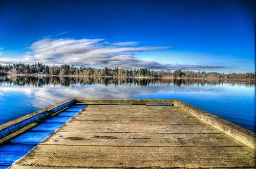
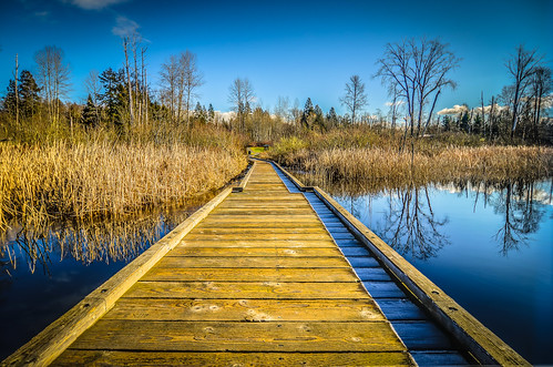
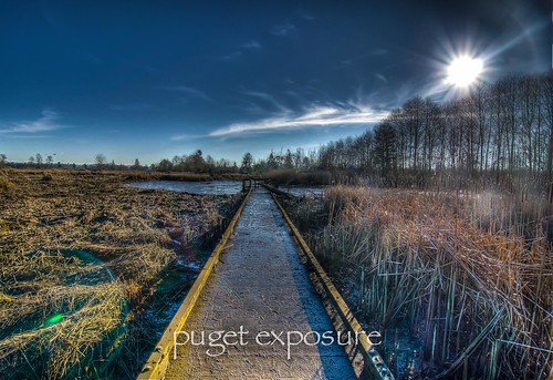
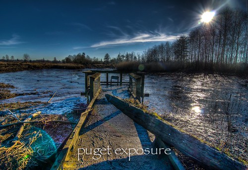
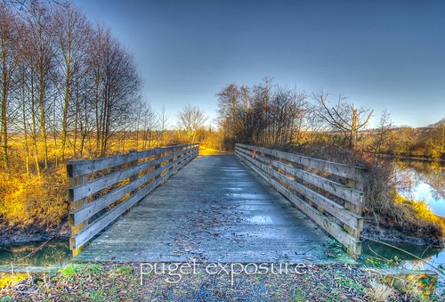
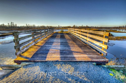
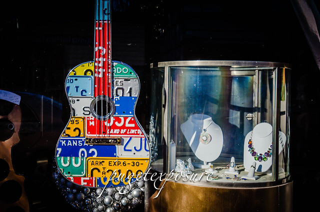
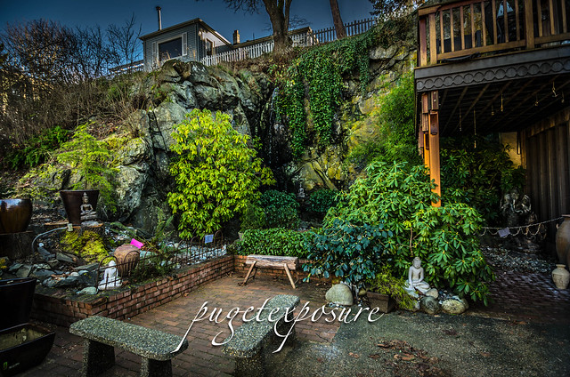
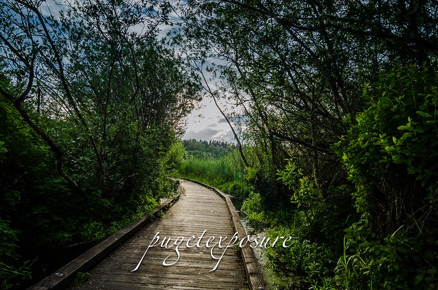
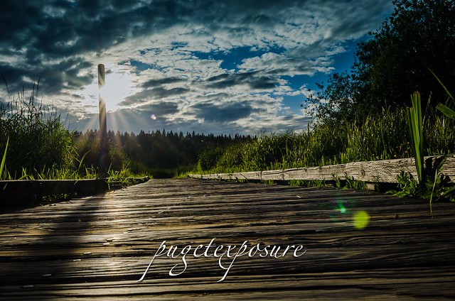
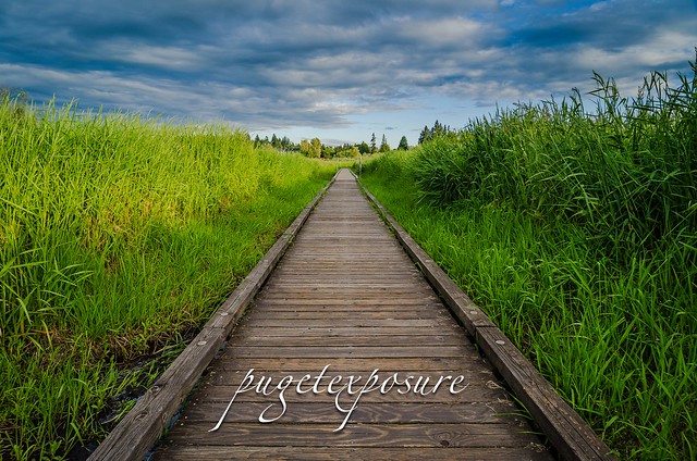
Mill Creek's floating Boardwalk offers a quick getaway and side of nature in suburbia

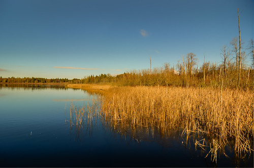
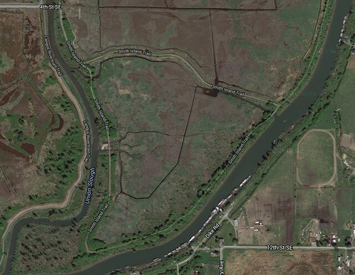
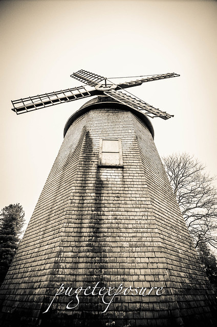
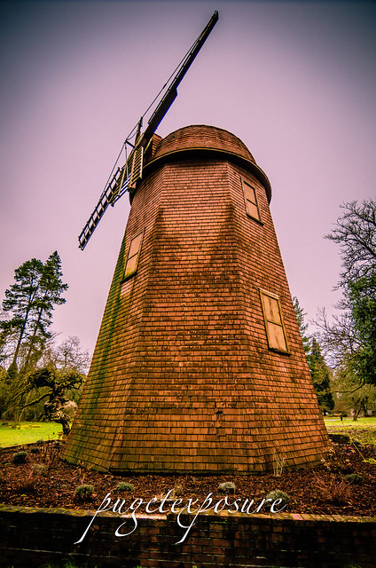
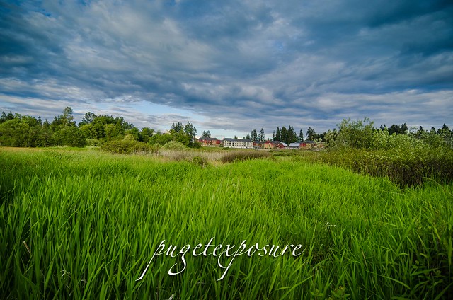
North Creek Park features a modern play ground area and around 80 acres of wetlands adjacent to the former homestead of the Bailey Farm. The Baily Farm, founded in 1891 by pioneer John Bailey, had 160 acres of farmland that once was home to cattle, dairy cows, and horses.  Ruth Bailey, the founders daughter-in-law, was the last person to work the farm and a steadfast proponent against the fast moving urbanization happening in and around Mill Creek. She did not want to see her families farm turned into asphalt parking lots and homes so she shooed away eager property buyers until her death in 1999.
By 2003 the entire homestead had been sold. Snohomish County purchased around 80 acres and private investors bought up the rest of the property.
Currently there is a 400 unit townhouse and condo complex being built at the south end of North Creek Park named Bailey Farms.
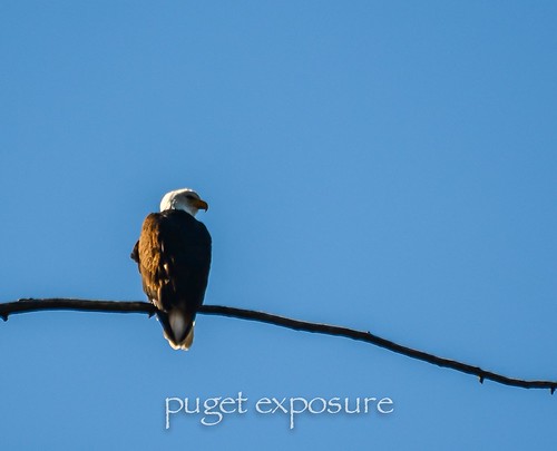
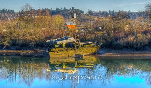
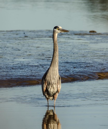
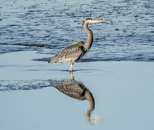
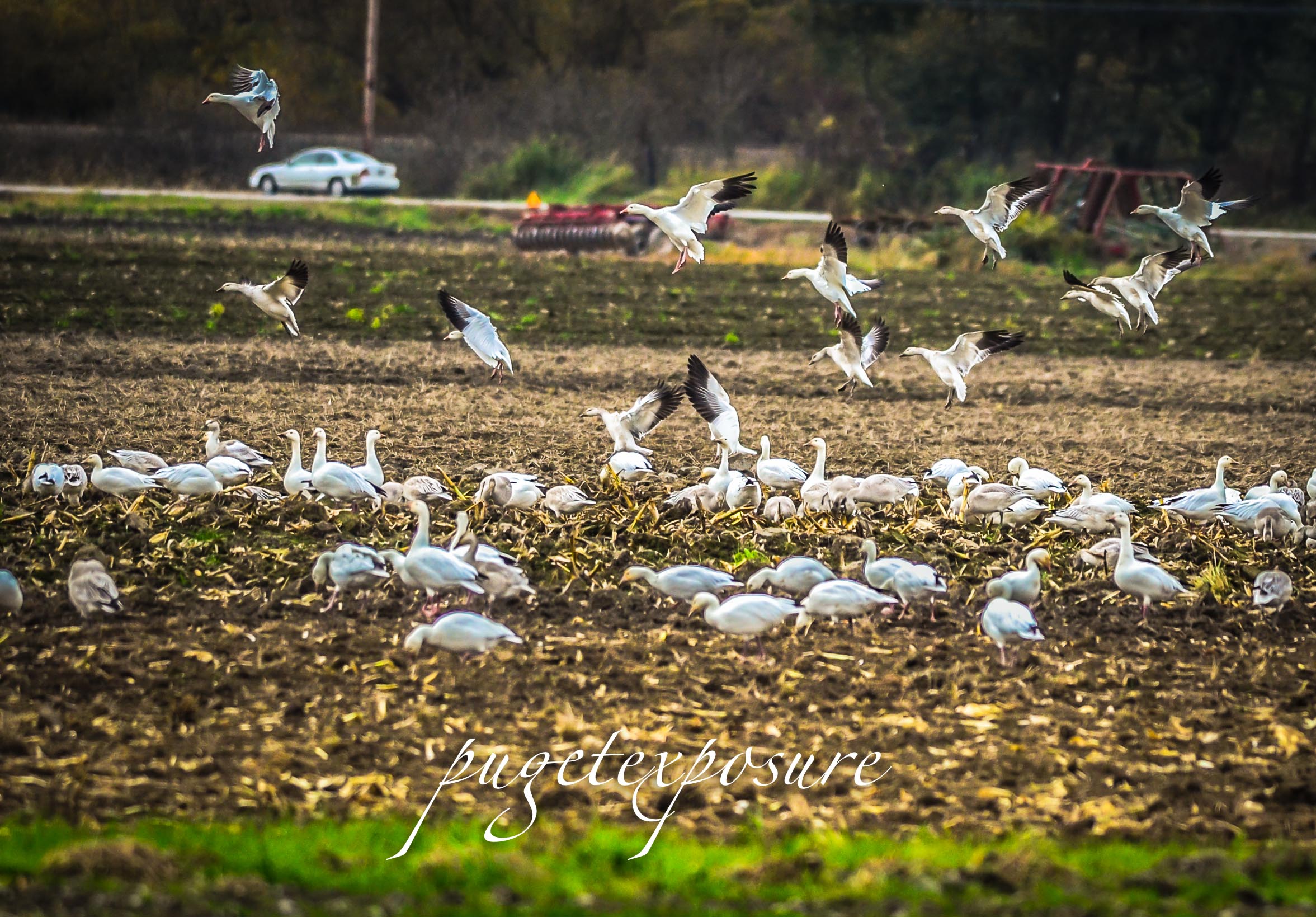
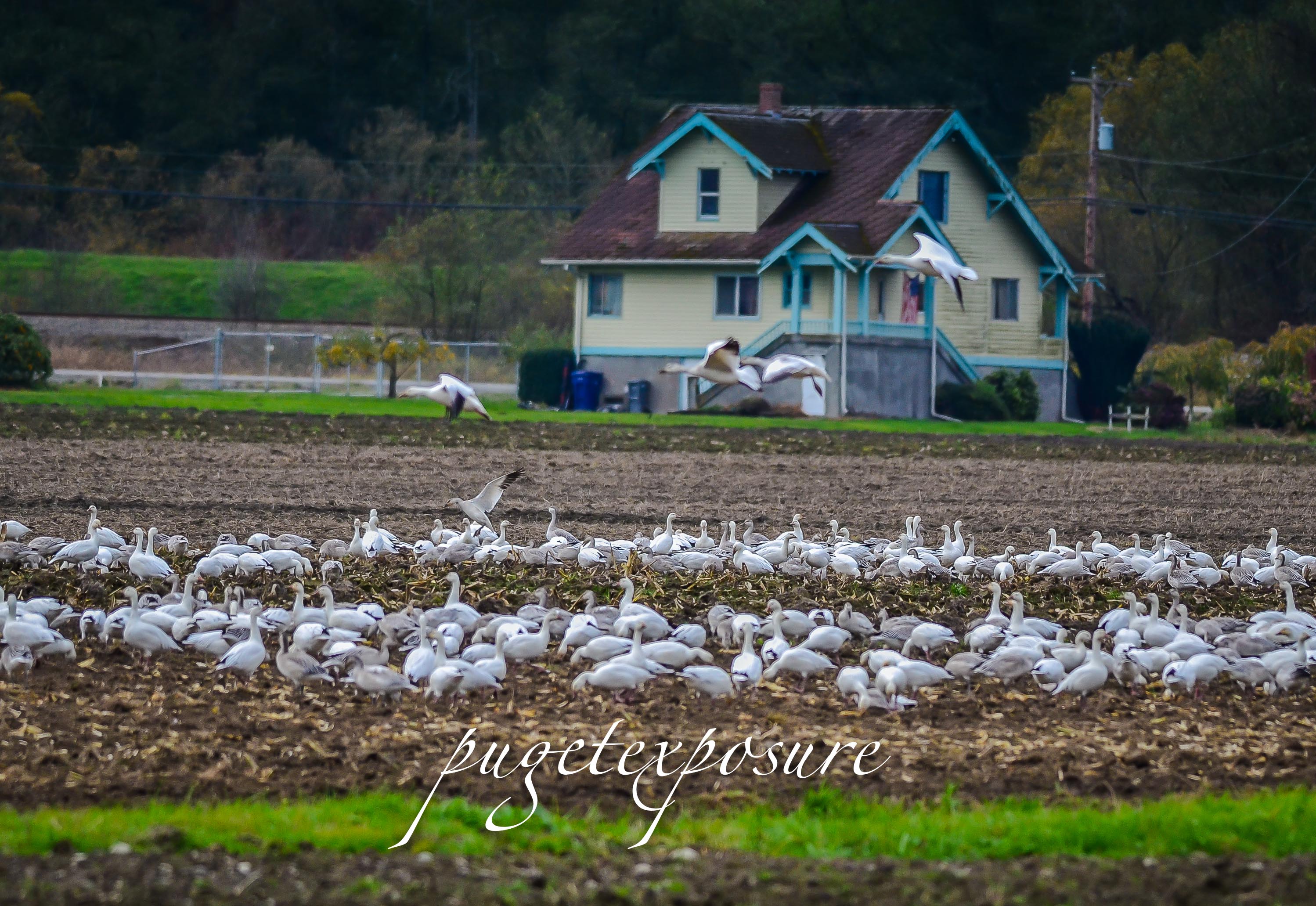
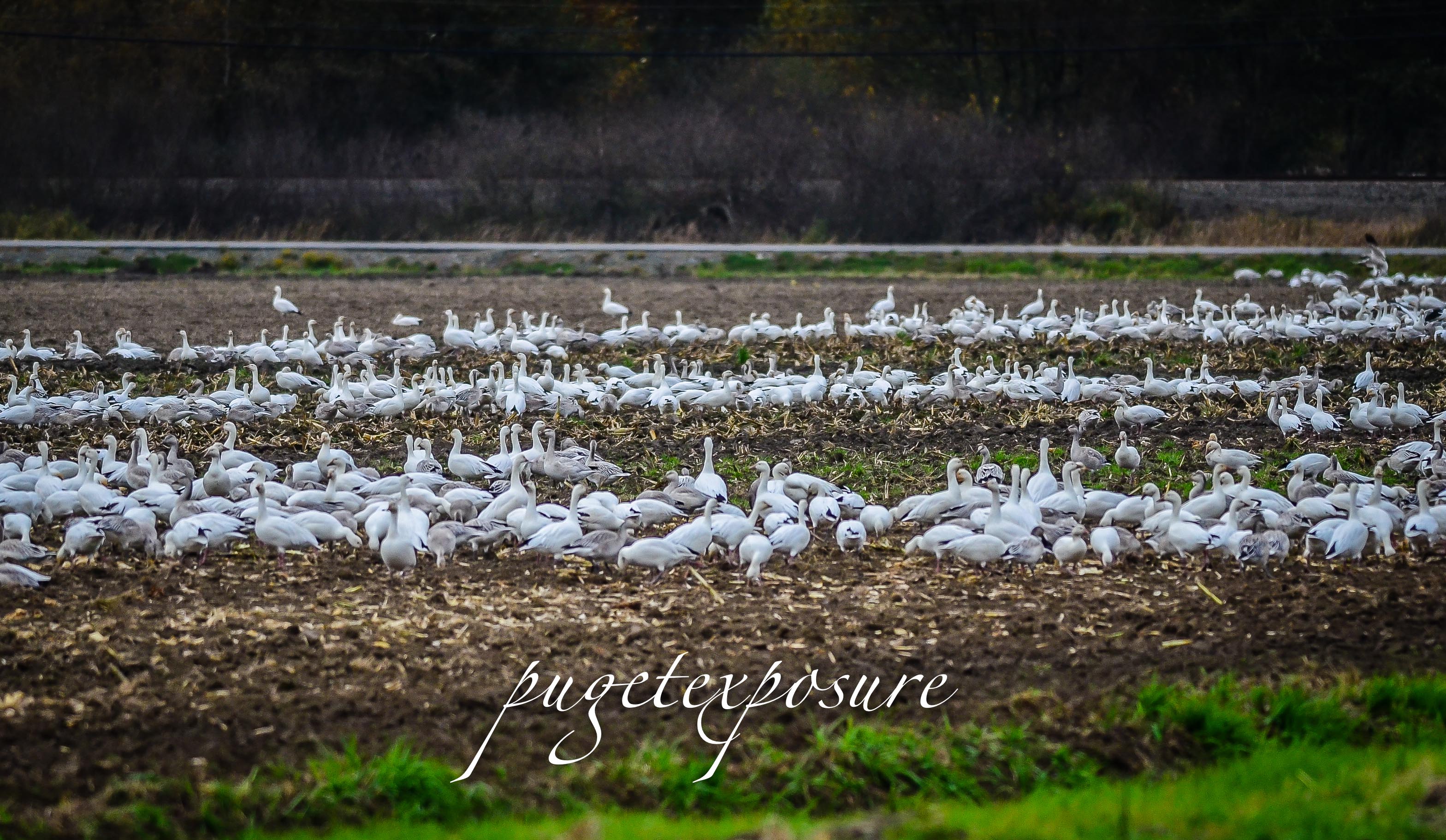
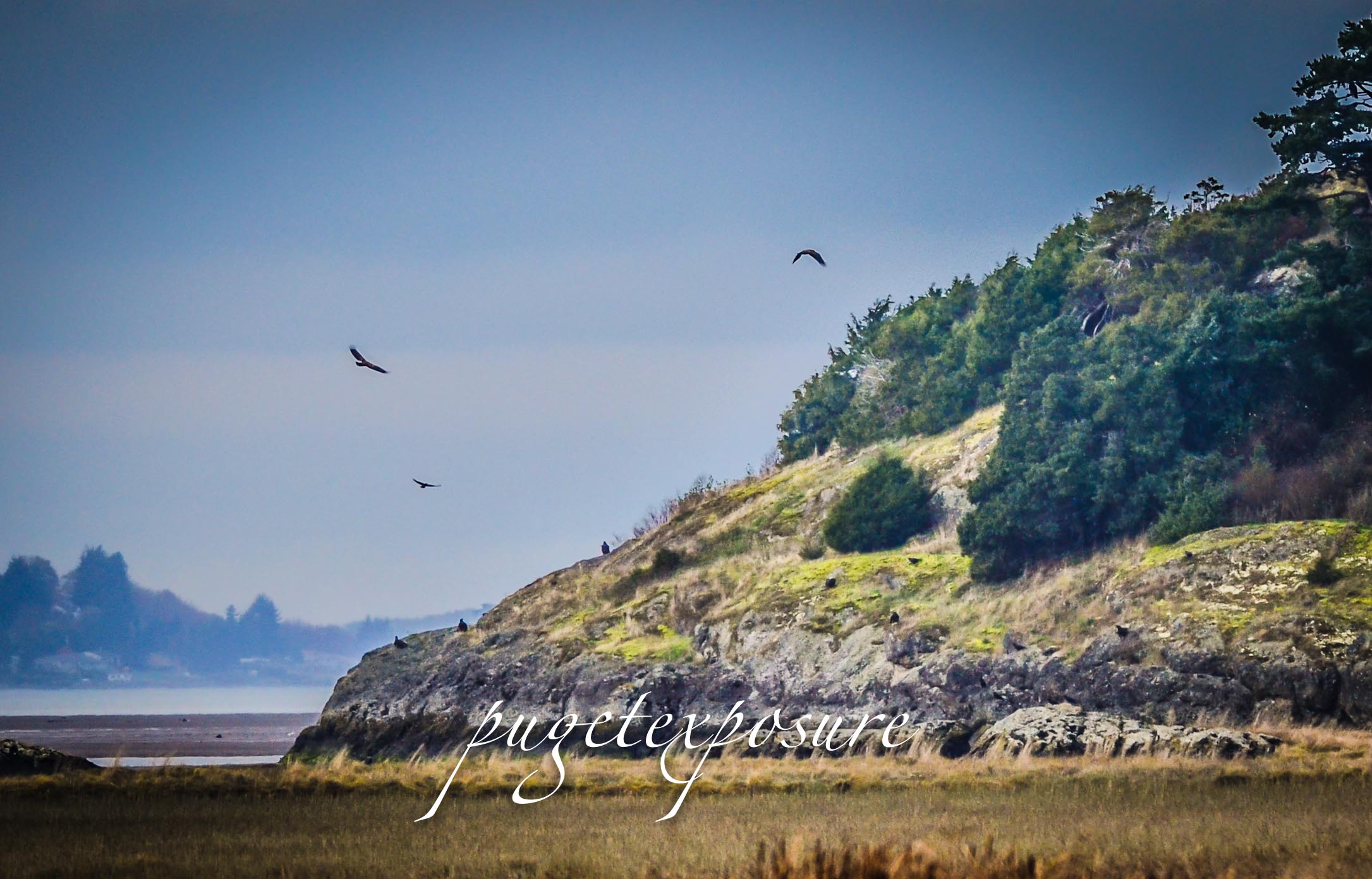
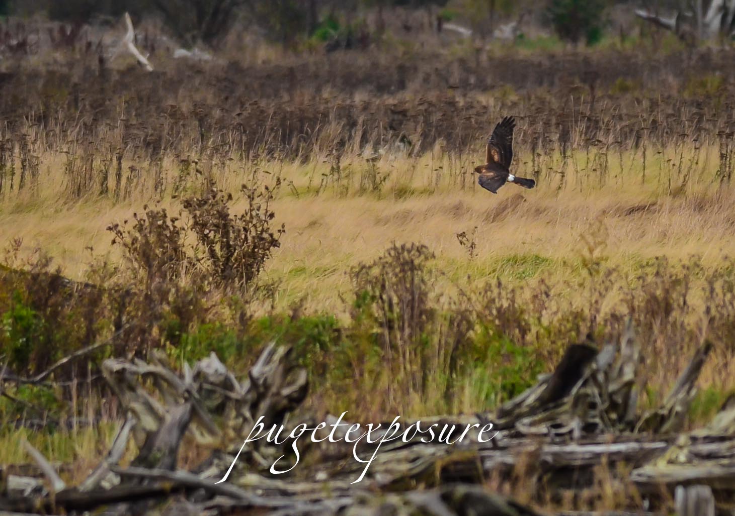
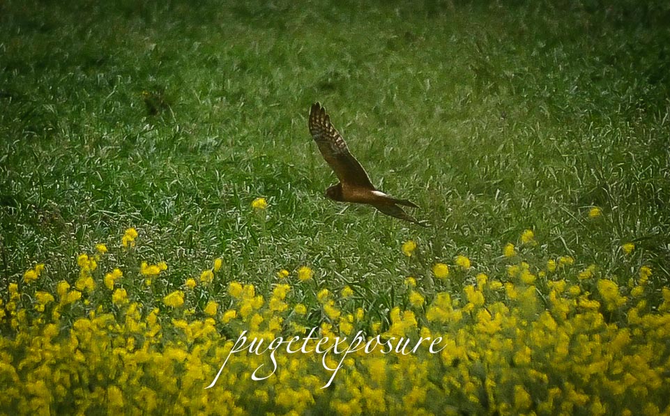
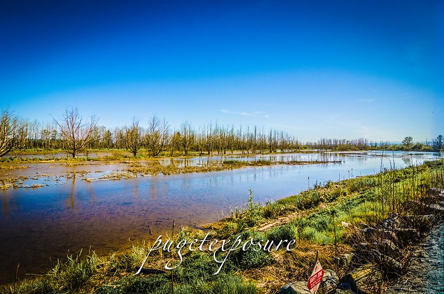
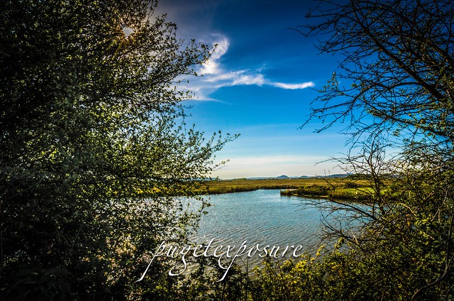
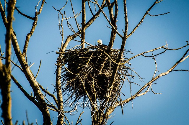
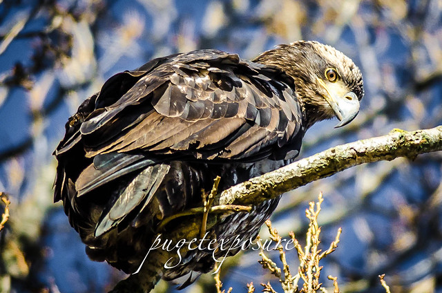
North Creek begins as a bubbling brook 12 miles away in south Everett and eventually drains into the Sammamish River. The wetlands of North Creek park act as a giant 80 acres flood plane for the Mill Creek area. The wetlands is home to many varieties of birds including ducks, herons, hawks, eagles and tiny song birds.
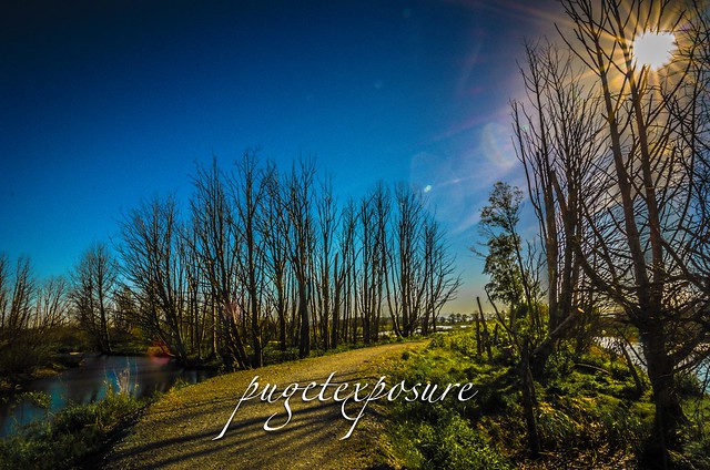
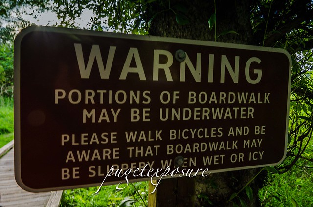
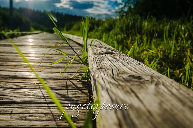
In 2012 Snohomish County refurbished and fitted the 3/4 mile long boardwalk with floatation allowing the boardwalk to rise and fall with the current water table within the wetlands.

North Creek Trail Boardwalk North Creek Trail Boardwalk North Creek Trail Boardwalk North Creek Trail Boardwalk North Creek Trail Boardwalk North Creek Trail Boardwalk North Creek Trail Boardwalk North Creek Trail Boardwalk Gear Used:
 
lens rental Washington State travel, Washington State travel, Washington Destinations, Photography, Photography spots, best things to do in Seattle, Best things to in Washington State, Washington Tourism Alliance, Washington State Tourism board, recommendations, recommendations for things to see in washington state, things to do in washington state, things to do in seattle, things to do in Tacoma washington, Washington Photographers, Washington nikon shooters, best seattle photography, washington exploration, experience washington, what to do while visiting seattle, seattle top attractions, seattle food, Space Needle, Explore Washington State, Puget Exposure Photography, Puget Exposure, Road Trips through Washington State, Weird Washington, King County, Snohomish County, Seattle, Everett, Tacoma, Kent, Redmond, Kirkland, Washington Sunrises where and when, Washington State Weather, Mill Creek, Mill Creek Parks, North Creek Park, North Creek Park Mill in Mill Creek, North Creek Boardwalk, Boardwalk in Mill Creek, Wildlife in Mill Creek, Walking and Hiking in Mill Creek

Sunday, May 5, 2013

No. 181 Mount Vernon Skagit Wildlife Area

Island Unit Headquarters
21961 Wylie Road
Mt. Vernon, WA 98273

MAP IT

The Skagit Wildlife Area covers about 16,700 acres west of the Cascade Mountain range. Bordered on the east edge by Highway 530 between Darrington and Rockport and to west along Skagit and Padilla Bays. Most of the 16 managed wildlife sanctuaries are located throughout the Skagit River Delta Region. Tidal action and the mixing of fresh and saltwater create a rich estuarine environment including open water, tidal mudflats and marshes providing safe and sustainable wildlife habitat for   birds of prey, hawks, eagles, marine birds, shorebirds, songbirds, upland birds, wading birds, waterfowl, deer and other smaller mammals.
Washington's DFW has contracts with regional farmers to plant barley and corn to enhance food  resources for local and wintering waterfowl.

In order to see and photography any wildlife its important to pay attention to the various habits of birds. If you plan on exploring a wildlife sanctuary mid day in the summer chances are you will have little luck in spotting a rare bird of prey. Ducks and smaller waterfowl can be scene throughout the day. But if you are keen on snapping images of birds of prey you have to understand which time of day they are active and also which food source they are hunting. Dawn and Dusk are the best times to spot birds of prey in action as they leave their nests high atop the trees and start stalking smaller prey. If its bright and sunny and mid 70s degrees out you will have reduced chances of seeing any wildlife. Unlike us humans who have sunglasses, air conditioning and access to refrigerated beverages, animals do not. They retreat the cooler tree top canopy's until the late afternoon.


Skagit WIldife Area
Island Unit Tidal area home to many ducks and insects
Skagit WIldife Area
Natures Window Frame
Skagit WIldife Area

Skagit WIldife Area
A Mature (White feathers) American Bald Eagle keeping a stealthy eye on its family nest

Skagit WIldife Area
Backdrop of Mount Baker behind Island Unit Wildlife Area

Gear Used:
 
lens rental Washington State travel, Washington State travel, Washington Destinations, Photography, Photography spost, best things to do in Seattle, Best things to in Washington State, Washington Tourism Alliance, Washington State Tourism board, recommendations, recommendations for things to see in washington state, things to do in washington state, things to do in seattle, things to do in Tacoma washington, Washington Photographers, Washington nikon shooters, best seattle photography, washington exploration, experience washington, what to do while visiting seattle, seattle top attractions, seattle food, Howarth Park in Everett Washington, Everett, Everett Washington, City of Everett Photography, Beaches near Mukilteo Washington, Beaches near Everett Washington, Puget Sound Beaches, sunset locations near Everett Washington, low tide photography ideas, Howarth Park Off Leash area, Howarth Park Everett Washington, Howarth Park Mukilteo, City Mukilteo, Mukilteo Off Leash Dog areas, Posession sound, Naval Air Station Everett
Exploring Washingotn State, Washington Wildlife Photographers, Wildlife Photography tips, Nature, Photographing Nature, Wildlife Photography in Washington, Skagit County Wildlife, Photographs of Skagit County Washington, Camano Island, Photographs of Skagit River, Birds of Prey, Mount Vernon Washington, Exploring Mount Vernon Washington, Sight of Beautiful Washington State, Seattlemet, Seattle Magazine, Road Trips through Washington State, What is there to see north of Seattle?

Saturday, March 2, 2013

No. 169 Clise Windmill

6046 West Lake Sammamish Pkwy NE
 Redmond, WA 98052

MAP IT

Marymoor Park in Redmond, is one of the most popular parks on the Eastside. With 640 acres of grass fields, gardens, trails, playgrounds, and more, it is a destination for families, sports enthusiasts, weekend bikers, and more. The park has become such an important part of community life in the area that it is easy to forget that it wasn't always a public area. The history of Marymoor Park is as fascinating as the park itself.
The Clise Windmill is located on the western edge of Marymoor Park near the Clise Mansion  along the Sammamish Slough. James Clise had this windmill constructed to resemble the many windmill he and his wide had enjoyed on their european vacations to Holland. 


Clise Marymoor Windmill Clise Marymoor Windmill Clise Marymoor Windmill


Gear Used:
 
lens rental Receive a FREE GIFT from Think Tank Photo Seattle, Washington, Things to do In Seattle, Visiting Seattle, What is there to see in Seattle, What is there to photograph in Seattle, Seattle Photography, Best Seattle Photography, Best Seattle Photography Images, Best locations, Washington State, Visiting Seattle, Visiting Washington State, Washington State Prints, Photos of Seattle, Seattle Downtown photographs, what to see in Seattle, what to do in Seattle, Seattle top 100, seattle top 200, Seattle Photographers, Seattle Best Photographers, Nikon shooters, Nikon cameras, Canon shooters, Canon Cameras, Seattle camera stores, Washington State Parks, Washington State Park Photography, Travel Photography, Seattle Roadtrip, Pacific Northwest images , Pacific Northwest Photographs, Downtown Seattle, What to do in Seattle, redmond washington, redmon, microsoft, king county photography, marymoor, dog park, dog parks near seattle, circus, manison, lake washington

Sunday, January 13, 2013

No. 157 La Conner

La Conner, WA
MAP IT
http://www.lovelaconner.com/


The quaint town of La Conner, established in 1867, is located on the western side of Skagit County along the shoreline of the Swinomish Channel. La Conner features many small business including restaurants, art galleries, antique shops and museums along 1st street. In mid spring La Conner host the majority of annual events around the Tulip Festival, where many thousands of road warriors head to the Skagit Valley to view hundreds of acres of blooming tulip fields.
The narrow streets and lack of parking make it more difficult to visit when any festival is going on. Aside from the major events La Conner is a popular destination for its selection of arts & crafts and seafood.
Looking south of town you can see a red deck arched bridge spanning the Swinomish Channel.
La Conner's red-arched  "Rainbow Bridge" built in 1957 connects La Conner to Fidalgo Island. Crossing over the Rainbow Bridge along Pioneer Parkway will take you north to Anacortes, WA


Rainbow Bridge, La Conner
Looking south down Swinomish Channel and Rainbow Bridge
La Conner Street View
1st Street, La Conner
La Conner Street View
1st Street, La Conner
His and Hers
His & Hers Gifts
La Conner Street View

La Conner Street View

Young Bald Eagle Eye View 4
Young Bald Eagle just outside of La Conner


Gear Used:


lens rental Learn Photography Online with the Pros Save $10 Now #KTCJQ12  Receive a FREE GIFT from Think Tank Photo Flatbooks - Clever eBooks for the Curious Mind