

Rainbow Falls State Park
4008 State Highway 6
Chehalis, WA 98532
From I-5: Take exit 77, go west on state highway 6 about 17 miles. Turn right on Chandler road (will cross over a new bridge) go 0.3 miles and turn right on Leudinghaus road. Travel 0.8 miles on Leudinghaus road and turn right into the park. Upon entering the park, the campground area will be to your right and the group camp and day-use area will be to your left.
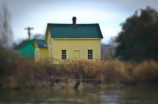
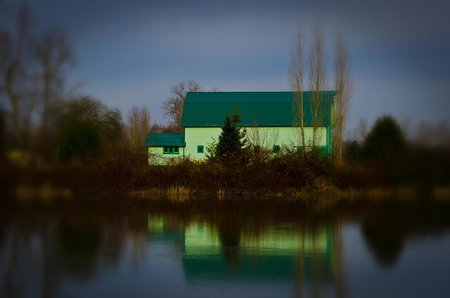
Rainbow Falls State Park is located along the east flow of the Chehalis River around 16 miles west of the city of Chehalis. The 139 acre state park is split in two by the Chehalis River and State highway 6. A heavy winter storm in December of 2007 washed out a vehicle bridge that was the former park entrance. The new entrance to the park is on the north side of the river along Leudinghaus Road.
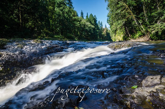
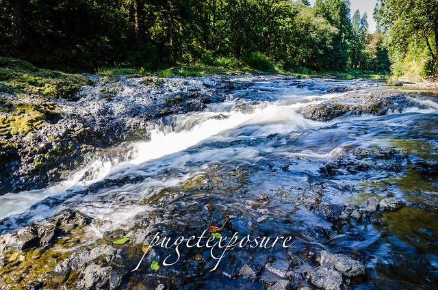
To view Rainbow Falls head south from the rangers station about 200 yards and look down past the old bridge foundation. The "Falls" is more like rapid than an actual waterfall. Depending on river height you may or may not see it. The Chehalis River makes an easterly turn through Rainbow Falls before heading northwest and ending in Aberdeen, WA.
The drop or rapid is around 10 feet over a layer of basalt rock left over from volcanic activity in the area thousands of years ago.

Events
We love to bring you guys the updates to best and greatest photography locations in and around Seattle and the greater Puget Sound area, photography tips and gear related stuff. However, we can’t keep doing that unless we have your continued support. If you would like to purchase any of images featured in an article, please do so by clicking HERE or on the Post Cards and Prints tab above in the header. You can also make secure donation to the travel fund via PayPal. If you frequently shop on Amazon.com, by clicking on the Amazon links listed below you can continue to browse Amazon and any purchase you make will give us a small portion of the sale to continue to run this website.
Banner Links for PEP
Gear Used:

 Washington State travel, Washington State travel, Washington Destinations, Photography, Photography spots, best things to do in Seattle, Best things to in Washington State, Washington Tourism Alliance, Washington State Tourism board, recommendations, recommendations for things to see in washington state, things to do in washington state, things to do in seattle, things to do in Tacoma washington, Washington Photographers, Washington nikon shooters, best seattle photography, washington exploration, experience washington, what to do while visiting seattle, seattle top attractions, seattle food, Space Needle, Explore Washington State, Puget Exposure Photography, Puget Exposure, Road Trips through Washington State, Weird Washington, King County, Snohomish County, Seattle, Everett, Tacoma, Kent, Redmond, Kirkland, Washington Sunrises where and when, Washington State Weather, Rainbow Falls State Park, Washington STate Parks, waterfalls in washington
4008 State Highway 6
Chehalis, WA 98532
From I-5: Take exit 77, go west on state highway 6 about 17 miles. Turn right on Chandler road (will cross over a new bridge) go 0.3 miles and turn right on Leudinghaus road. Travel 0.8 miles on Leudinghaus road and turn right into the park. Upon entering the park, the campground area will be to your right and the group camp and day-use area will be to your left.
Rainbow Falls State Park is located along the east flow of the Chehalis River around 16 miles west of the city of Chehalis. The 139 acre state park is split in two by the Chehalis River and State highway 6. A heavy winter storm in December of 2007 washed out a vehicle bridge that was the former park entrance. The new entrance to the park is on the north side of the river along Leudinghaus Road.
To view Rainbow Falls head south from the rangers station about 200 yards and look down past the old bridge foundation. The "Falls" is more like rapid than an actual waterfall. Depending on river height you may or may not see it. The Chehalis River makes an easterly turn through Rainbow Falls before heading northwest and ending in Aberdeen, WA.
The drop or rapid is around 10 feet over a layer of basalt rock left over from volcanic activity in the area thousands of years ago.
Events
Free days at state parks: Visit Washington state parks for free. The Discover Pass is not required to visit a state park on ten designated free days in 2013.
The 2013 State Parks free days are as follows:
Jan. 21 – In honor of Martin Luther King Day
March 30 – In honor of Washington State Parks' 100th birthday on March 19
April 27 and 28 – National Parks Week
June 1 – National Trails Day
June 8 and 9 – National Get Outdoors Day and Department of Fish and Wildlife Free Fishing weekend
Aug. 4 – Peak season free day
Sept. 28 – National Public Lands Day
Nov. 9 through 11 – Veteran's Day weekend
Please note: A Discover Pass is still required to access lands managed by the Washington State Department of Natural Resources and the Washington Department of Fish and Wildlife during State Parks free days. For more information, please visitwww.discoverpass.wa.gov.
Please Support Puget Exposure
The 2013 State Parks free days are as follows:
Jan. 21 – In honor of Martin Luther King Day
March 30 – In honor of Washington State Parks' 100th birthday on March 19
April 27 and 28 – National Parks Week
June 1 – National Trails Day
June 8 and 9 – National Get Outdoors Day and Department of Fish and Wildlife Free Fishing weekend
Aug. 4 – Peak season free day
Sept. 28 – National Public Lands Day
Nov. 9 through 11 – Veteran's Day weekend
Please note: A Discover Pass is still required to access lands managed by the Washington State Department of Natural Resources and the Washington Department of Fish and Wildlife during State Parks free days. For more information, please visitwww.discoverpass.wa.gov.