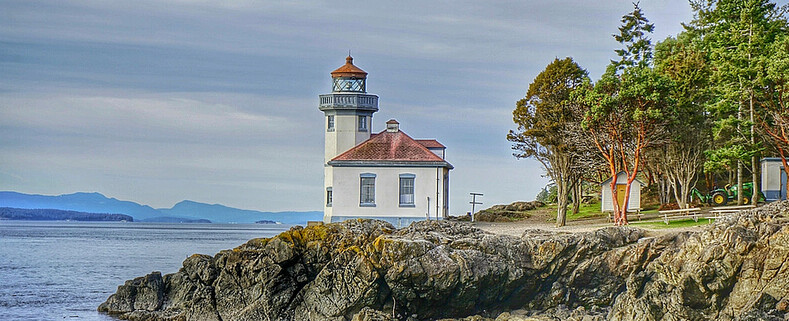
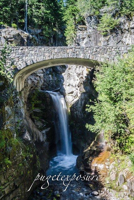
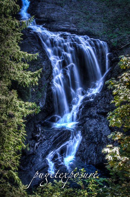
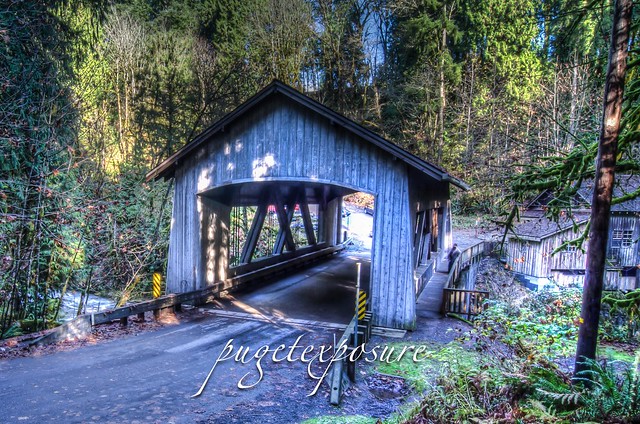
Christine Falls is a waterfall on Van Trump Creek in Mt Rainier National Park. The falls is a two tiered drop totaling 69 feet (21 m) feet high. The upper drop is 32 feet (9.8 m) high and the lower drop is 37-foot (11 m). The lower drop cascades under the Christine Falls Bridge which was built in 1928.
Christine Falls are located immediately next to SR 706, on Van Trump Creek, about 2 1/2 miles east of Cougar Rock campground, or about 3 1/2 miles west of Narada Falls. It's pretty obvious, due to the amount of people usually around the falls, the tight gorge next to the bridge and the sign on the far side of the bridge. A short path leads to good views upstream to the falls from a fenced overlook.
Please Support Puget Exposure
We love to bring you guys the updates to best and greatest photography locations in and around Seattle and the greater Puget Sound area, photography tips and gear related stuff. However, we can’t keep doing that unless we have your continued support. If you would like to purchase any of images featured in an article, please do so by clicking HERE or on the Post Cards and Prints tab above in the header. You can also make secure donation to the travel fund via PayPal. If you frequently shop on Amazon.com, by clicking on the Amazon links listed below you can continue to browse Amazon and any purchase you make will give us a small portion of the sale to continue to run this website.
Banner Links for PEP
Gear Used:
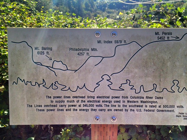
Washington State travel, Washington State travel, Washington Destinations, Photography, Photography spots, best things to do in Seattle, Best things to in Washington State, Washington Tourism Alliance, Washington State Tourism board, recommendations, recommendations for things to see in washington state, things to do in washington state, things to do in seattle, things to do in Tacoma washington, Washington Photographers, Washington nikon shooters, best seattle photography, washington exploration, experience washington, what to do while visiting seattle, seattle top attractions, seattle food, Space Needle, Explore Washington State, Puget Exposure Photography, Puget Exposure, Road Trips through Washington State, Weird Washington, King County, Snohomish County, Seattle, Everett, Tacoma, Kent, Redmond, Kirkland, Washington Sunrises where and when, Washington State Weather, Christine Falls, Mount Rainier National Park, Waterfalls
Wallace Falls State Park Gold Bar, WA MAP IT Driving Directions:
From Everett follow US 2 for 28 miles east to the hamlet of Gold Bar. Just before milepost 28, turn left onto 1st Street (signed for Wallace Falls State Park). Pro-ceed for 0.4 mile to a four-way stop. Turn right onto May Creek Road and continue for 1.5 miles to Wallace Falls State Park and the trailhead (elev. 300 ft). Restrooms and water available at parking lot.
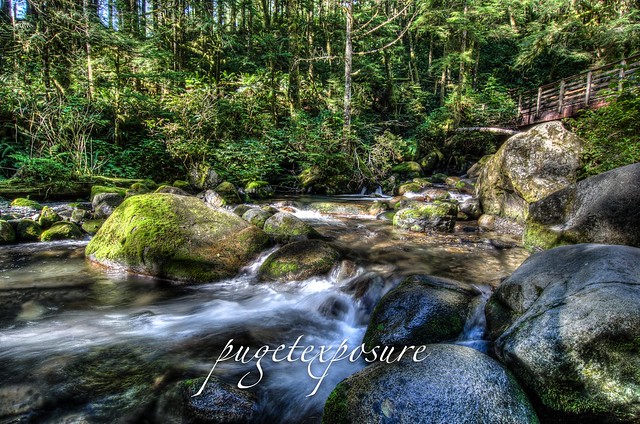
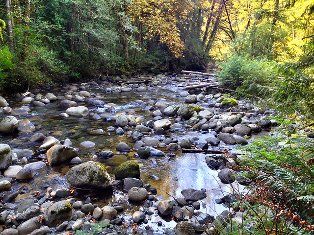
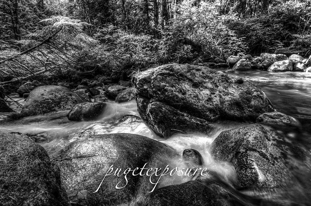
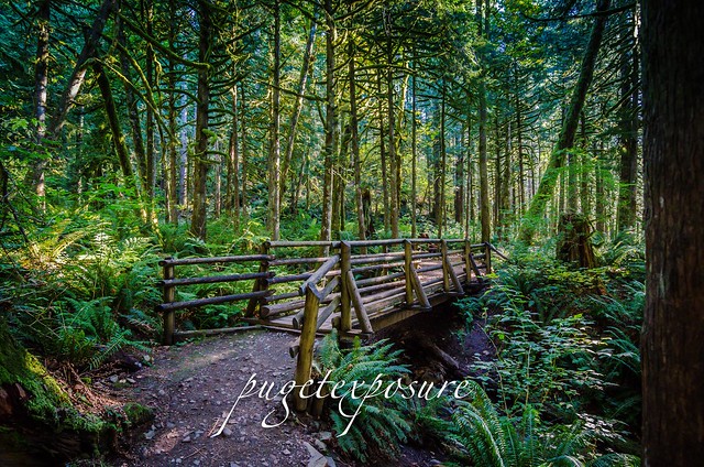
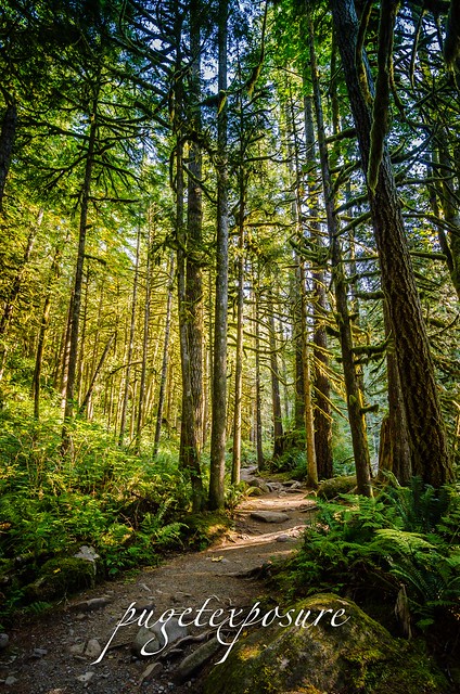
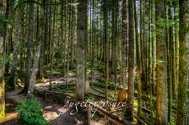
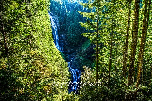
Wallace Falls, named after homesteaders Joe and Sarah Kwayaylsh members of the Skykomish tribe, is a 4,735 acre forest land on the western slope of the North Cascade Mountain range in Snohomish County. The park has three back country lakes, Jay Lake, Shaw Lake and Wallace Lake which are connected via the Wallace River. The river trickles, snakes, gurgles and plunges its way through the park until the valley basin. Some where within the park there has to be a waterfall worth of a title right? Well there are more than 9 waterfalls in the park. Some small some larger, some are running year round while others only run in late winter/early spring with the snowmelt run off. The 4 falls that are more easily accessible can be found along the Woody Trail, a 2.3 mile / 3.7 km long dirt trail that is well maintained and well marked. After recent rain fall, the trail might be come very muddy and slippery in spots. There are numerous switch backs and steep inclines that have tall raised steps. At 6'1 I did not have much trouble navigating the steps and switch backs, but those shorter might have more difficulty with the high steps. 2.3 miles may not seem like much, just remember its 2.3 miles each way (5.6 miles round trip) and its up and down hill sides with incremental elevation gains of 500 feet in short distances. Proper footwear and good to better conditioning is required to make it a safe and enjoyable hike. We made Wallace Falls into a mid morning hike and returned to the trailhead in about 3 1/2 hours with stops along the way (see pictures below :)
Wallace River
Crossing over Small Falls
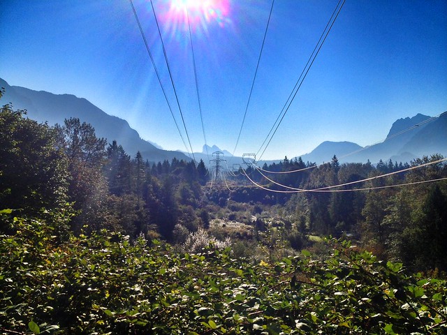
The Trail begins with a 1/4 walk under some buzzing high energy power lines
Another bend in the trail that follows Wallace River
S
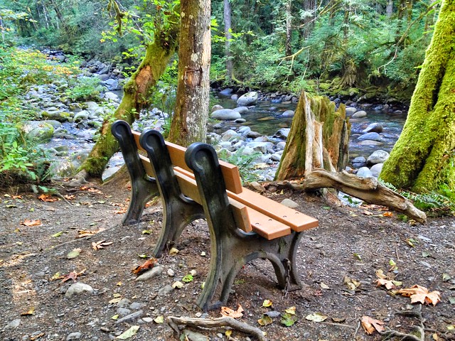
Along the trail there are a few benches to take a break and enjoy the sights and sounds
Sma
This is one of many wooden bridges to cross along the trail
Crossing over the North Fork of Wallace River
Middle Falls Overlook
Middle Falls Overlook
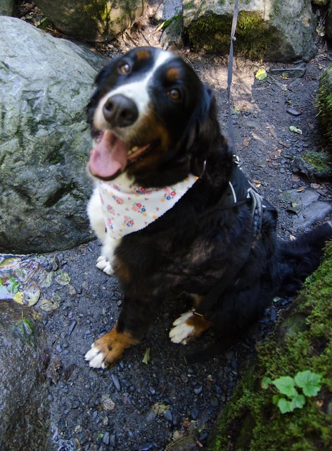
Wallace Falls State Park is DOg Friendly, so bring you dog on a leash for some exploring
Please Support Puget Exposure
We love to bring you guys the updates to best and greatest photography locations in and around Seattle and the greater Puget Sound area, photography tips and gear related stuff. However, we can’t keep doing that unless we have your continued support. If you would like to purchase any of images featured in an article, please do so by clicking HERE or on the Post Cards and Prints tab above in the header. You can also make secure donation to the travel fund via PayPal. If you frequently shop on Amazon.com, by clicking on the Amazon links listed below you can continue to browse Amazon and any purchase you make will give us a small portion of the sale to continue to run this website.
Banner Links for PEP
Gear Used:
Washington State travel, Washington State travel, Washington Destinations, Photography, Photography spots, best things to do in Seattle, Best things to in Washington State, Washington Tourism Alliance, Washington State Tourism board, recommendations, recommendations for things to see in washington state, things to do in washington state, things to do in seattle, things to do in Tacoma washington, Washington Photographers, Washington nikon shooters, best seattle photography, washington exploration, experience washington, what to do while visiting seattle, seattle top attractions, seattle food, Space Needle, Explore Washington State, Puget Exposure Photography, Puget Exposure, Road Trips through Washington State, Weird Washington, King County, Snohomish County, Seattle, Everett, Tacoma, Kent, Redmond, Kirkland, Washington Sunrises where and when, Washington State Weather, Wallace Falls State Park, Washington State Park, Lower Falls, Upper Falls, Middle Falls, Snohomish County
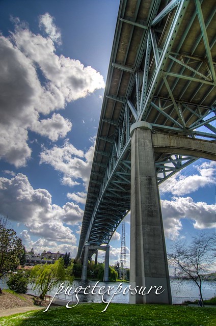
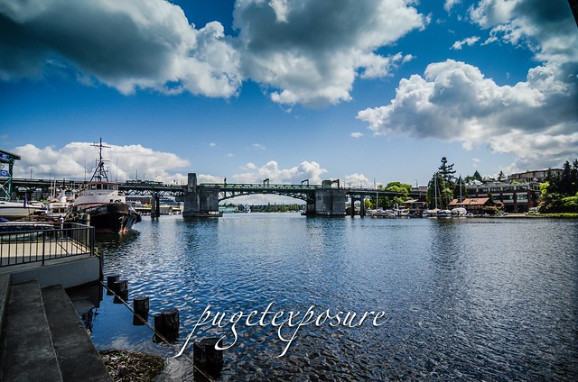
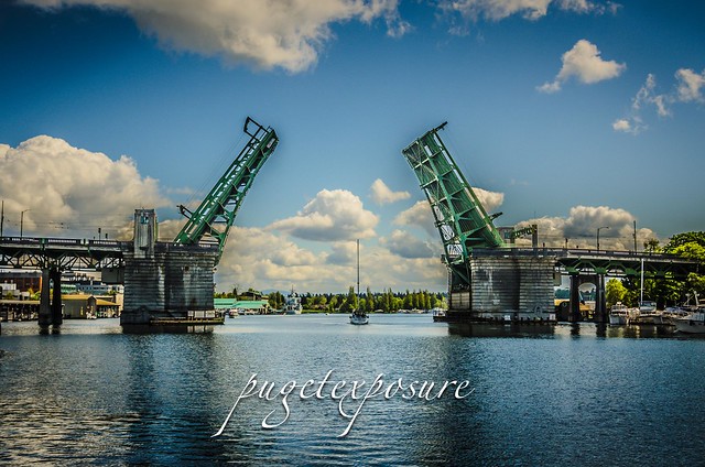
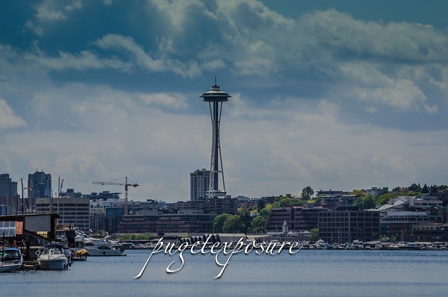
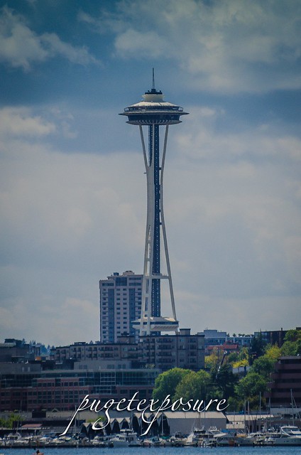
North Passage Point Park is a small 0.8 green space on the north shore of Lake Union directly under the I-5 Ship Canal Bridge that spans the Portage Bay Canal. For it being tucked away and its small size it makes up for with views of Queen Anne, Space Needle and the Eastlake Ave Draw Bride to the east. Dedicated in 1977 after the construction of the I-5 Ship Canal Bridge project its the sister park to the South Passage Point Park on the opposite shoreline.
Looking up at Ship Canal Bridge I-5
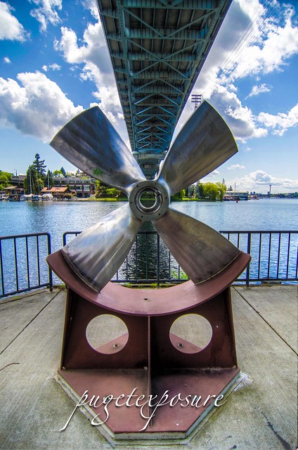
Shallow Draft Propeller from Tugboat "Artic Bear"
Eastlake Ave Draw Bridge
Sailboat passing through the Eastlake Ave Draw Bridge
Downtown Seattle view
Zoom View of Seattle Space Needle
Gear Used:
Washington State travel, Washington State travel, Washington Destinations, Photography, Photography spots, best things to do in Seattle, Best things to in Washington State, Washington Tourism Alliance, Washington State Tourism board, recommendations, recommendations for things to see in washington state, things to do in washington state, things to do in seattle, things to do in Tacoma washington, Washington Photographers, Washington nikon shooters, best seattle photography, washington exploration, experience washington, what to do while visiting seattle, seattle top attractions, seattle food, Space Needle, Explore Washington State, Puget Exposure Photography, Puget Exposure, Road Trips through Washington State, Weird Washington, King County, Snohomish County, Seattle, Everett, Tacoma, Kent, Redmond, Kirkland, Washington Sunrises where and when, Washington State Weather,Seattle Parks, List of Seattle parks, North Passage Bay Park, South Passage Bay Park, Views around Seattle, Seattle Waterfront Photography locations, Seattle Park Photograps, SEattle Photographers, City Photographs of Seattle, Best places to visit in Seattle, different views of Seattle, read more about the puget sound and seattle over at www.pugetexposure.com
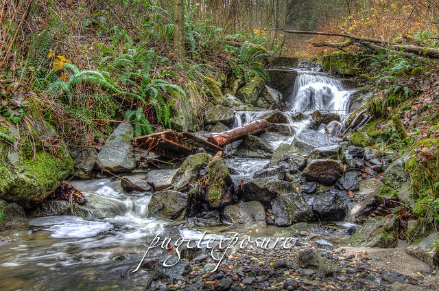
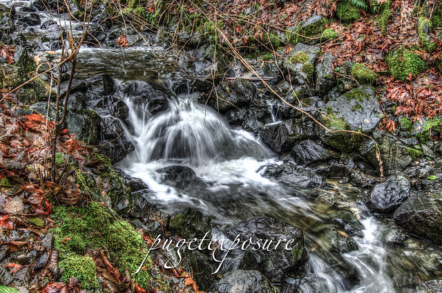
Lower Japanese Gulch Stream
This 1/2 half miles stream runs parallel to the Boeing Factory Rail Road Tracks. Park at the Tails and Trails Dog Park off of 5th Avenue, walk past the gate and keep to the right of the rail road tracks to connect with the service road. You will start hearing the cascading water in about 300 yards up the gravel road on the right hand side. This stream runs high after recent rain falls.
Washington State travel, Washington State travel, Washington Destinations, Photography, Photography spost, best things to do in Seattle, Best things to in Washington State, Washington Tourism Alliance, Washington State Tourism board, recommendations, recommendations for things to see in washington state, things to do in washington state, things to do in seattle, things to do in Tacoma washington, Washington Photographers, Washington nikon shooters, best seattle photography, washington exploration, experience washington, what to do while visiting seattle, seattle top attractions, seattle food, Mukilteo Washington, Mukilteo Washington Family Photographers, Mukilteo Lighthouse off leash dog parks in snohomish county, Snohomish County Photographers, Mukilteo Parks, mukilteo Hiking, living in mukilteo washington, Mukilteo realestat, mUkilteo houses, Japanese gulch Mukilteo Washington
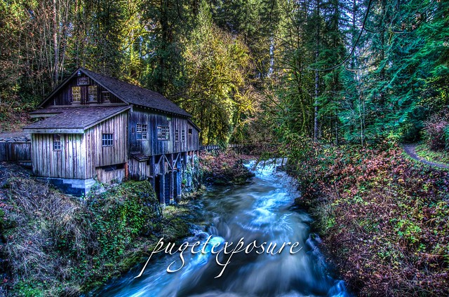
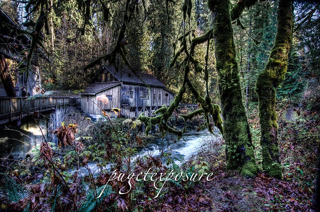
Built in 1876 along east bank of a Cedar Creek on a rocky slope this grist mill uses the power of the falling water to provide the energy needed to mill grains or press apples. It is one of 54 working grist mills in the United States.
Washington State travel, Washington State travel, Washington Destinations, Photography, Photography spost, best things to do in Seattle, Best things to in Washington State, Washington Tourism Alliance, Washington State Tourism board, recommendations, recommendations for things to see in washington state, things to do in washington state, things to do in seattle, things to do in Tacoma washington, Washington Photographers, Washington nikon shooters, best seattle photography, washington exploration, experience washington, what to do while visiting seattle, seattle top attractions, seattle food, Cedar Grist Mill in Washington State, Abandoned Washington State, farming in Washington State, Cedar Grist Mill Washington STate, Cedar Grist Mill Photographs, Cedar Grist Mill Photography Prints, Cedar Grist Mill, Where is the Cedar Grist Mill?
Picnic Point Park
12001 Picnic Point Road
Edmonds, WA 98026
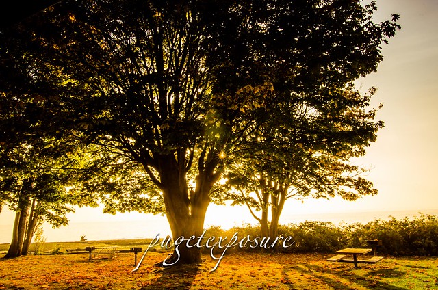
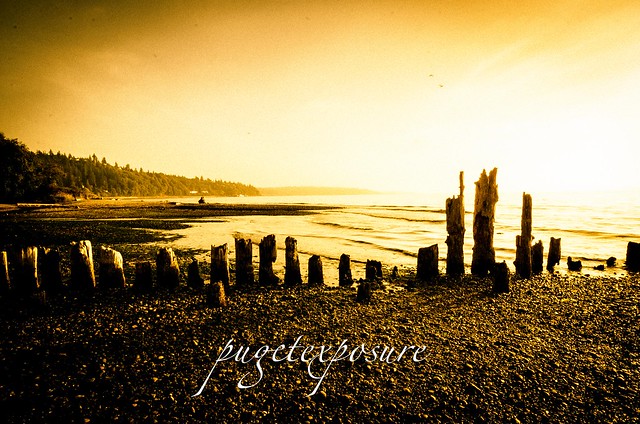
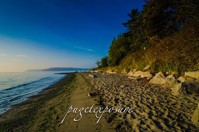
Located on the shores of Puget Sound, Picnic Point Park offers a
tranquil and scenic setting for picnicking and beach activities. Tables
and charcoal cookers are available for picnicking enjoyment. With its
excellent views of Whidbey Island and the distant Olympic Mountain
range, sunset viewing is always a popular pastime.
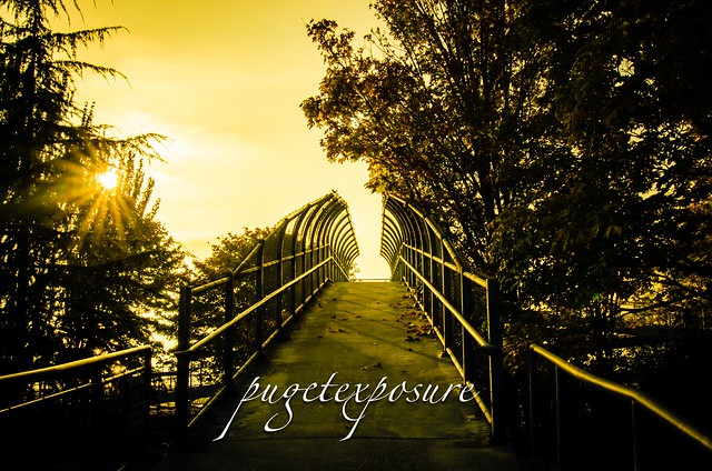
With its large pedestrian overpass, the park provides convenient access
to the beach, picnic areas, and restrooms. Those who are physically
challenged may require assistance.
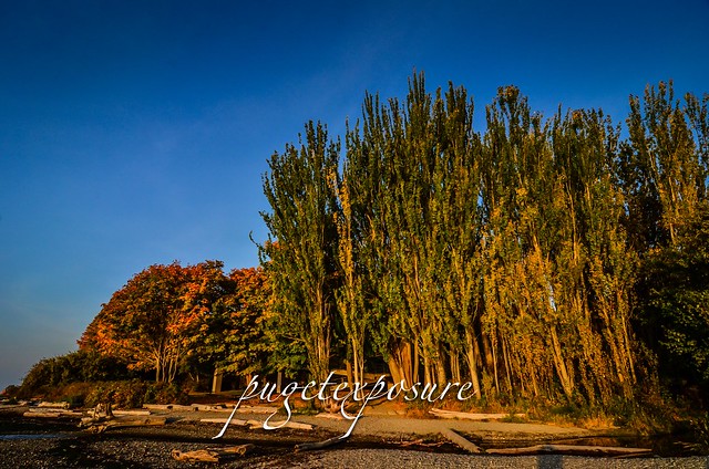
As with all the beaches lining the Puget Sound area their accessibility
depends on the current tide levels. To get the most beach area make sure
you visit the park during a low tide.
Picnic Point Edmonds Washington, Picnic Point, family parks in edmonds, Picnic Point in Snohomish County, top snohomish county parks, Puget sound beaches, Beaches in Edmonds Washington, Dog parks in Edmonds, best places to see a sunset in Edmonds, WA, Explore Washington, Explore Edmonds Washington, Picnic Point Sunset Vistas, Picnic Point Park Snohomish, visiting picnic point park, Washington State Photographers, Washington Landscape Photographers, Landscape Photographer, Edmonds Photography, Edmonds Washington Post Cards, Washington Sunset Photography, Picnic Point Park Photos, Picnic Point Photography