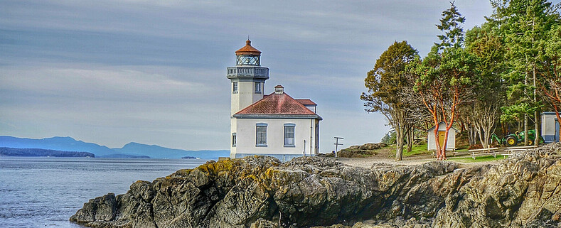
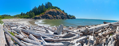
Cape Disappointment State Park covers 1,882 acres, has 2 miles of ocean beaches and features 2 lighthouses the Cape Disappointment Lighthouse and the North Head Lighthouse. The cliff at the southern tip of the park rise to over 230 feet above the Pacific Ocean. There are many trails that traverse the state park and lead you to the lighthouses and interpretive center. There are primitive to full utility sites available for tents and RV's and you can also reserve yurts via the state website. Modern bathroom facilities have coin operated hot showers.
The Columbia River, named after Captain Robert Grey's vessel Columbia Redivivia in 1792, travels nearly 1,200 miles from its source in the Canadian rockies before reaching the Pacific Ocean at Cape Disappointment. The width and strength of the Columbia River causes lots of sand and sediment to build up at the mouth of the river. The rapid flowing river over the shallow sand bar colliding with the Pacific Ocean creates one of the worlds most dangerous waterways. Between 1725 and 1961 234 ships have run aground or been sunk by the turbulent waters.
The current name for Cape Disappointment dates back to a captain's log entry from July 1788 made by Captain John Meares, who tried to seek shelter for his vessel during a violent sea. After rounding the cape in search of calmer waters he wrote, "Disappointment continued to accompany us...we can safely say no river exists." Captain Meares christened the cape, "Cape Disappointment."
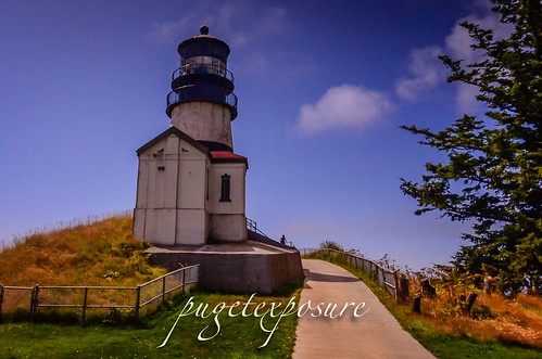
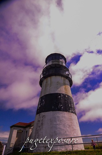
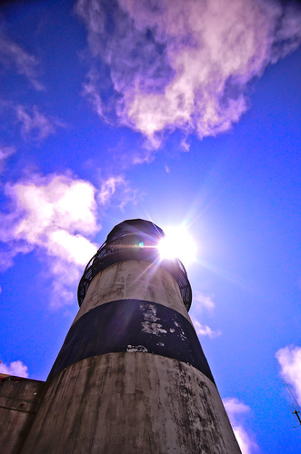
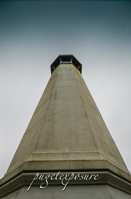
The first attempts at marking the entrance to the Columbia River included topping of trees on the bluff and hanging a white flag. The increased marine traffic and shipwrecks along the cape resulted in a need for better navigation including channel markers and a lighthouse. On October 15th, 1856 the 53' foot tall Cape Disappointment Lighthouse was light. The lighthouse was maintained by 7 different light keepers from 1856 to 1930s. The fourth-order Fresnel lens was removed and the light electrified in 1937. The lighthouse became fully automated in 1973.
In March 1865 after the bark Industry wrecked near the cape and 17 crew drowned Light Keeper Captain Munson rebuilt a battered longboat as a lifeboat. One year later the cargo ship W.B Scranton ran aground and the entire crew was saved with the lifeboat. Through Lighthouse Keeper Munson's efforts a life saving station was established in 1871.
Today the United States Coast Guard continues to respond to maritime emergencies from its Cape D station located at Cape Disappointment and to train crew members from across the country on surf and heavy seas rescues through its National Motor Lifeboat School.
Cape Disappointment Lighthouse distinctive black horizontal stripe was added to distinguish it from the North Head Lighthouse just 2 miles to the north
National Motor Lifeboat School photo credit: USCG Petty Officer Jamie Parsons
View from Waikiki Beach Photo credit : Abhinaba Basu
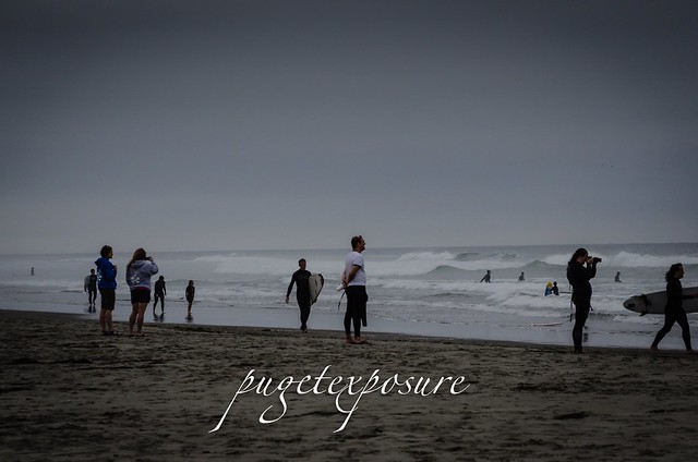
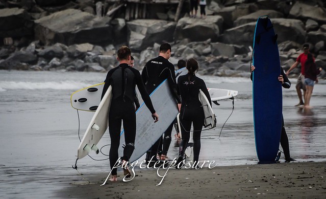
Westhaven State Park Grays Harbor Bay Westport, Washington MAP IT Westhaven State Park is a 79.06-acre day-use park with 1,215 feet of shoreline on the Pacific Ocean and Half Moon Bay. The park has panoramic views of the beach and is within minutes of the city of Westport, the marina and nearby attractions. Sitting along the South Jetty, the park is a popular destination for surfing, jetty fishing, crabbing and picnicking. A concrete boardwalk transverses the primary dune, connecting this park with Westport Light State Park, 1.3 miles away.
Please Support Puget Exposure
We love to bring you guys the updates to best and greatest photography locations in and around Seattle and the greater Puget Sound area, photography tips and gear related stuff. However, we can’t keep doing that unless we have your continued support. If you would like to purchase any of images featured in an article, please do so by clicking HERE or on the Post Cards and Prints tab above in the header. You can also make secure donation to the travel fund via PayPal. If you frequently shop on Amazon.com, by clicking on the Amazon links listed below you can continue to browse Amazon and any purchase you make will give us a small portion of the sale to continue to run this website.
Banner Links for PEP
Gear Used:
Washington State travel, Washington State travel, Washington Destinations, Photography, Photography spots, best things to do in Seattle, Best things to in Washington State, Washington Tourism Alliance, Washington State Tourism board, recommendations, recommendations for things to see in washington state, things to do in washington state, things to do in seattle, things to do in Tacoma washington, Washington Photographers, Washington nikon shooters, best seattle photography, washington exploration, experience washington, what to do while visiting seattle, seattle top attractions, seattle food, Space Needle, Explore Washington State, Puget Exposure Photography, Puget Exposure, Road Trips through Washington State, Weird Washington, King County, Snohomish County, Seattle, Everett, Tacoma, Kent, Redmond, Kirkland, Washington Sunrises where and when, Washington State Weather,
The Grays Harbor Inlet is one of the few along Washington State's coastline to allow ocean going vessels to enter without having to sail up a difficult river or channel. The towns of Hoquiam, Westport and Aberdeen saw increased growth and revenue from the booming timber industry in the late 1800s. By 1880s a number of ships had wreck near the entrance to Grays harbor and local representatives headed to Washington to ask law makers for funds to construct a lighthouse to aid in navigation and protect their lumbar industry.
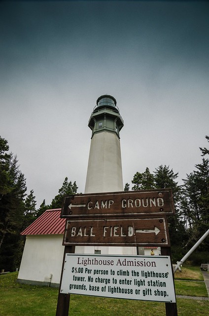
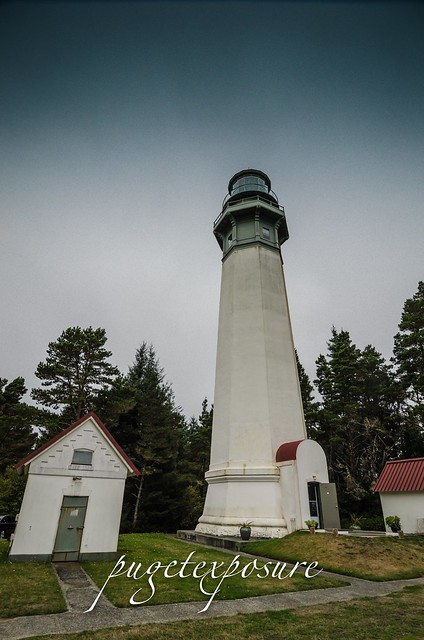
After 14 years of funding issues and construction delays the 107 foot brick and mortar lighthouse was built on a tract of land 400 feet from the break water. Over the past 100 years storms and sediment accretion from the jetty protruding from the entrance to Grays Harbor have deposited nearly 3000 feet of sand in front of the lighthouse. Currently Grays Harbor Lighthouse sits 4 blocks from the ocean hidden amongst the trees with only its light tower rising above the tree line.
There are 135 metal stair bolted to the brick interior which take depending on your fitness level about 10 minutes to ascend.
There is no fee to lighthouse grounds or gift shop but it will cost you $5 and some sweat to get to the top of the lighthouse.
Garys Harbor Lighthouse with fog signal building Photograph courtesy University Washington
Please Support Puget Exposure
We love to bring you guys the updates to best and greatest photography locations in and around Seattle and the greater Puget Sound area, photography tips and gear related stuff. However, we can’t keep doing that unless we have your continued support. If you would like to purchase any of images featured in an article, please do so by clicking HERE or on the Post Cards and Prints tab above in the header. You can also make secure donation to the travel fund via PayPal. If you frequently shop on Amazon.com, by clicking on the Amazon links listed below you can continue to browse Amazon and any purchase you make will give us a small portion of the sale to continue to run this website.
Banner Links for PEP
Gear Used:
Washington State travel, Washington State travel, Washington Destinations, Photography, Photography spots, best things to do in Seattle, Best things to in Washington State, Washington Tourism Alliance, Washington State Tourism board, recommendations, recommendations for things to see in washington state, things to do in washington state, things to do in seattle, things to do in Tacoma washington, Washington Photographers, Washington nikon shooters, best seattle photography, washington exploration, experience washington, what to do while visiting seattle, seattle top attractions, seattle food, Space Needle, Explore Washington State, Puget Exposure Photography, Puget Exposure, Road Trips through Washington State, Weird Washington, King County, Snohomish County, Seattle, Everett, Tacoma, Kent, Redmond, Kirkland, Washington Sunrises where and when, Washington State Weather, Grays Harbor, Grays Harbor Lighthouse, Washington State Tallest Lighthouse, Westport, Washington, Lighthouses
Long Beach Peninsula was established into a resort area in the 1880s by Henry Harrison Tinker who invested monies into land claims, built hotels and infrastructure to attract vacationers from the Portland area to western Washington's coast. People would board a ship in Portland, Oregon and float down the Columbia River to the Port of Ilwaco and would ride on horse drawn wagons up to "Tinkerville" now called Long Beach. In 1889 the Ilwaco Railway and Navigation Company laid a narrow gauge railroad that ran up the whole peninsula which was in service until 1930 when automobiles and the push for a national highway system arrived in western Washington.
The 28 mile long peninsula lies between the Pacific Ocean and Willapa Bay is known for its abundant seafood harvest including the largest salmon run in the world, razor clams, halibut, cod and oysters. Half of the oysters harvested in the State of Washington come from the Long Beach Peninsula.
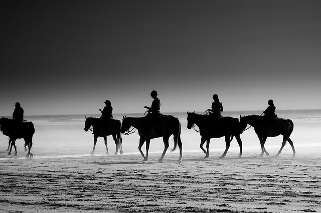
The soft yellow sand and warm summer temperatures attracted thousands of visitors to make the 8 hour ship/train voyage to Long Beach back in the late 1880s. Today people still converge on Long Beach for its resort town feel. Although there are no longer horse drawn wagons making their way up and down the beach you can still bring your own horse or take a guided horse back ride on the beach. Restaurants, museums, gift shops and kite shops keep downtown Long Beach bustling in the summer months.
There are around 1,300 people that live year round in Long Beach but during the summer months population numbers swell as tourists, vacationers and vacation home owners arrive in great numbers.
There are many fishing, food, and kite flying festivals that are held at Long Beach every year.
Although the temperatures can reach the mid 80s in the summer the pacific ocean is still very for swimmers but the wide beaches and boardwalk make beach walking easy and fun.
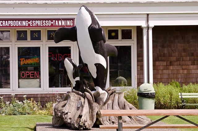
Orca Statue downtown Long Beach
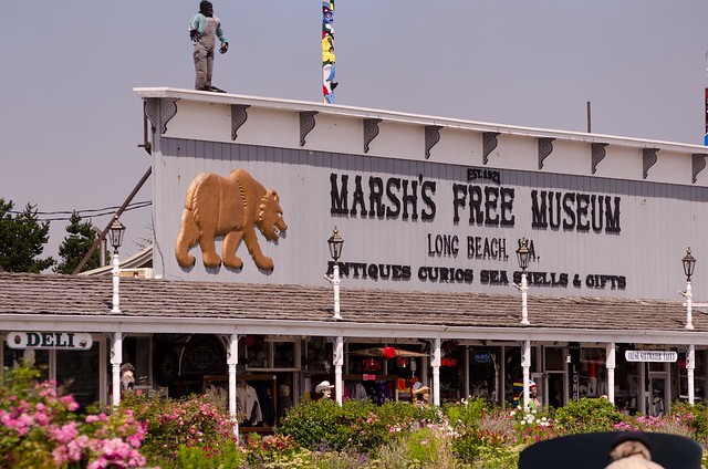
former "World's Largest Frying Pan" cast for the Razor Clam festival in 1941
Jake the Alligator Man Mural in Fish Alley
Evening Beach Trot
Please Support Puget Exposure
We love to bring you guys the updates to best and greatest photography locations in and around Seattle and the greater Puget Sound area, photography tips and gear related stuff. However, we can’t keep doing that unless we have your continued support. If you would like to purchase any of images featured in an article, please do so by clicking HERE or on the Post Cards and Prints tab above in the header. You can also make secure donation to the travel fund via PayPal. If you frequently shop on Amazon.com, by clicking on the Amazon links listed below you can continue to browse Amazon and any purchase you make will give us a small portion of the sale to continue to run this website.
Banner Links for PEP
Gear Used:
Washington State travel, Washington State travel, Washington Destinations, Photography, Photography spots, best things to do in Seattle, Best things to in Washington State, Washington Tourism Alliance, Washington State Tourism board, recommendations, recommendations for things to see in washington state, things to do in washington state, things to do in seattle, things to do in Tacoma washington, Washington Photographers, Washington nikon shooters, best seattle photography, washington exploration, experience washington, what to do while visiting seattle, seattle top attractions, seattle food, Space Needle, Explore Washington State, Puget Exposure Photography, Puget Exposure, Road Trips through Washington State, Weird Washington, King County, Snohomish County, Seattle, Everett, Tacoma, Kent, Redmond, Kirkland, Washington Sunrises where and when, Washington State Weather, Long Beach Washington, history of long beach, jake the snake fish, meet jake
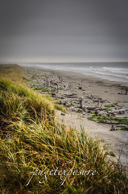
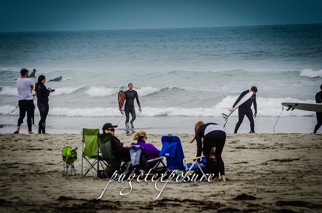
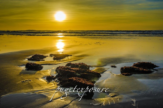
Lincoln City is a small quaint oceanfront town along US Hwy 101. The beaches are sandy and very wide. During low tide the beach can be up to 2oo yards deep. The town has about 7000 year round residence and in the summer months can swell 2x to 3x with many tourist flocking to the pacific ocean on holiday trips. If you are planning to travel to the Oregon coast I suggest booking early since hotel rates will be 4-5 times higher in the spring and summer versus the fall and winter.
The northern part of the town features newly widened streets and
walkways along 4 city blocks of storefronts that feature everything from
handmade arts&crafts to kites and candy shops.
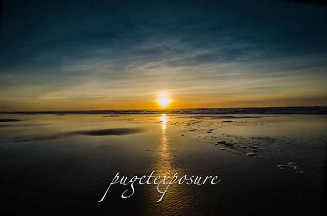
Evening coatsal sunset
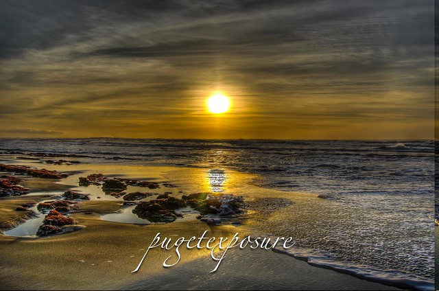
Tide Pools visible during low tide
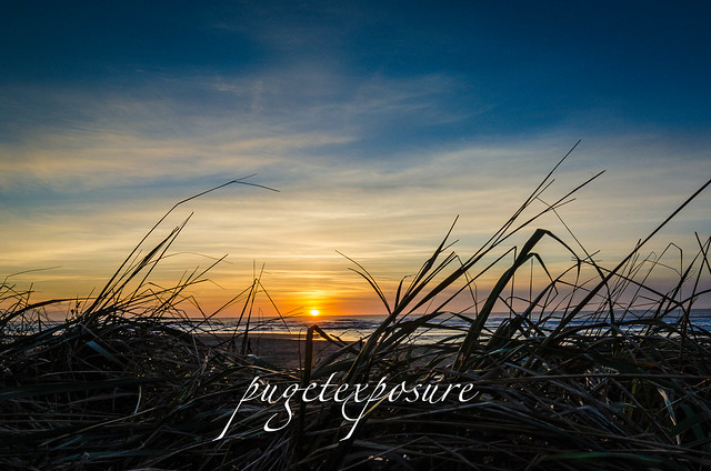
Beach grass and sunset
Gear Used:
Washington State travel, Washington State travel, Washington Destinations, Photography, Photography spost, best things to do in Seattle, Best things to in Washington State, Washington Tourism Alliance, Washington State Tourism board, recommendations, recommendations for things to see in washington state, things to do in washington state, things to do in seattle, things to do in Tacoma washington, Washington Photographers, Washington nikon shooters, best seattle photography, washington exploration, experience washington, what to do while visiting seattle, seattle top attractions, seattle food, Oregon Photographers, Oregon Coast, Oregon Photography, Destination Oregon, What to see in Lincolns City Oregon,Pacific Ocean Landscape Photography, My trip to Lincoln City Oregon, sunset landscape photography in Oregon