Lime Kiln Lighthouse

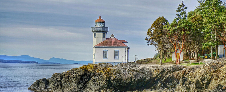
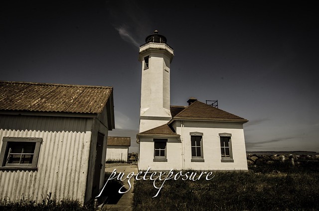
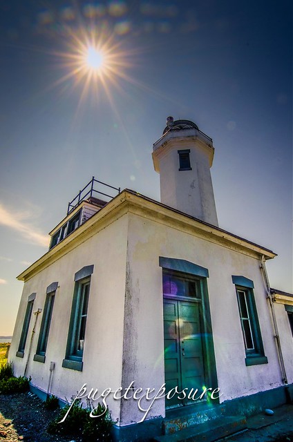
Lime Kiln Lighthouse on the west side of San Juan Island, Washington

Lime Kiln Lighthouse on the west side of San Juan Island, Washington

Lime Kiln Lighthouse on the west side of San Juan Island, Washington

Lime Kiln Lighthouse on the west side of San Juan Island, Washington

Lime Kiln Lighthouse on the west side of San Juan Island, Washington

Showing posts with label san juan. Show all posts

Sunday, July 14, 2013

No. 203 Mount Erie, Anacortes

Mount Erie
Heart Lake Road / Ray Auld Dr
Anacortes, WA
MAP IT 


Mount Erie View POI


Mt. Erie View Point  is on the highest mountain of Fidalgo Island in Skagit County. The 160 acre park is operated by the Anacortes Community Forest Lands and offers various adventure activities such as multiple rock face ascents, trails and a number of hill top viewing areas. At the intersection of Heart Lake Road and Ray Auld Dr. there is a parking area and trail heads that meander through the forest. Located at the south end of the parking lot is Erie Mountain Dr, a 1.5 mile one lane paved road that you can either hike, bike or drive to the main viewing areas. The drive takes about 10 minutes as it zig zags its way up 800 feet in elevation to the top.
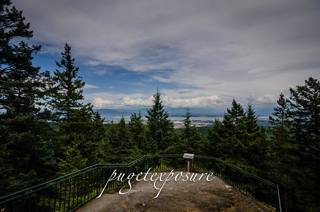
The end of Erie Mountain Drive is at around 1200 feet and has multiple viewing areas that looks east, west, and south all are just a few minute walk from the parking lot. The south face of MT. Erie is a popular rock climbing location with its exposed rock face that extends 900 feet vertically down to Lake Campbell.


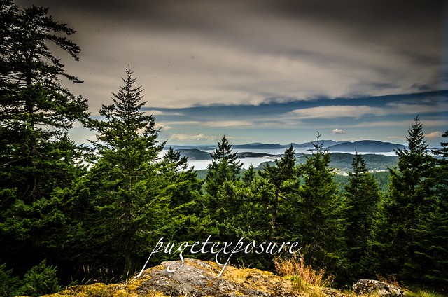
Mount Erie Overlook, Anactores Washington
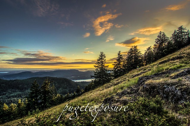
Looking East towards Padilla Bay and Burlington, WA
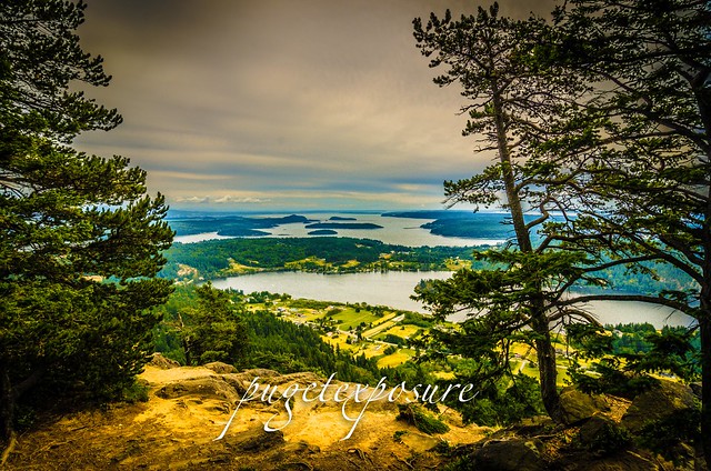
Mount Erie Overlook, Anactores Washington
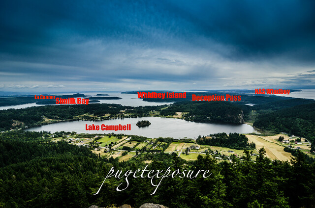
Looking South over Lake Campbell


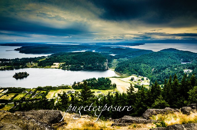
Mount Erie Overlook, Anactores Washington
Lake Campbell, Deception Pass, Naval Air station Whidbey, and Whidbey Island

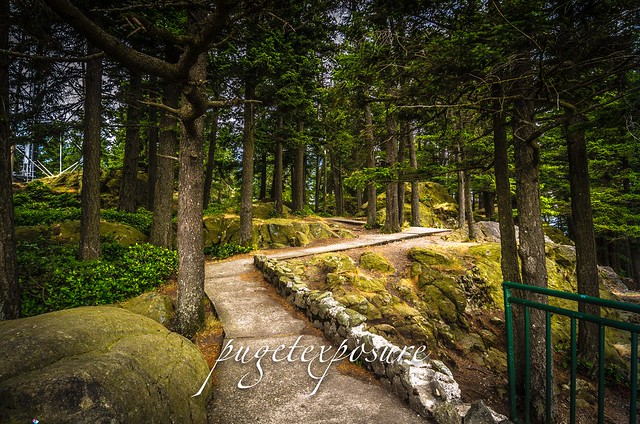
Mount Erie Overlook, Anactores Washington
Overlook Forest Trail

Mount Erie Overlook, Anactores Washington
Burrows Bay, Allen Island, Lopez Island


Washington State travel, Washington State travel, Washington Destinations, Photography, Photography spost, best things to do in Seattle, Best things to in Washington State, Washington Tourism Alliance, Washington State Tourism board, recommendations, recommendations for things to see in washington state, things to do in washington state, things to do in seattle, things to do in Tacoma washington, Washington Photographers, Washington nikon shooters, best seattle photography, washington exploration, experience washington, what to do while visiting seattle, seattle top attractions, seattle food, Mount Erie, Mount Erie Anacortes, Anactores washington state, Fidalgo Island, Things to do in anancortes

Sunday, June 9, 2013

No. 191 Bay View State Park

Bay View State Park
10901 Bay View-Edison Rd
Mt Vernon, WA 98273

MAP IT 

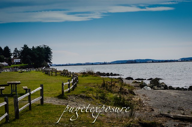
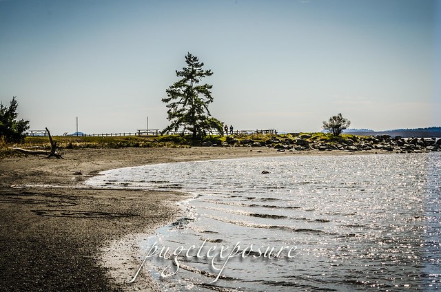
Bay View State Park covers around 25 acres and has a play area, camp ground including yurts is located on the eastern shore of Padilla Bay in Skagit County and has 1200 feet of shoreline.
Padilla Bay is an estuary at the saltwater edge of the large delta of the Skagit River in the Salish Sea. It is about eight miles long (north to south) and three miles across. In 1980, this bay was selected to be included in the National Estuarine Research Reserve System. Because the bay is filled with sediment from the Skagit River, the bottom is very shallow, flat, and muddy. It is so shallow that almost the whole bay is intertidal. This means that it is flooded at high tide. When the tide goes out the whole bay empties out, exposing miles and miles of mud flats. This condition allows unusually large eelgrass meadows to grow. There are nearly 8,000 acres of eelgrass (Zostera marina and Z. japonica) in Padilla Bay.
Habitats in the Padilla Bay support herring, smelt, pink and chum salmon, flatfish, Dungeness crab, ducks including Black Brant, eagles, shorebirds, and peregrine falcons.  Mammals found in Padilla Bay include harbor seals and river otters.


  Padilla Bay Padilla Bay


Gear Used:
 
lens rental Washington State travel, Washington State travel, Washington Destinations, Photography, Photography spots, best things to do in Seattle, Best things to in Washington State, Washington Tourism Alliance, Washington State Tourism board, recommendations, recommendations for things to see in washington state, things to do in washington state, things to do in seattle, things to do in Tacoma washington, Washington Photographers, Washington nikon shooters, best seattle photography, washington exploration, experience washington, what to do while visiting seattle, seattle top attractions, seattle food, Space Needle, Explore Washington State, Puget Exposure Photography, Puget Exposure, Road Trips through Washington State, Weird Washington, King County, Snohomish County, Seattle, Everett, Tacoma, Kent, Redmond, Kirkland, Washington Sunrises where and when, Washington State Weather, Anacortes, Padilla Bay National Estuarine Research Reserve, Padilla Bay is located in Skagit County, Washington, in the northern reaches of greater Puget Sound, on the southeastern fringe of the San Juan Archipelago. The Padilla Bay National Estuarine Research Reserve (NERR) protects one of the largest continuous beds of eelgrass in the contiguous United States. The surrounding region is part of the Skagit Valley agricultural complex, one of the most fertile regions in the world. Padilla Bay covers more than 11,000 acres of a broad, flat intertidal embayment disconnected from normal flows of the Skagit River due to diking. Habitats within the reserve are predominately aquatic with most of its habitat dominated by eelgrass (Zostera marina and Z. japonica), with a smaller portion of its boundary including uplands, freshwater sloughs, and high salt marsh. Habitats in the Padilla Bay NERR support herring, smelt, pink and chum salmon, flatfish, Dungeness crab, ducks including Black Brant, eagles, shorebirds, and peregrine falcons. Mammals found in Padilla Bay include harbor seals and river otters.

Monday, April 22, 2013

No. 179 Visit National State Parks for free ALL WEEK

National Park Week April 20th through the 28th 2013


From now until Friday, entrance to all national parks is waived as part of National Parks week. Around here, the biggies are Mount Rainier National Park and Olympic National Park. (North Cascades does not charge an entrance fee.)

The weather forecast is looking promising for both parks, especially for the next few days.

 Ebey's Landing Whidbey Island 

 Fort Casey Military Fort
Admiralty Head Lighthouse 
Fort Ebey Armory 
Fort Ebey State Park

North Cascade National Park Area

Artist Point
Picture Lake, Vista Point

Olympic National Park

Hurricane Ridge
Sul Duc Falls
Neah Bay
Ruby Beach
Rialto Beach

Click here to see what other national parks are in Washington. And click here for a list of hikes in North Cascades, Mount Rainier and Olympic national parks from the Washington Trails Association.


Monday, February 4, 2013

No. 164 Cascade Lake, Orcas Island

Cascade Lake
Moran State Park
Orcas Island


Directions to Moran State Park: starting at the Orcas Island ferry terminal follow Orcas Road for 9 miles to Eastsound Village. Continue driving through town and after approximately 1 more mile take a right onto Olga road. The entrance to Moran State Park will be 3 miles ahead.


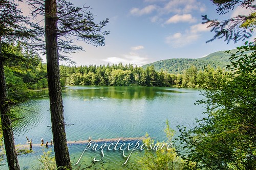
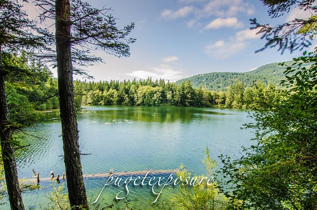
Cascade Lake is located on Orcas Island within Moran State Park. Covering an area of over 220 acres this fresh water lake is a popular destination in the summer for family and kids to col off on a hot day. There are plenty of trails that begin at the lake and lead off into all directions. The Cascade Loop trail is about 2.2 miles in length and stays along the shore line. Other trails will take you up the  the Rustic Falls and Cascade Falls


Cascade Lake Cascade Lake

Fishing: The fishing season starts on April 30th and fishing licenses ( about $8 ) can be purchased in Eastsound Village from Eastsound Sporting Goods. Cascade Lake is stocked yearly with rainbows, cutthroat, and kokanee trout. Cascade Lake as well as Mountain Lake and Twin Lakes ( Both just up the road from Cascade ) make for a decent day of fishing. Pick up a watercraft launching permit for $7 and launch your boat. No combustion engines are allowed on the lakes.


 Gear Used:
 
lens rental Learn Photography Online with the Pros Save $10 Now #KTCJQ12  Receive a FREE GIFT from Think Tank Photo Washington State travel, Washington State travel, Washington Destinations, Photography, Photography spost, best things to do in Seattle, Best things to in Washington State, Washington Tourism Alliance, Washington State Tourism boared, recommendations, recommendations for things to see in washington state, things to do in washington state, things to do in seattle, things to do in Tacoma washington, Washington Photographers, Washington nikon shooters, best seattle photography, washington exploration, experience washington, what to do while visiting seattle, seattle top attractions, seattle food, visiting orcas island, orcas island, san juan islands, visiting san juan islands, san juan, san juan de fuca, puget sound, how to expierience washington, washington state san juan islands, landscape photography in washington, landscape photography tips,

Saturday, February 2, 2013

No. 163 Washington Park Loop

Washington Park
Sunset Ave,
Anacortes, WA 98221


Directions:
From I-5 take Highway 20 west. Enter Anacortes on Spur 20 and take Commercial Avenue to 12th Street. Turn left on 12th and follow the signs (approximately 3 miles) to Washington Park.

Washington Park sits on a peninsula at the west end of Fidalgo Island. The 220-acre city park features camping, a boat launch, and day use picnic sites. A scenic 2.2-mile loop road winds through the park’s forested hills and meadows with views of the San Juan Islands and Olympic Mountains.
There are 73 campsites, 46 have water and electrical hook-ups. A sewer dump station is located near the park exit. Camping check out time is 1pm daily. The campground and the park are open year round from 6am to 10pm. The loop road is open from 6am to dusk for pedestrians and open from 10am to dusk for vehicular traffic.


Found the sunshine
Halfway through the loop trail you pop out of the forest to this parking spot looking out across Burrows Channel.

 
Sunset At Anacortes
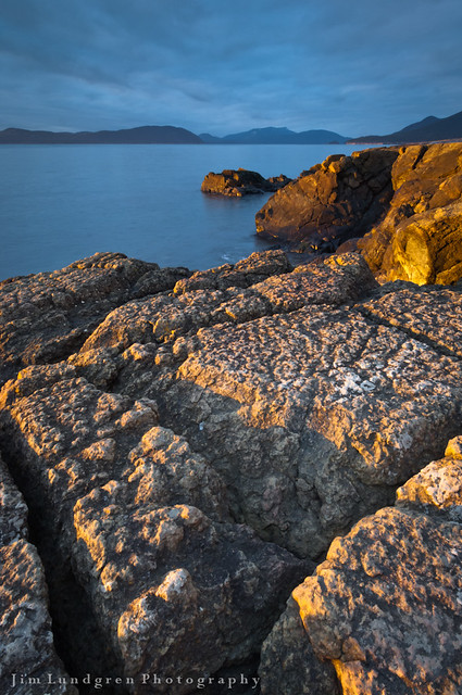
Sunset light from West Beach along Loop Rd by Jim Lundgren


Gear Used:
 
lens rental Learn Photography Online with the Pros Save $10 Now #KTCJQ12  Receive a FREE GIFT from Think Tank Photo Washington State travel, Washington State travel, Washington Destinations, Photography, Photography spost, best things to do in Seattle, Best things to in Washington State, Washington Tourism Alliance, Washington State Tourism boared, recommendations, recommendations for things to see in washington state, things to do in washington state, things to do in seattle, things to do in Tacoma washington, Washington Photographers, Washington nikon shooters, best seattle photography, washington exploration, experience washington, what to do while visiting seattle, seattle top attractions, seattle food,fidalgo island, what to see in anacortes washington, Anacortes Washingotn, what is there to see in anacortes, Anacortes best photography, san juan islands best photography, Washington state ferry system, experience washington, washington best photographers, Downtown Anacortes Washington

Sunday, August 19, 2012

No. 95 Point Wilson Lighthouse

Point Wilson Lighthouse


The Point Wilson Light was built in 1913 by the United States Lighthouse Service. At a height of 51 feet (16 m), the beacon is the tallest on Puget Sound, marking the entrance to Admiralty Inlet. The lighthouse replaced an earlier wooden light tower built in 1879 on the roof of the station keeper's house.
The Point Wilson Lighthouse, located on the north end of Fort Worden State Park near Port Townsend, Washington, is on the National Register of Historic Places and the Washington State Heritage Register. It is one of the most important navigational aids in Washington, a link connecting Puget Sound and the Strait of San Juan de Fuca.

Getting there:
Take the Washington State Ferry Run from Edmonds, WA to Kingston aprox a 40min sailing. Head west along Hwy 104 for 14 miles, then turn right onto Hwy 19 for another 15 miles. Merge onto Hwy 20 N towards Port Townsend. From Highway 20 in Port Townsend, turn left on Kearney Street and when it ends turn right onto Blaine Street. From Blaine Street, turn left onto Walker Street, which will become Cherry Street. Follow Cherry Street 1.6 miles to Fort Worden where the road changes to Fort Worden Way. Enter Fort Worden and turn right on Eisenhower Avenue. When Eisenhower Avenue ends, turn left on Harbor Defense Way and follow it 0.8 miles to the Point Wilson Lighthouse.  


Point Wilson Lighthouse

lens rental Learn Photography Online with the Pros Save $10 Now #KTCJQ12  Receive a FREE GIFT from Think Tank Photo

Tuesday, August 14, 2012

No.93 Mount Constitution


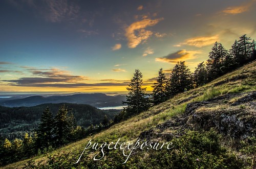
mount constitution sunset, orcas island

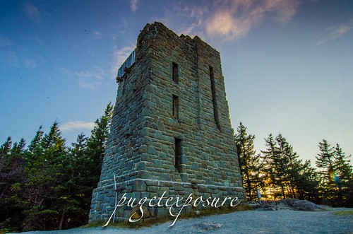
 Mount Constitution at 2,409-foot-high is the highest point on the San Juan Island chain in the Puget Sound. It is located with in Moran State Park which is a 5,252-acre park with five freshwater lakes and over 30 miles of hiking trails, scenic overlooks, waterfalls and wildlife spotting opportunities.
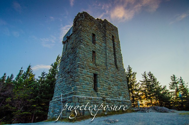
 A 25 minute drive along Mt Constitution Road brings you to the parking lot underneath the observation tower. The stone observation tower was built by the Civilian Conservation Corps in 1936. The tower offers panoramic views of the surrounding islands, the Cascade Mountains and a variety of Canadian and American cities.

Mount Constitution Sunset Orcas Island
Sunset from Mount Constitution


Receive a FREE GIFT from Think Tank Photo Washington State travel, Washington State travel, Washington Destinations, Photography, Photography spost, best things to do in Seattle, Best things to in Washington State, Washington Tourism Alliance, Washington State Tourism board, recommendations, recommendations for things to see in washington state, things to do in washington state, things to do in seattle, things to do in Tacoma washington, Washington Photographers, Washington nikon shooters, best seattle photography, washington exploration, experience washington, what to do while visiting seattle, seattle top attractions, visiting the san juan islands, moran state park on orcas island, mount constitution orcas island, washington san juan islands, landscape photography of orcas island, hiking on orcas island, hikingin the san juan, hikingin the san juan islands, aerial view of orcas island, washington state road trips, washington state ferry, washington photography, washington state landscape photographers 

Wednesday, August 8, 2012

No. 89 Visiting Orcas Island

Orcas Island is the largest island of the San Juan Island Chain in the Puget Sound waters between the United States and Canada.
With a land area of 57.3 square miles and a population of 4,453, Orcas Island is slightly larger, but less populous, than neighboring San Juan Island. Orcas is shaped like a pair of saddlebags, separated by fjord-like Eastsound, with Massacre Bay on the south side, and tiny Skull Island just off the coast. At the northern end of the island is the village of Eastsound, the largest population center on Orcas and the second largest in San Juan County.
Other, smaller towns - or hamlets - on the island include Orcas (where the inter-island/mainland ferry lands), West Sound (technically part of Eastsound), Deer Harbor, Rosario (technically part of Eastsound), Olga and Doe Bay.
Orcas Island is accessible by air via Eastsound Airport or water landings by seaplane as well as by water via the Washington State Ferry system or private watercraft. During the summer season, there is an island shuttle that runs from the ferry landing to Eastsound and other points.

Arrive early or stay late in Anacortes, here are somethings to do in Anacortes

Orcas

The Washington Ferry Terminal is on the south end of Orcas Island. There are a few hotels, gift shops and restaurants within walking distance that you can check out on arrival after the 90min ferry sailing from Anacortes or after stagging in the ferry departure lanes on your departure. Ferry wait times can range from 1 to 3 hours on busy weekend afternoons.
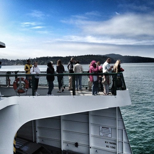
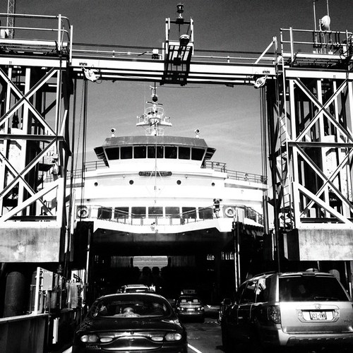
Bow Riders - Passengers face the salt spray on board @wsdot ferry. San Juan's, WaOrcas Island Ferry


Deer Harbor

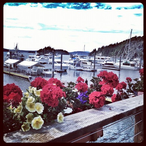
Deer Harbor located 25min west of Orcas on the southwest corner of Orcas Islands is main hub for water activities such as kayaking, fishing and whale watching excursions. The town wraps around a small cove and rise up on the hill. Unless you plan on booking an activity, arriving on a personal boat  or staying in a resort the limited public parking and lack of shops or waterfront access won't hold your visit for more than 20min of looking at large private yachts parked in the marina.
Deer Flowers Snack Bar, Deer Harbor- Orcas Island, Wa

Eastsound

At the center of the island, at the top of a beautiful fjord, Eastsound is a walker’s village. It definitely has that small town feel with its narrow roads, one way streets and limited street parking. There are  art galleries, boutiques, restaurants, cafes, and grocery stores within walking distance of the shoreline. However with only 5 parking spots your best bet is to park in the Island Market's parking lot and go explore on foot.
Orcas Island is an ISLAND with locals on ISLAND TIME. Do your best to pack everything you need for your trip especially photo equipment. If you live in a metropolitan area you might need to understand that ISLAND TIME works a bit differently. Shops open late in the morning and close early. Some are closed Sunday and Monday others Tuesday Wednesday. And since getting inventory to an island 90min away on a ferry, the store items are limited.
If you have a special diet, taking meds make sure to bring extra along for your visit.
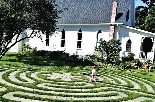
My favorite spots in Eastsound are the Emmanuel Episcopal Parish with its Labyrinth and the Off-Leash Dog Park.
Beach access on the west and north sides of Orcas Island are mostly  located on Forestry Lands or owned by private people. There is limited beach access to north limited to just under 50 yards between two houses. If you use google maps or a gps unit to find roads and green areas you might find out that they are part of private resort clubs or private do not trespass roads.
If you need to stretch out your legs and arms from the travel getting to Orcas Island, park your car in Eastsound and spend an hour walking through town, then head east to Moran State Park for its lakes, trails and 2400ft high Mount Constitution scenic overlook.


Walking the Line - Emmanuel Parish, Eastsound, Orcas Island
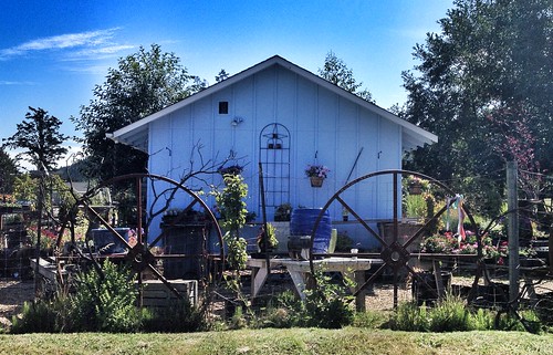
Art Cottage Eastsound, Orcas Island WashingtonOrcas Island Off-Leash Dog Park


Moran State Park

Moran State Park is a 5,252-acre camping park with five freshwater lakes and over 30 miles of hiking trails, scenic overlooks, waterfalls and wildlife spotting opportunities. Atop the 2,409-foot-high Mt. Constitution, the highest point on the San Juan Islands, there stands a stone observation tower built by the Civilian Conservation Corps in 1936. The tower offers panoramic views of the surrounding islands, the Cascade Mountains and a variety of Canadian and American cities.

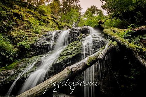
Cascade Waterfall
Rustic Falls
San Juan Artwork Gallery


Mount Constitution Sunset Orcas IslandCascade FallsCascade Lakemount constitution sunset, orcas island lens rental Learn Photography Online with the Pros Save $10 Now #KTCJQ12  Receive a FREE GIFT from Think Tank Photo