


Sul Duc Falls
Olympic National Park
GETTING THERE: From Port
Angeles, drive west 27 miles on U.S. Highway 101, turn south on Sol Duc
Hot Springs Road (also known as the Sol Duc River Road). The Sol Duc
Ranger Station is about 12 miles from U.S. 101. Sol Duc Campground is an
Olympic National Park campground, not to be confused with an RV
campground operated by the resort. The end of the road is just under 14
miles, elevation 2,000 feet.
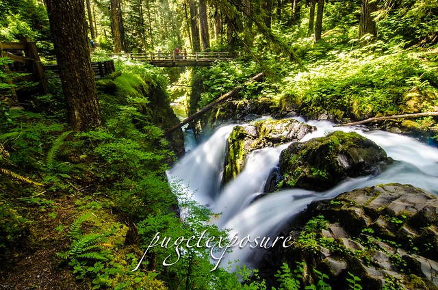
Normally most waterfalls are approached from a creek or river bed level, but here a Sul Duc Falls you are above the waterfall which offers a unique not available at most falls.

A 0.8 mile walk along a wide, well trekked trail, winds you under the canopys of old-growth forest trees, numerous tiny creeks dot the trail on your way to the Canyon Creek shelter, built by the Civilian Conservation Corps. The shelter is well worth a visit. A one-of-a-kind structure with a cupola, it's a good place to leave your pack on a wet day while you hike a bit farther to view the falls. As you approach the Canyon Creek shelter you will start to hear the rumblings of thousands of gallons of water from the Sul Duc River cascading over a sandstone brim in three separate falls, then flows furiously through a deep canyon. A rustic wooden bridge spans the chasm 70 feet above the canoyon and you will have to shout to be heard above the roar. Cross the bridge and turn left to head up river for alternate views of the bridge and falls. Hikers can continue on the Sol Duc Trail or explore the Canyon Creek Trail. It is just over three miles to upper Deer Lake at 3,500 feet and a junction with the Bogachiel River Trail.
In summer, the spray will dampen your face and camera lenses. The falls don't get much sun, but when shafts of sunlight beam between the somber trees, it is a cosmic moment.
 |
| Click here to order Greeting Cards ad large wall prints of Sul Duc Falls |

 san juan islands photos


0 comments:
Post a Comment