


The Whidbey Island Scenic Byway is part of the Great North Cascades Loop. This section of the byway is around 75 miles in length and takes just over 2 hours to drive without any stops. But there are plenty of scenic overlooks and parks to visit along the way. You don't have to visit every stop listed in this guide. This byway has much to offer and is worth visiting again and again throughout the year as seasons change the scenery and different wildlife species become active.
Starting off in Anacortes, Washington (77 miles north of Seattle, WA)
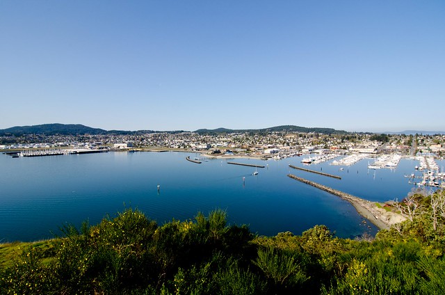
A) Cape Sante Overlook
Anacortes is homeport to the San Juan Islands in the Pacific Northwest. Located on Fidalgo Island, it is conveniently situated halfway between Seattle and Vancouver BC and is the destination point for the San Juans and International ferry runs for Washington State.
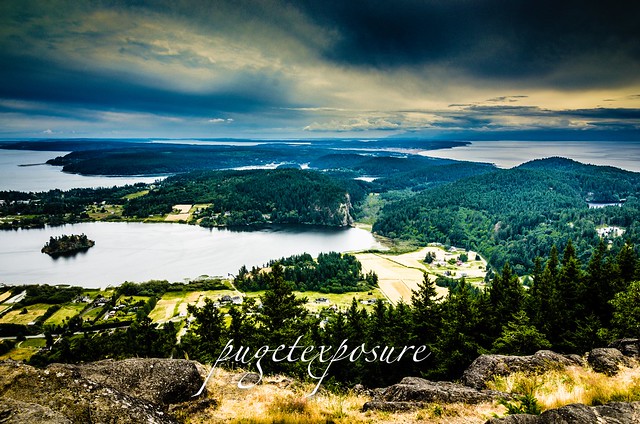 B) Mount Erie View Point
 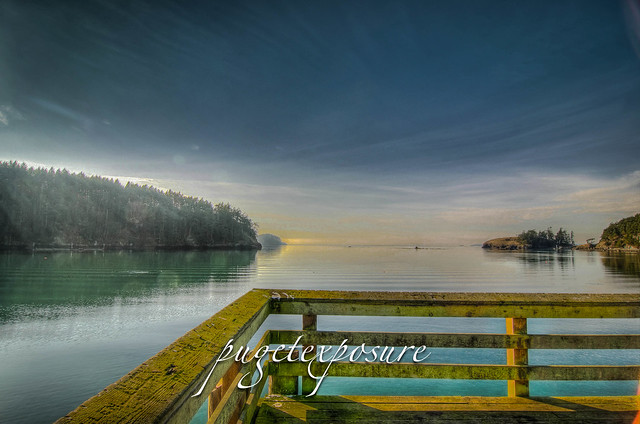 Mt. Erie View Point is on the highest mountain of Fidalgo Island in Skagit County. The 160 acre park is operated by the Anacortes Community Forest Lands and offers various adventure activities such as multiple rock face ascents, trails and a number of hill top viewing areas.
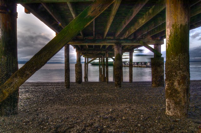
C) Bowman Bay Pier
 Bowman Bay is located just north of the Deception Pass Bridge off of Highway on Fidalgo Island. The bay is separated from Lottie Bay to the south by a small and growing sand bar but it still is subject to tidal changes. Check current tidal conditions before your arrival to predict access to the shoreline.
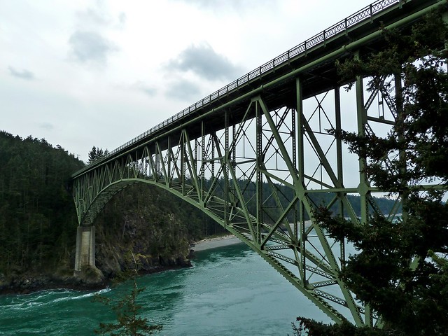
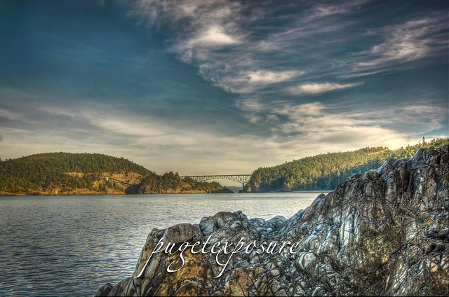
 D) Deception Pass Bridge
The main feature of the park is the 180 foot tall Deception Pass Bridge, which was completed in 1935. The quarter mile long bridge spans two cuts in between Fidalgo and Whidbey Island. When the bridge first opened in 1935 on average 700 cars crossed between Whidbey Island and the Mainland. Today over 20,000 cars and trucks cross the bridge daily.
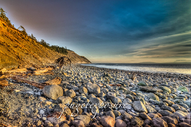
 E) West Beach
 West Beach is a long, gravelly shoreline dotted with boulders and driftwood and as excellent views of the Olympic Mountains, the San Juan Islands, and even Victoria on a clear day. Keeping an eye on the changes in tide levels is important if you want to take a stroll around the large boulders to the north and look back at the cut and Deception Pass Bridge.
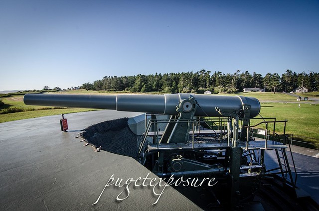
F) Fort Ebey State Park
Fort Ebey was originally commissioned by the United States Army in 1942 as military artillery Battery 248. Battery 248 featured 2 rapid fire 6-inch shell cannons, earth covered concrete support structure and fire control post. An SCR-296A radar facility was located south of the battery.
 G) Fort Casey
 In 1858, the U.S. government purchased ten acres of land costing $400 for the construction of Admiralty Head Lighthouse. In 1890, the army took over the premises. It named its garrison "Fort Casey" in honor of Brigadier General Thomas Lincoln Casey, the last U.S. Army chief of engineers. At that time, Fort Casey, in union with Fort Worden and Fort Flagler, was said to comprise a "triangle of fire" guarding the entrance to Puget Sound.
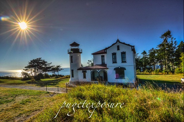 H) Admiralty Head Light House
The Admiralty Head Lighthouse, built in 1903 by the Army Corps of Engineers, is located in Fort Casey State Park near Coupeville on Whidbey Island. The beacon, high on a bluff, 127 feet above sea level, was an important navigational aid, especially for sailing ships entering Admiralty Inlet from the Strait of Juan de Fuca. It replaced the Red Bluff Lighthouse, a wooden Cape Cod style structure built in 1861. Although decommissioned in 1922, the Admiralty Head Lighthouse received national recognition in 1990 when the U. S. Postal Service selected it for a collection of five commemorative lighthouse stamps honoring the U.S. Coast Guard’s bicentennial.
J) Clinton/Mukilteo Ferry
Return to the Mainland via Washington State Ferry Clinton / Mukilteo run. The crossing takes about 20 minutes


0 comments:
Post a Comment