


Distance from Portland: 30 min East along Interstate 84
Reasons to Go: Year round 620 ft Waterfall right off the interstate
50000 East Historic Columbia River Highway,
Bridal Veil, OR
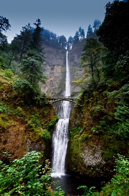
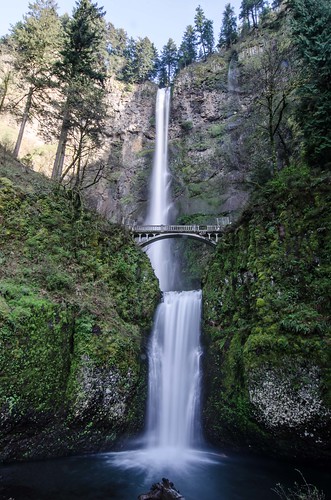
About the Hike: Oregon's most popular trail climbs to viewpoints at Multnomah Falls, a 542-foot, two-tiered plume that plummets into a misty, mossy forest grotto.
Difficulty: A moderate, 2.2-mile hike with 700 feet of elevation gain to the top of Multnomah Falls, or a difficult 5.4-mile loop to Wahkeena Falls with 1,600 feet of elevation gain.
Season: Open all year
Getting There: Drive Interstate 84 east of Portland 31 miles to Multnomah Falls exit 31, park, and walk under the overpass.
 |
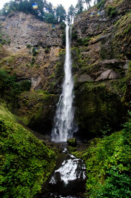 |
| Upper Multnomah Falls |
 |
| January 2014 a bolder crashed through the Benson Memorial Bridge. The bridge is expected to remained closed through Memorial Day. |
Underground springs from Larch Mountain are the year-round source of water for the waterfall, augmented by spring runoff from the mountain's snowpack and rainwater during the other seasons.
A foot trail leads to Benson Footbridge, a 45-foot (14 m)-long footbridge that allows visitors to cross 105 feet (32 m) above the lower cascade. The trail continues to a platform at the top of the upper falls where visitors get a bird's-eye view of the Columbia Gorge and also of "Little Multnomah", a small cascade slightly upstream from the "upper" falls, which is not visible from ground level. The footbridge is named after Simon Benson, who had the bridge built in 1914.
Benson soon gave Portland land that included most of the falls as well as nearby Wahkeena Falls. The Oregon-Washington Railroad and Navigation Company gave Portland land at the base of Multnomah Falls contingent upon their agreement to build a lodge at the site. A few years later architect A.E. Doyle, who designed the Meier & Frank Building, was commissioned by the city to design the lodge, which was completed in 1925. The lodge is now on the National Register of Historic Places.
In contrast to other falls along the Gorge, the Multnomah area is also reachable via a stretch of I-84 east of Troutdale, Oregon. The rest area and tunnel under the road (as well as the Union Pacific Railroad tracks) allow Interstate travelers from either direction to stop and visit the falls.
In 1995, a 400 ton boulder fell 225 feet (69 m) from the face of the waterfall into the pool above Benson Bridge. It caused a 70-foot (21 m) splash of water and gravel to wash over the footbridge, which in turn caused minor injuries to a wedding party that happened to be on it for photos at the time.
Gear Used:


0 comments:
Post a Comment