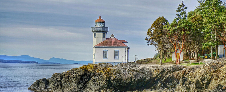
Lime Kiln Lighthouse

Lime Kiln Lighthouse on the west side of San Juan Island, Washington

Lime Kiln Lighthouse on the west side of San Juan Island, Washington

Lime Kiln Lighthouse on the west side of San Juan Island, Washington

Lime Kiln Lighthouse on the west side of San Juan Island, Washington

Lime Kiln Lighthouse on the west side of San Juan Island, Washington

Showing posts with label whidbey island. Show all posts

Friday, July 18, 2014

No. 291 Naval Air Station Whidbey Open House 2014


NAVAL AIR STATION WHIDBEY ISLAND, Wash. 
Open House Saturday, July 19, 2014, at Ault Field from 9 a.m. to 3 p.m. 


This event is an opportunity for the public to learn about past, current, and future operations at the Navy’s only air station in the Pacific Northwest and to see static displays of all its assigned aircraft.

A 5K run along the base’s flight line will be held at 9 a.m. with registration starting at 7:30 a.m. Aircraft displays include the EA-18G Growler, EA-6B Prowler, P-3C Orion and MH-60 Knighthawk helicopter, and two unmanned aerial vehicles, the Scan Eagle and an Integrator.

There will also be other visual displays, guided bus tours, a K-9 Working Dog demonstration, bouncy toys for children and a climbing wall for those wishing to test their climbing acumen. Aviation memorabilia will also be available for purchase as well as a variety of food and beverages. There is no ATM on the flight line so please plan accordingly.

All guests will come onto Ault Field via Charles Porter Gate, located just west of the Ault Field and Goldie roads intersection. All visitors over the age of 18 will be required to have state or government issued identification for .access to the base.

Due to security measures, the following items are not allowed on the base: 

- Large bags
- Backpacks
- Weapons
- Coolers
- Pet
- Drugs or drug paraphernalia to include all marijuana products. Other medically prescribed drugs are allowed only if they are in marked medical containers (For example, don't bring medicine in Sunday through Saturday containers).

Visitors are limited to the following items, which will be subject to search by Security Forces:

- Strollers and wagons for toddlers
- Diaper bags for guests with small children
- Small women's purses
- Handicapped items such as wheel chairs
- Official service dogs
- Bottled water, two bottles per person. Free water-refill stations will be available
- Hydration packs (Eg. CamelBaks - hydration only, no backpacks)
- Cameras, video recorders and binoculars. Visitors will be required to show the items work. Items must be small enough to carry by hand.

Recommended Items include:
- Sunscreen

Friday, May 9, 2014

No. 274 Whidbey Scenic Isle Way


The Whidbey Island Scenic Byway is part of the Great North Cascades Loop. This section of the byway is around 75 miles in length and takes just over 2 hours to drive without any stops. But there are plenty of scenic overlooks and parks to visit along the way. You don't have to visit every stop listed in this guide. This byway has much to offer and is worth visiting again and again throughout the year as seasons change the scenery and different wildlife species become active.

Starting off in Anacortes, Washington (77 miles north of Seattle, WA)

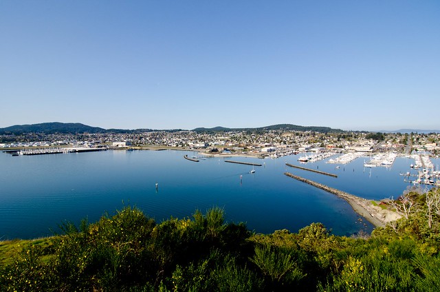
View from Above-Anacortes, Wa
A) Cape Sante Overlook 
Anacortes is homeport to the San Juan Islands in the Pacific Northwest. Located on Fidalgo Island, it is conveniently situated halfway between Seattle and Vancouver BC and is the destination point for the San Juans and International ferry runs for Washington State.


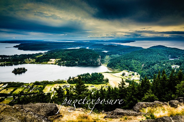
Mount Erie Overlook, Anactores WashingtonB) Mount Erie View Point 
Bowman Pier, Deception PassMt. Erie View Point is on the highest mountain of Fidalgo Island in Skagit County. The 160 acre park is operated by the Anacortes Community Forest Lands and offers various adventure activities such as multiple rock face ascents, trails and a number of hill top viewing areas.


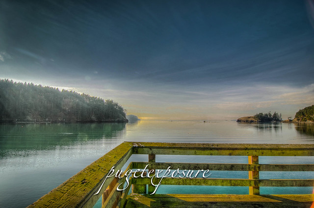
C) Bowman Bay Pier
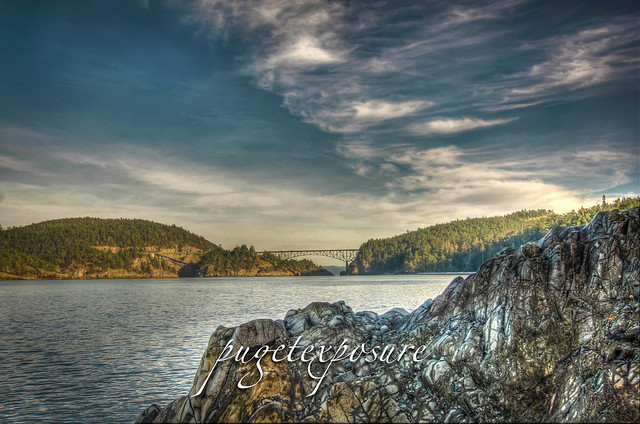
Deception Pass looking South WestBowman Bay is located just north of the Deception Pass Bridge off of Highway on Fidalgo Island. The bay is separated from Lottie Bay to the south by a small and growing sand bar but it still is subject to tidal changes. Check current tidal conditions before your arrival to predict access to the shoreline. 


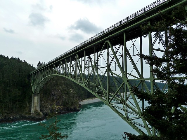
D) Deception Pass Bridge
The main feature of the park is the 180 foot tall Deception Pass Bridge, which was completed in 1935. The quarter mile long bridge spans two cuts in between Fidalgo and Whidbey Island. When the bridge first opened in 1935 on average 700 cars crossed between Whidbey Island and the Mainland. Today over 20,000 cars and trucks cross the bridge daily.


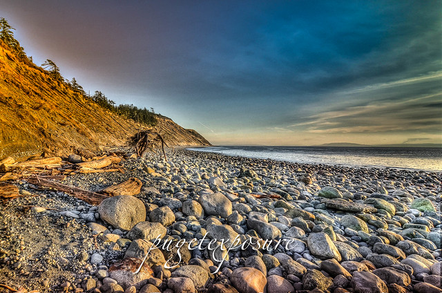
Deception Pass CutE) West Beach
West Beach is a long, gravelly shoreline dotted with boulders and driftwood and as excellent views of the Olympic Mountains, the San Juan Islands, and even Victoria on a clear day.  Keeping an eye on the changes in tide levels is important if you want to take a stroll around the large boulders to the north and look back at the cut and Deception Pass Bridge.

Fort Ebey State Park


F) Fort Ebey State Park
Fort Ebey was originally commissioned by the United States Army in 1942 as military artillery Battery 248. Battery 248 featured 2 rapid fire 6-inch shell cannons, earth covered concrete support structure and fire control post. An SCR-296A radar facility was located south of the battery


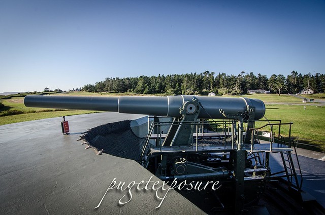
Fort Casey 10 inch Gun on display G) Fort Casey
In 1858, the U.S. government purchased ten acres of land costing $400 for the construction of Admiralty Head Lighthouse. In 1890, the army took over the premises. It named its garrison "Fort Casey" in honor of Brigadier General Thomas Lincoln Casey, the last U.S. Army chief of engineers. At that time, Fort Casey, in union with Fort Worden and Fort Flagler, was said to comprise a "triangle of fire" guarding the entrance to Puget Sound. 


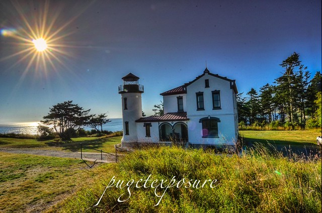
Admiralty Head LighthouseH) Admiralty Head Light House
The Admiralty Head Lighthouse, built in 1903 by the Army Corps of Engineers, is located in Fort Casey State Park near Coupeville on Whidbey Island. The beacon, high on a bluff, 127 feet above sea level, was an important navigational aid, especially for sailing ships entering Admiralty Inlet from the Strait of Juan de Fuca. It replaced the Red Bluff Lighthouse, a wooden Cape Cod style structure built in 1861. Although decommissioned in 1922, the Admiralty Head Lighthouse received national recognition in 1990 when the U. S. Postal Service selected it for a collection of five commemorative lighthouse stamps honoring the U.S. Coast Guard’s bicentennial.


Old Pier Mukilteo Beach
J) Clinton/Mukilteo Ferry
Return to the Mainland via Washington State Ferry Clinton / Mukilteo run. The crossing takes about 20 minutes

Sunday, July 14, 2013

No. 203 Mount Erie, Anacortes

Mount Erie
Heart Lake Road / Ray Auld Dr
Anacortes, WA
MAP IT 


Mount Erie View POI


Mt. Erie View Point  is on the highest mountain of Fidalgo Island in Skagit County. The 160 acre park is operated by the Anacortes Community Forest Lands and offers various adventure activities such as multiple rock face ascents, trails and a number of hill top viewing areas. At the intersection of Heart Lake Road and Ray Auld Dr. there is a parking area and trail heads that meander through the forest. Located at the south end of the parking lot is Erie Mountain Dr, a 1.5 mile one lane paved road that you can either hike, bike or drive to the main viewing areas. The drive takes about 10 minutes as it zig zags its way up 800 feet in elevation to the top.
The end of Erie Mountain Drive is at around 1200 feet and has multiple viewing areas that looks east, west, and south all are just a few minute walk from the parking lot. The south face of MT. Erie is a popular rock climbing location with its exposed rock face that extends 900 feet vertically down to Lake Campbell.


Mount Erie Overlook, Anactores Washington
Looking East towards Padilla Bay and Burlington, WA
Mount Erie Overlook, Anactores Washington
Looking South over Lake Campbell


Mount Erie Overlook, Anactores Washington
Lake Campbell, Deception Pass, Naval Air station Whidbey, and Whidbey Island

Mount Erie Overlook, Anactores Washington
Overlook Forest Trail

Mount Erie Overlook, Anactores Washington
Burrows Bay, Allen Island, Lopez Island


Washington State travel, Washington State travel, Washington Destinations, Photography, Photography spost, best things to do in Seattle, Best things to in Washington State, Washington Tourism Alliance, Washington State Tourism board, recommendations, recommendations for things to see in washington state, things to do in washington state, things to do in seattle, things to do in Tacoma washington, Washington Photographers, Washington nikon shooters, best seattle photography, washington exploration, experience washington, what to do while visiting seattle, seattle top attractions, seattle food, Mount Erie, Mount Erie Anacortes, Anactores washington state, Fidalgo Island, Things to do in anancortes

Thursday, May 9, 2013

No. 182 Maple Grove Beach and Boat Launch

Maple Grove Boat Ramp
682-698 S Boat Ramp Rd
Camano Island, WA


Located on the north west corner of Camano Island, west Utsalady Bay, the Maple Grove Boat Ramp offers salt water access to boaters and kayakers. There are 5 parking stalls for vehicles and 15 for trailers. Be careful you park in the appropriate parking place or you might  get towed especially during fishing season. As with any beach along the Puget Sound tidal flows will increase or decrease the size of the beach. There are stairs that lead you from the parking lot down to the rocky beach. The beach during low tide is about 400 yards wide.
Maple Grove is about 10 minutes from English Boom Reserve and offers open western views to Oak Harbor, Whidbey Island, Crescent Bay and Skagit Bay.
This is one of the few areas to have public access to salt water on the north end of Camano Island. Much of the western and northern shoreline are private property or belong to gated communities that prohibit the public from the beach.
Maple Grove offers views of Mount Bakers south western slope, Whidbey Island, Skagit Bay and Crescent Harbor.
Maple Grove Beach
Western Slope of Mount Baker during sunset "Golden Hour"
Maple Grove Beach
mooring buoy off of Maple Grove
Maple Grove Beach
Sun Glare looking over at Oak Harbor, Whidbey Island
Maple Grove Beach
Maple Grove Residences
Maple Grove Beach
Sunset Sunburst over Whidbey Island, WA
Maple Grove Beach Gear Used:
 
lens rental Washington State travel, Washington State travel, Washington Destinations, Photography, Photography spost, best things to do in Seattle, Best things to in Washington State, Washington Tourism Alliance, Washington State Tourism board, recommendations, recommendations for things to see in washington state, things to do in washington state, things to do in seattle, things to do in Tacoma washington, Washington Photographers, Washington nikon shooters, best seattle photography, washington exploration, experience washington, what to do while visiting seattle, seattle top attractions, seattle food, Camano Island Washington, Camano Island Public Beaches, Kayaking on Camano Island, Camano Island Public Boat Ramps, Maple Grove Boat Ramp, North end of Camano Island, Camano Island Photographers, Camano Island Photography, Boating in Skagit Bay, Boating in Crescent Bay, Fishing on Camano Island

Monday, April 22, 2013

No. 179 Visit National State Parks for free ALL WEEK

National Park Week April 20th through the 28th 2013


From now until Friday, entrance to all national parks is waived as part of National Parks week. Around here, the biggies are Mount Rainier National Park and Olympic National Park. (North Cascades does not charge an entrance fee.)

The weather forecast is looking promising for both parks, especially for the next few days.

 Ebey's Landing Whidbey Island 

 Fort Casey Military Fort
Admiralty Head Lighthouse 
Fort Ebey Armory 
Fort Ebey State Park

North Cascade National Park Area

Artist Point
Picture Lake, Vista Point

Olympic National Park

Hurricane Ridge
Sul Duc Falls
Neah Bay
Ruby Beach
Rialto Beach

Click here to see what other national parks are in Washington. And click here for a list of hikes in North Cascades, Mount Rainier and Olympic national parks from the Washington Trails Association.


Thursday, February 14, 2013

No. 167 Fort Ebey Armory

Fort Ebey Armory

400 Hill Valley Drive
Coupeville, WA 98239, USA
website: http://www.parks.wa.gov/parks/?selectedpark=Fort%20Ebey&subject=all

MAP IT


Fort Ebey was originally commissioned by the United States Army in 1942 as military artillery Battery 248. Battery 248 featured 2 rapid fire 6-inch shell cannons, earth covered concrete support structure and fire control post. An SCR-296A radar facility was located south of the battery. 
Fort Ebey was part of the United States Army Coastal and Harbor Defense Strategy during World War II. 
From 1942 until 1946 Fort Ebey served along with the "triangle of fire" Fort Casey, Fort Worden and Fort Flagler guarding the entrance to Puget Sound and the Bremerton Navy Yard as well as the cities of Seattle, Tacoma and the State Capitol at Olympia. 
Today Fort Ebey State Park features 3 miles of saltwater shoreline (low tide)  and a 645-acre camp ground with many hiking trails, freshwater lake for fishing.
Discover Pass Fee Required
Fort Ebey Armory Bunker
Fort Ebey Armory
Fort Ebey Gun Tourette
Remnance of 6-inch Cannon Tourette
Fort Ebey Parasail Launch area


Gear Used:
 
lens rental Learn Photography Online with the Pros Save $10 Now #KTCJQ12  Receive a FREE GIFT from Think Tank Photo Seattle, Washington, Things to do In Seattle, Visiting Seattle, What is there to see in Seattle, What is there to photograph in Seattle, Seattle Photography, Best Seattle Photography, Best Seattle Photography Images, Best locations, Washington State, Visiting Seattle, Visiting Washington State, Washington State Prints, Photos of Seattle, Seattle Downtown photographs, what to see in Seattle, what to do in Seattle, Seattle top 100, seattle top 200, Seattle Photographers, Seattle Best Photographers, Nikon shooters, Nikon cameras, Canon shooters, Canon Cameras, Seattle camera stores, Washington State Parks, Washington State Park Photography, Travel Photography, Seattle Roadtrip, Pacific Northwest images , Pacific Northwest Photographs, Downtown Seattle, What to do in Seattle, whidbey island, forts, military base, whidbey, fort ebey, sunrise, sunset, sunrise photography, sunset photography, what to see on whidbey island, whidbey island landslide, news, accident, landslide

Tuesday, February 12, 2013

No. 166 Fort Ebey State Park

Fort Ebey State Park
 400 Hill Valley Drive
 Coupeville, WA 98239, USA
website: http://www.parks.wa.gov/parks/?selectedpark=Fort%20Ebey&subject=all

MAP IT


Fort Ebey was originally commissioned by the United States Army in 1942 as military artillery Battery 248. Battery 248 featured 2 rapid fire 6-inch shell cannons, earth covered concrete support structure and fire control post. An SCR-296A radar facility was located south of the battery. 
Fort Ebey was part of the United States Army Coastal and Harbor Defense Strategy during World War II. 
From 1942 until 1946 Fort Ebey served along with the "triangle of fire" Fort Casey, Fort Worden and Fort Flagler guarding the entrance to Puget Sound and the Bremerton Navy Yard as well as the cities of Seattle, Tacoma and the State Capitol at Olympia. 
Today Fort Ebey State Park features 3 miles of saltwater shoreline (low tide)  and a 645-acre camp ground with many hiking trails, freshwater lake for fishing.
Discover Pass Fee Required


Fort Ebey State Park
Evening Light during Low Tide
Fort Ebey Beach
Setting Sun Low Tide
Fort Ebey Armory Bunker
Fort Ebey Armory
Fort Ebey Gun Tourette
Remnance of 6-inch Cannon Tourette
Fort Ebey Parasail Launch area


Gear Used:
 
lens rental Learn Photography Online with the Pros Save $10 Now #KTCJQ12  Receive a FREE GIFT from Think Tank Photo

Tuesday, February 5, 2013

No. 165 Bowman Bay, Whidbey Island

Bowman Bay
MAP IT


Bowman Bay is located just north of the Deception Pass Bridge off of Highway on Fidalgo Island. The bay is separated from Lottie Bay to the south by a small and growing sand bar but it still is subject to tidal changes. Check current tidal conditions before your arrival to predict access to the shoreline.
Until the late 1800s, this calm-watered cove was the site of a large Samish village, one of several that existed near Deception Pass.  Evidence of their presence in the area remains in the form of thick groves of Nootka rose that grow atop iron-rich shell middens.
Before receiving its modern name, Bowman Bay was known as “Reservation Bay” due to the period in which it was a military reservation.  In the early 1900s, Bowman Bay was one of several modern-day park areas set aside for military use.  The area was eventually renamed in honor of Amos Bowman, who was one of the first white settlers on Fidalgo Island.  Nearby Anacortes is amalgamation of “Anna Curtis,” Bowman’s wife.  At the turn of the century, Bowman had a wooden dock built at the bay in hopes that it would become a major port, but Bowman’s dream was never realized.


Bowman Pier, Deception Pass
Looking out towards the Puget Sound from Bowman Pier
Bowman Sound Low Tide
Low Tide at Bowman Bay
Bowman Sound Low Tide 2
Another low angle view of Bowman Pier
Gear Used:
 
lens rental Learn Photography Online with the Pros Save $10 Now #KTCJQ12  Receive a FREE GIFT from Think Tank Photo
Washington State travel, Washington State travel, Washington Destinations, Photography, Photography spost, best things to do in Seattle, Best things to in Washington State, Washington Tourism Alliance, Washington State Tourism boared, recommendations, recommendations for things to see in washington state, things to do in washington state, things to do in seattle, things to do in Tacoma washington, Washington Photographers, Washington nikon shooters, best seattle photography, washington exploration, experience washington, what to do while visiting seattle, seattle top attractions, seattle food