Lime Kiln Lighthouse

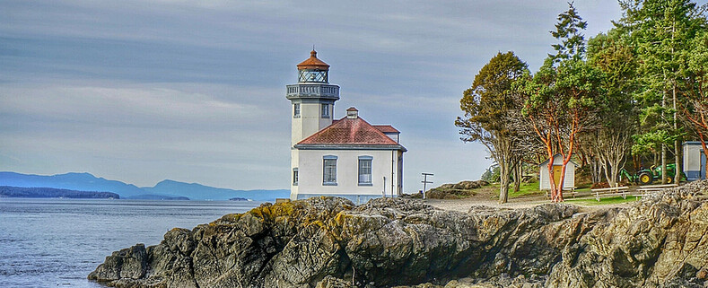
Lime Kiln Lighthouse on the west side of San Juan Island, Washington

Lime Kiln Lighthouse on the west side of San Juan Island, Washington

Lime Kiln Lighthouse on the west side of San Juan Island, Washington

Lime Kiln Lighthouse on the west side of San Juan Island, Washington

Lime Kiln Lighthouse on the west side of San Juan Island, Washington

Showing posts with label Olympic National Forest. Show all posts

Monday, April 22, 2013

No. 179 Visit National State Parks for free ALL WEEK

National Park Week April 20th through the 28th 2013


From now until Friday, entrance to all national parks is waived as part of National Parks week. Around here, the biggies are Mount Rainier National Park and Olympic National Park. (North Cascades does not charge an entrance fee.)

The weather forecast is looking promising for both parks, especially for the next few days.

 Ebey's Landing Whidbey Island 

 Fort Casey Military Fort
Admiralty Head Lighthouse 
Fort Ebey Armory 
Fort Ebey State Park

North Cascade National Park Area

Artist Point
Picture Lake, Vista Point

Olympic National Park

Hurricane Ridge
Sul Duc Falls
Neah Bay
Ruby Beach
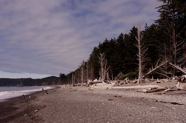
Rialto Beach

Click here to see what other national parks are in Washington. And click here for a list of hikes in North Cascades, Mount Rainier and Olympic national parks from the Washington Trails Association.


Tuesday, August 28, 2012

No.100 Hurricane Ridge


hurricane ridge _2
Sunset atop of Hurricane Ridge

Hurricane Ridge is a mountainous area in Washington's Olympic National Park. It can be accessed by road from Port Angeles and is open to hiking, skiing, and snowboarding.
At an elevation of about 5,200 feet (1,585 m), Hurricane Ridge is a year-round destination. In summer, visitors come for views of the Olympic Mountains, as well as for superb hiking. During the winter months the small, family oriented Hurricane Ridge Ski and Snowboard Area offers lift-serviced downhill skiing and snowboarding.
Spectacular views of the Olympic National Park can be seen from the Hurricane Ridge viewpoint. The road leading west from the Hurricane Ridge visitor center is dotted with picnic areas and trail heads. A paved trail called the Hurricane hill trail is popular with visitors, and is about 1.6 miles long (one-way) with an elevation gain of about 700 ft. It is not uncommon to find snow on the trails even as late as July. Several other dirt trails of varying distances and difficulty levels branch off of the Hurricane hill trail. The picnic areas are open only in the summer, and have restrooms, water and paved access to picnic tables.

Hurricane Ridge
Western Slope of Hurricane Ridge in evening Light
Hurricane Ridge
Olympic Mountain Range from the Parking Lot
Hurricane Ridge
Purple Wild Flowers
Hurricane Ridge
Plenty of Deer walking through the meadows
Hurricane Ridge
Deer looking for a sweet grass snack
Hurricane Ridge
Waiting for the Blue Hour
All images are copyrighted by © Pugetexposure Photography. Do NOT use my images on blogs, personal or professional websites, or any other digital media without my explicit permission.

Gear Used:
 
lens rental Learn Photography Online with the Pros Save $10 Now #KTCJQ12  Receive a FREE GIFT from Think Tank Photo

Wednesday, August 22, 2012

No.97 Sul Duc Falls

Sul Duc Falls
Olympic National Park

GETTING THERE: From Port Angeles, drive west 27 miles on U.S. Highway 101, turn south on Sol Duc Hot Springs Road (also known as the Sol Duc River Road). The Sol Duc Ranger Station is about 12 miles from U.S. 101. Sol Duc Campground is an Olympic National Park campground, not to be confused with an RV campground operated by the resort. The end of the road is just under 14 miles, elevation 2,000 feet.
Normally most waterfalls are approached from a creek or river bed level, but here a Sul Duc Falls you are above the waterfall which offers a unique not available at most falls.  


Sul Duc Falls

A 0.8 mile walk along a wide, well trekked trail, winds you under the canopys of old-growth forest trees, numerous tiny creeks dot the trail on your way to the Canyon Creek shelter, built by the Civilian Conservation Corps. The shelter is well worth a visit. A one-of-a-kind structure with a cupola, it's a good place to leave your pack on a wet day while you hike a bit farther to view the falls. As you approach the Canyon Creek shelter you will start to hear the rumblings of thousands of gallons of water from the Sul Duc River cascading over a sandstone brim in three separate falls, then flows furiously through a deep canyon. A rustic wooden bridge spans the chasm 70 feet above the canoyon and you will have to shout to be heard above the roar. Cross the bridge and turn left to head up river for alternate views of the bridge and falls. Hikers can continue on the Sol Duc Trail or explore the Canyon Creek Trail. It is just over three miles to upper Deer Lake at 3,500 feet and a junction with the Bogachiel River Trail.

In summer, the spray will dampen your face and camera lenses. The falls don't get much sun, but when shafts of sunlight beam between the somber trees, it is a cosmic moment.
With or without sun, there is a wild beauty that no season of the year can subdue. Pick a season -- you can't miss. Just make sure the Sol Duc River Road -- also known as Sol Duc Hot Springs Road -- is open before you set out, as storms can cause temporary closures.
Bring a tripod, wide angle lens, shutter release and plenty of lens clothes to dry off the water spray. 

The Sol Duc Trail has two trailheads, but the shortest approach to Sol Duc Falls is from the end of the Sol Duc River Road, elevation 2,000 feet. The other approach is from the Sol Duc Campground (1,700 feet). The trail is wide and easy to hike through old-growth forest of Douglas fir. The trail joins the Canyon Creek Trail and Sol Duc Falls at .7 miles. The Sol Duc Trail continues climbing to intersect the Appleton Pass trail at five miles (3,100 feet) and eventually reaches the High Divide at 8 1/2 miles, elevation 5,050 feet.


Sul Duc Falls
Click here to order Greeting Cards ad large wall prints of Sul Duc Falls
lens rental Learn Photography Online with the Pros Save $10 Now #KTCJQ12  Receive a FREE GIFT from Think Tank Photo san juan islands photos

Sunday, July 8, 2012

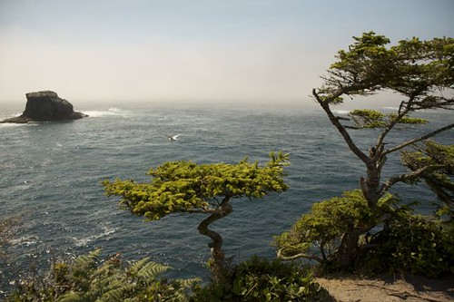
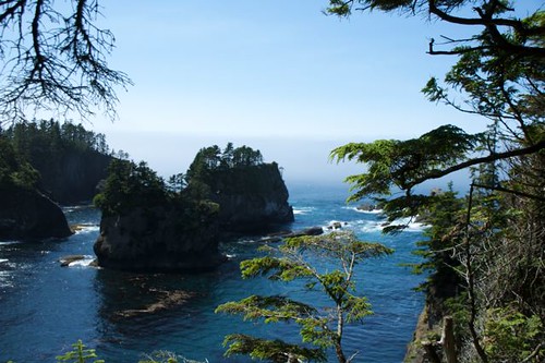
No. 67 Olympic National Park / Coastline : Neah Bay

Rating : 3 out 5
Distance from Seattle, WA : ALL day trip from Seattle
Reason to go: Western tip of the continental USA. Drive deep into rainforest and emerge above 200ft cliffs carved out from the pacific ocean.
Difficulty: 5 out of 5. Recommend taking at least 2 days to get here. The drive is a slow and goes on forever it seems. To make it here in a day is really not the best way of seeing this western corner of Washington.
To get to the cliffs edge you must navigate a narrow 3ft raised board walk against hikers coming the back from the shore. Little area to pass especially if your carrying a large camera bag on your back. Walk takes aprox 15-20min from the parking lot.
Pet Rules: Do to the terain, raised boardwalk, high & steep cliffs leave your pet safely in your vehicle


All images are copyrighted by © Pugetexposure Photography. Do NOT use my images on blogs, personal or professional websites, or any other digital media without my explicit permission.

Gear Used:
  All images are copyrighted by © Pugetexposure Photography. Do NOT use my images on blogs, personal or professional websites, or any other digital media without my explicit permission.

Gear Used:
 
lens rental Learn Photography Online with the Pros Save $10 Now #KTCJQ12  Receive a FREE GIFT from Think Tank Photo

No. 66 Olympic National Forest / Coastline : RUBY BEACH

Rating : 4 out 5
Distance from Seattle, WA : 190 miles aprox. 3 1/2hrs
Reason to go: When the weather is fair location offers amazing landscape imagery. Washington & Oregon coastline suffer from morning & afternoon marine layers. If you are camping nearby you will have better chances to capture a clear day 
Difficulty: 2 out of 5 (1/4 mile walk down dirt path descending 200ft from parking lot. A few steps are over a foot apart. 

do not use my images on blogs or websites without my permission. If you would like to license a photo, please contact me.

Ruby Beach  

Ruby Beach


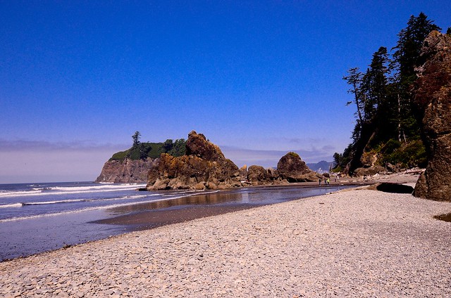
Ruby Beach, located about 35 miles south of the town of Forks ("Twilight") on Washington's Olympic Peninsula, is one of the most scenic beaches in the state that is accessible to the public. It offers rugged sea stacks, flat sand, and a small stream that flows through it just at the base of the short trail from the parking lot.
 To reach Ruby Beach, simply drive south from Forks, or north from Aberdeen, on highway 101. The turn-off, especially from the north, is not well marked. Coming from Forks, it's on your right; pay attention or you'll miss it. A short dirt road leads to a gravel parking lot with space for about 50 vehicles and a couple of Sani-Cans, which are the only "amenities" at the beach. A short path switchbacks down the slope through spruce and fir and salmonberries, and emerges into a jumble of logs at the top of the beach. There's a "landing" of sorts where you can pause and take in the view of the jagged sea stacks through the trees. 
Once you reach the beach proper, take a stroll among the giant boulders, marvel at the rugged coasline, or simply sit on a log and revel in the fresh salt air. In summer, the beach is often crowded, but mid-week visitors will usually find plenty of free space to explore and enjoy. Like most of the Washington coast, Ruby Beach is often fog-shrouded or storm-swept, but on a clear or partly-cloudy day, the sunsets can be spectacular. Ruby Beach for photographers is like a candy store for kids... if you've brought a camera - and no one should visit this beach without one! - be sure to stay and watch as the setting sun plays among the rocks and turns the beach into a sparkling jewel.
Camping on the beach is not permitted, but many people enjoy picnics or barbecues on the beach, or gather round a campfire to roast marshmallows as evening falls. Make sure you bring a jacket, even in summer; the weather can change quickly, and it's often windy and cool, even during warmer months. Dry socks and shoes are handy as well, since crossing the small stream that bisects the beach can result in wet feet, particularly at high tide when it's impossible to cross on the flat, sandy beach of the intertidal zone.

Pets: Unless posted, most Washington State Beaches are Dog Friendly and require pets to remain on short leashes.
The path down to the beach is fairly narrow and you will pass by coolers, strollers, hikers. It is important that you have a well behaved dog that doesn't pull on the leash or jump after strangers. When I am out with my dog navigating tree stumps, narrow foot paths, elevated paths I like to keep her secure in a Ruff Wear harness. This harness allows the leash to be attached behind the shoulder blades instead of to her collar. It also has a grab handle to help her get over high rocks and toppled trees.


Places to Stay:
Campgrounds at Kalaloch and South Beach are the only places to camp on the southern coast of Olympic National Park. Kalaloch is open year-round, and has 175 campsites, four of which are wheelchair accessible. Make sure to reserve a site as early on in the year as possible, as they fill up quickly and most are booked throughout the summer. South Beach, just south of Kalaloch, has about 50 campsites and is open Memorial Day - late September.
Kalaloch Lodge, right on the beach, has rooms and cabins available upon reservation.
Recreation:
Hiking the southern coast of the Olympic Peninsula provides some amazing sights of the pristine beaches and marine wildlife. North of Ruby Beach, the Hoh River creates a natural boundary.
Kalaloch is a great place for bird watching. Western gulls, bald eagles, and other coastal birds can be spotted nesting and feeding along the southern coast.
When hiking the coast, always check the tides (current charts available at the Kalaloch Information Station). Certain areas may become impassable during high tides and overland trails must be used.
Nearby Areas:
To the north, the Hoh Rain Forest is about a 45-minute drive from Kalaloch. To the south, Queets and the Quinault are only 30 miles away. Make sure to consult the Getting Around page for a table of the different mileages between park destinations.


Gear Used:
 
lens rental

Monday, August 15, 2011

No. 06 Olympic National Foreset / Coastline : Rialto Beach

Rating : 3 out 5
Distance from Seattle, WA : 190 miles aprox. 3 1/2hrs
Reason to go: When the weather is fair location offers amazing landscape imagery. Washington & Oregon coastline suffer from morning & afternoon marine layers. If you are camping nearby you will have better chances to capture a clear day 
Difficulty: 1 out of 5. Raod brings you into a parking lot 100 yards from the beach. You walk along a carpeted boardwalk that takes you to the tree line and then your on the rocky beach within minutes.
Pet Rules: Pets must remain on leash

Don't use my image on a website or blog without my permission. If your interested in licensing this image please contact me


Don't use my image on a website or blog without my permission. If your interested in licensing this image please contact me


 Gear Used:
 
lens rental Washington State travel, Washington State travel, Washington Destinations, Photography, Photography spost, best things to do in Seattle, Best things to in Washington State, Washington Tourism Alliance, Washington State Tourism board, recommendations, recommendations for things to see in Washington state, things to do in Washington state, things to do in seattle, things to do in Tacoma washington, Washington Photographers, Washington nikon shooters, best seattle photography, washington exploration, experience washington, what to do while visiting seattle, seattle top attractions, seattle food, Washington Olympic National Forest, Visiting Washington Coastline, Washington State Beaches, Photos of Rialto Beach in Washington State, Olympic National Forest Rialto Beach, Road trips in Washington State,