Lime Kiln Lighthouse

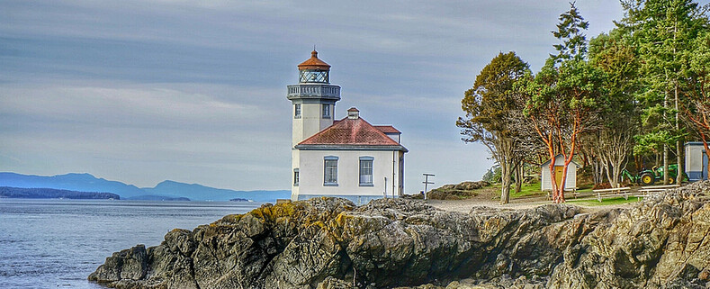
Lime Kiln Lighthouse on the west side of San Juan Island, Washington

Lime Kiln Lighthouse on the west side of San Juan Island, Washington

Lime Kiln Lighthouse on the west side of San Juan Island, Washington

Lime Kiln Lighthouse on the west side of San Juan Island, Washington

Lime Kiln Lighthouse on the west side of San Juan Island, Washington

Showing posts with label landscape. Show all posts

Friday, March 13, 2015

No. 307 Colorful Public Gardens around the Sound

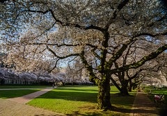
Univerity of Washington Cherry Blossoms 2014University of Washington's Liberal Arts Quadrangle
Liberal Arts Quadrangle Cherry Blossoms
4182 NE Stevens Way, Seattle, WA 98105

One of the most popular places in Seattle for gazing at the bloom is at University of Washington's Liberal Arts Quadrangle. The original grove of Yoshino Cherry trees were planted in the Seattle Washington Arboretum around 1939. Later during construction of the 520 floating bridge 31 Yochina Cherry Trees were transplanted to the University of Washington campus. That makes this grove of white and pink fragrant cherry trees 75 years old. The average lifespan of a Yochina Cherry Tree is between 60 to 100 years.

Continue Reading about the Quad
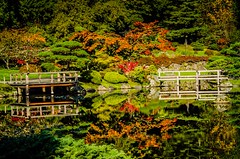

Seattle Japanese GardenSeattle Japanese Garden
1075 Lake Washington Blvd E
Seattle WA 98112


Opened to the Seattle public in 1960 the Seattle Japanese Garden celebrates 52 years of educating and inspiring visitors from around the world about the art of Japanese miniature idealized landscapes and garden design.
The garden located in the southwest corner of the University of Washington Botanic Gardens at Washington Park Arboretum, along Lake Washington Boulevard E., features over 100 types of plants, trees and koi ponds in a 3.5 acre gated area.

Continue Reading about the Japanese Garden 
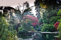

Kubota Garden Foot Bridge
Kubota Garden
9817 55th Avenue S.
 Seattle, WA 


The Kubota Garden is a 20 acre asian style garden on a hill side in a south Seattle neighborhood that was started over 60 years ago by Mr. Fujitaro Kubota. After immigrating from Japan, Mr. Kubota a self-taught landscape and gardener built his landscaping business and soon began to plan and construct his vision of the Japanese-style garden on his private property in 1927. Continue Reading about Kubota Garden 


Nishiyama Japanese Nishiyama Japanese Garden
Everett Community College
90 Westmore Ave
Everett, WA

The Nishiyama Japanese Garden at Everett Community College represents a compressed world of mountains, forests, lakes, rivers, meadows and village. Access to the garden for self-guided tours is provided at no charge on days when EvCC classes are in session and on special occasions.
The garden has eleven primary elements, each with a quiet message of its own. These include entry gate, entry area, waterfall, stream, tea garden, rock garden, Tsubo garden, side gate, stone bridge, earthen bridge, Iwakuni wooden bridge, and stucco masonry wall with tiled roof enclosing the entire garden site.  
Continue Reading about the Nishiyama Garden 
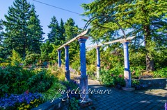

Evergreen Arboretum & GardensEverett Arboretum
145 Alverson Blvd
Everett, WA 98201

Evergreen Arboretum & Gardens is both a place of beauty and education and is free to the public. Located on 3 ½ acres in Everett Washington, its ten themed gardens include the Urban Tree Walk, Entrance Garden, Rock Garden, Northwest Native Plant Trail, Rain Garden, Japanese Maple Grove, Northwest Demonstration Garden, Viewing Mound, Woodland and Conifer Gardens as well as the 200' Snohomish County Master Gardener's Demonstration Border and sculptures throughout. 
Continue Reading 
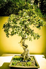


Pacific Rim Bonsai Museum
2515 S. 336th St.

Federal Way, WA 


The Pacific Bonsai Museum features outstanding bonsai from the Pacific Rim nations of Canada, China, Japan, Korea, Taiwan and the United States.
Weyerhaeuser Company opened the Collection in 1989, in conjunction with the Washington State Centennial celebration.
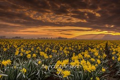
Morning Rows YellowsSkagit Valley Daffodils
Mount Vernon, WA

For last 2 weeks the fields around Mount Vernon and La Connor, Washington have been seeing sign of spring. The daffodil fields are close to being in full bloom with many acres covered in rows upon rows of yellow speckles. It is definitely worth the trip to spend the afternoon driving through the floral route.
Daffodils are one of the early spring bloomers and you will want to go sooner than later. By end of March, early April and weather or wind blow off the tops of the Daffodils.

Continue Reading
Bellevue Botanical Garden Bellevue Botanical Gardens
12001 Main St, Bellevue, WA 

Bellevue Botanical Garden is a botanical garden located at 12001 Main Street, Bellevue, Washington. It is open daily; admission is free. The garden area includes display gardens, woodlands, meadows and wetlands

continue reading 
Tuesday, September 2, 2014

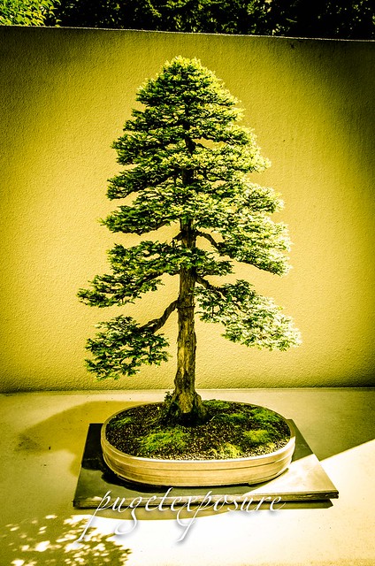
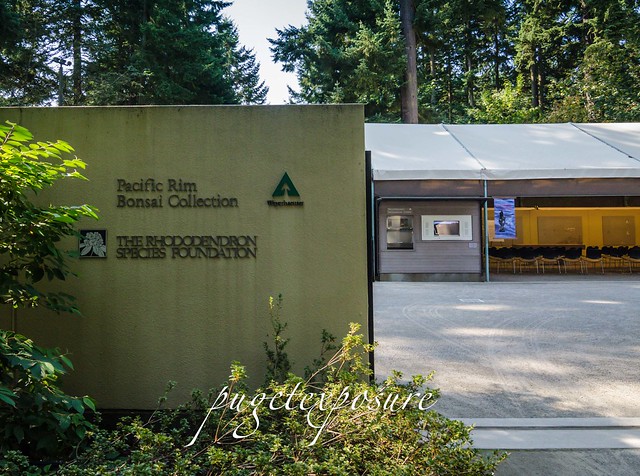
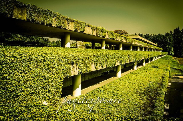
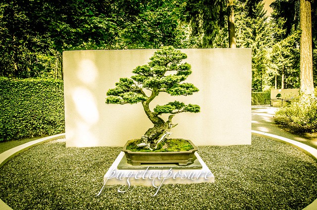
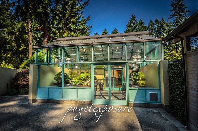
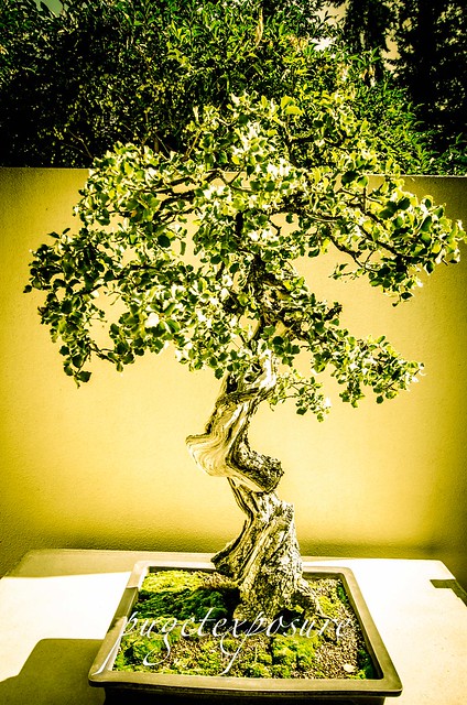
No. 296 Pacific Rim Bonsai Museum


Pacific Rim Bonsai Museum
2515 S. 336th St.
Federal Way, WA 98003
website: http://pacificbonsaimuseum.org/
MAP IT 

Hours

Tuesdays – Sundays (closed Mondays)
10:00 AM – 4:00 PM year-round

Admission is free.


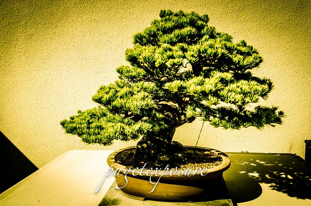
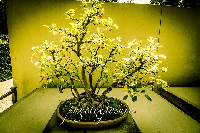
The Pacific Bonsai Museum features outstanding bonsai from the Pacific Rim nations of Canada, China, Japan, Korea, Taiwan and the United States.
Weyerhaeuser Company opened the Collection in 1989, in conjunction with the Washington State Centennial celebration. The Collection was established to symbolize Weyerhaeuser’s long-term commitments to its customers, its community, and its forest resources. At the end of 2013 the corporation gifted the entire collection to a new non-profit, The George Weyerhaeuser Pacific Rim Bonsai Collection, now known as the Pacific Bonsai Museum.
There are currently about 100 trees in the Collection, about 60 of which are on display in the viewing area, while the others are held in reserve in a “growing area” that is not open to the public. Trees are periodically rotated between the growing area and display area in order to add variety and seasonal interest to the exhibit. Many of the trees are well-known to those familiar with the art, having been featured in books or magazines. Several of the trees have won awards for quality and many are the work of nationally or internationally famous artists. All have been nurtured with care and patience by skilled hands.

Museum Mission

The Pacific Bonsai Museum collection serves as cultural and educational resource for the Puget Sound region and beyond. Visitors of all ages and cultures will be inspired and delighted as they discover the depth and beauty of this interpretive art form.


Pacific Rim Bonsai Museum
Pacific Rim Bonsai Museum Pacific Rim Bonsai Museum Pacific Rim Bonsai Museum Pacific Rim Bonsai Museum Pacific Rim Bonsai Museum Pacific Rim Bonsai Museum

Thursday, April 17, 2014

No. 265 Springtime is a great time to visit Washington State Water Falls

As we enter the 5 week of Spring of 2014 the flowers are in bloom everywhere it seems and the weather is producing more blue skies and warmer temps consistently. Which puts most people in a happier mood.
Temperatures in the lowlands are staying above 40 degrees and the temperatures in the mountains are getting warmer as well. This means the snow and ice that fell and accumulated since last October is beginning to thaw and looking for a way to the ocean. 
Now is the best time to go out and see waterfalls running at full levels. The April Spring Showers combined with ice and snow melt add dramatic volumes of water rushing down the sides of mountains and cascading over the edges of waterfalls. 
Though some trails still may have residual snow and may be muddy they are worth the hike. During the summer months when forest floors and trails are dry there is upwards of 60% less water moving down the mountain causing larger falls to run at low levels and many smaller waterfalls disappear as their water sources dry up. 


Here is a list of waterfalls inside Washington State Parks that are worth a hike:


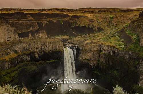
Palouse Region Palouse Falls - Eastern Washington
The Palouse Falls is tucked away in the Eastern part of Washington State. After a very windy drive, including a few miles on dirt roads, you can find this amazing location. The falls consists of an upper falls with a drop of ~20 feet (6.1 m) which lies 1,000 feet (300 m) north northwest of the main drop, and a lower falls, with a drop of ~180 feet (55 m).


Wallace Falls State ParkWallace Falls - Gold Bar, WA
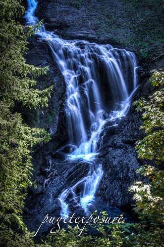
Cascade FallsWallace Falls, named after homesteaders Joe and Sarah Kwayaylsh members of the Skykomish tribe, is a 4,735 acre forest land on the western slope of the North Cascade Mountain range in Snohomish County. The park has three back country lakes, Jay Lake, Shaw Lake and Wallace Lake which are connected via the Wallace River. The river trickles, snakes, gurgles and plunges its way through the park until the valley basin. 


Cascade Falls - Orcas Island, WA
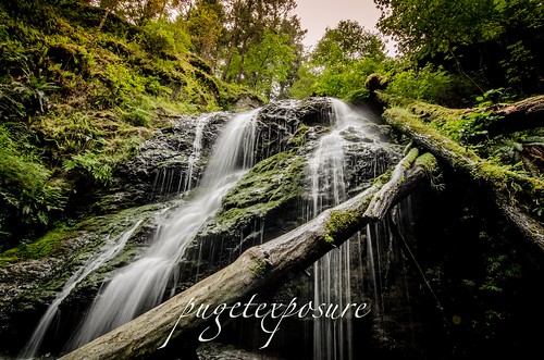
At about 40 feet tall, Cascade Falls is the largest waterfall in the San Juan Islands. Cascade Creek squiggles down a flume, dropping through a jumble of logs and branches before it veils out over a broad bulbous face into a small grotto lined with several old growth cedar trees. 


Rustic Falls, Cascade Creek, Moran State Park Rustic Falls - Orcas Island, WA 
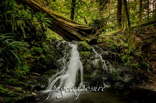
Rustic Falls is part of Cascade Creek, which runs between Mountain Lake and Cascade Lake in Moran State Park. The 0.8 mile walk from the trail head is located on the east side of Cascade Lake in Moran State Park Orcas Island

Saturday, January 18, 2014

No. 234 My favorite Seattle Sunset Vistas

The Pacific Northwest has amazing sunset vistas for when the weather cooperates. Here are my favorite skyline and landscape spots for viewing the sunset

Seattle Area:

Kerry Park 
 250 W Highland Dr
Queen Ann Hill, Seattle, WA 
Downtown Seattle from Kerry Park

If your looking for that picturesque post card image of Seattle then head over to Queen Anne Hill to Kerry Park. At just over 1 acre the parks has the best viewpoint looking out over downtown Seattle Skyline, Elliott Bay and the Seattle Skyline, with an occasional backdrop of Mount Rainier, draws tourists on foot and photographers to this spot. At sunset they often line the hand rails just as the city and the sound are beginning to glow with lights. At night it becomes almost a fantasy scene, with brightly lit ferries gliding across the water and the Space Needle shining from its 500-foot pedestal.
 Kerry park tends to be a little windy - so a sturdy tripod will be very useful. Check the weather outlook for clear morning and evening. Mount Rainier only is visible in certain conditions. . The best sunset colors are usually in summer but some of the most delicate hues are in spring - usually the day before/after a storm. Continue Reading about Kerry Park

"They Might be Giants" Colored

Gas Works Park in Seattle, Washington is a 19.1 acre (77,000 m²) public park on the site of the former Seattle Gas Light Company gasification plant, located on the north shore of Lake Union at the south end of the Wallingford neighborhood. Gas Works park contains remnants of the sole remaining coal gasification plant in the US. The plant operated from 1906 to 1956, and was bought by the City of Seattle for park purposes in 1962. The park opened to the public in 1975. The park was designed by Seattle landscape architect Richard Haag, who won the American Society of Landscape Architects Presidents Award of Design Excellence for the project. It was originally named Myrtle Edwards Park, after the city councilwoman who had spearheaded the drive to acquire the site and who died in a car crash in 1969. In 1972, the Edwards family requested that her name be taken off the park because the design called for the retention of much of the plant. In 1976, Elliott Bay Park was renamed Myrtle Edwards Park.

 Westpoint Lighthouse
West Point USCG Lighthouse - Discovery Park, Seattle, WAThe site is one of breathtaking majesty. Situated on Magnolia Bluff overlooking Puget Sound, Discovery Park offers spectacular view of both the Cascade and the Olympic Mountain ranges. The secluded site includes two miles of protected tidal beaches as well as open meadow lands, dramatic sea cliffs, forest groves, active sand dunes, thickets and streams.


Seattle Ferris Wheel  The downtown Seattle waterfront has a new attraction on the back of Pier 57. Opened for business on June 29th, 2012 Seattle's Great Wheel is a 175 foot tall Big Wheel type "Ferris Wheel" with 42 enclosed gondolas that rotates 40 feet out over Elliot Bay behind Pier 57. The 42 air conditioned gondolas each hold up to six passengers, and there's also a VIP gondola with a glass bottom floor and four leather seats. VIP tickets are $25 and include a Seattle Great Wheel tee-shirt and a shorter wait time. Tickets for the VIP gondola are available only at the pier and the gondola cannot be reserved for a specific time. All rides last about 12 minutes and include three rotations.

The Eagle, 1971 Painted steel Alexander CalderThe Olympic Sculpture Park is a public 9-acrea park along the waterfront of Seattle near Alaska Way that opened on January 20, 2007. It is situated at the northern end of the Seattle seawall and the southern end of Myrtle Edwards Park. The former industrial site was occupied by the oil and gas corporation Unocal until the 1970s and subsequently became a contaminated brownfield before the Seattle Art Museum proposed to transform the area into one of the only green spaces in Downtown Seattle. The park is operated by the Seattle Art Museum, which also operates an expanded main branch at First Avenue and University Street and the Seattle Asian Art Museum in Volunteer Park on Capitol Hill. As a free-admission public outdoor sculpture park with both permanent and visiting installations, it is a unique institution in the United States.


Belvedere Park
Belvedere Park, West Seattle
This park has a stunning view across Elliott Bay to downtown Seattle, and on clear days to the Cascade Mountains and Mt. Rainier. Divided into two parts on the east and west sides of Admiral Way, the east section features a totem pole depicting stylized beavers, fish and frogs.
Belvedere Viewpoint is a popular spot for scenic photos and as a backdrop for wedding and other ceremonial photos.


Hamilton Viewpoint Seattle, WAHamilton Park in West Seattle neigborhood is one of the best places to get sweeping views of downtown Seattle from across Elliott Bayfor both evening sunsets and early morning sunrises. Depending on weather conditions so can also see the westerns ide of the cascade mounatin range behind the city skyline.
The park hours are 4am to 11pm and there is a gate at the entrance to the parking lot.
In spring and summer the bluff has full shrubs and trees that add to the foreground. In late fall and winter the viewpoint opens up more. Some locals even ski and snowboard here when there is enough snow on the ground to build moguls. 


Seattle's Space Needle from Alki Trail in West SeattleAlong the Alki Trail next to Salty's Restaurant From Seattle take HWY 99 or South Bound I-5 to the West Seattle Bridge and the Harbor Ave SW Exit. Once you pass the shipyard there are multiple parking areas to access the alki trail and view the Seattle waterfront from across Elliot Bay.

Monday, October 28, 2013

No. 226 Mount Rainer Reflection Lakes


One of the most photographed areas of Mount Rainier is of its south face from Reflection Lakes. Anytime you can combine a mountain and wide spanning mountain lake you are bound to make a stunning landscape image. That is of course if the weather and clouds cooperate with the photographer. Thousands of snap shooters, smart phone photographers and amateur to pro photographers make the drive around the south side of Mount Rainier and stop at Reflection Lakes. 
During summer the lake shore and hills sides are covered in colorful blooms of wildflowers. Reflection Lakes is closed to swimming and Fishing but nearby Louise Lake is open to fishing and wading. 
For a successful image plan on shooting at sunrise and sunset during the summer and fall months.
 Mount Rainier is so large and tall that is has its own weather pattern. Which can make taking a photograph tricky. Fast moving high winds can blow in clouds and also clear the south face in just a few minutes. Most photographers make multiple trips up and down the national park. If you have the time to spend a few hours in the park take a notepad with you and write notes about places, mile markers, and description of the trail, area for your Scouting Tips. 
Mount Rainier National Park is so vast that you could spend years hiking the trails and revisiting spots during various times of the year and see Mount Rainier in different light every time. 
For current road conditions and closures visit the official Mount Rainier National Parks Page
Other useful websites to plan your visit


Mount Rainier National Park
Late summer view from Reflection Lakes
Two Mountains, One Shot
Fall Colors at Reflection Lakes - Mike Hoy
Reflection Lakes, Mount Rainier
Snow and Ice at Reflection Lakes - Steve Vought
Please Support Puget Exposure 

 We love to bring you guys the updates to best and greatest photography locations in and around Seattle and the greater Puget Sound area, photography tips and gear related stuff. However, we can’t keep doing that unless we have your continued support. If you would like to purchase any of images featured in an article, please do so by clicking HERE or on the Post Cards and Prints tab above in the header. You can also make secure donation to the travel fund via PayPal. If you frequently shop on Amazon.com, by clicking on the Amazon links listed below you can continue to browse Amazon and any purchase you make will give us a small portion of the sale to continue to run this website. Banner Links for PEP Gear Used:
 
lens rental Washington State travel, Washington State travel, Washington Destinations, Photography, Photography spots, best things to do in Seattle, Best things to in Washington State, Washington Tourism Alliance, Washington State Tourism board, recommendations, recommendations for things to see in washington state, things to do in washington state, things to do in seattle, things to do in Tacoma washington, Washington Photographers, Washington nikon shooters, best seattle photography, washington exploration, experience washington, what to do while visiting seattle, seattle top attractions, seattle food, Space Needle, Explore Washington State, Puget Exposure Photography, Puget Exposure, Road Trips through Washington State, Weird Washington, King County, Snohomish County, Seattle, Everett, Tacoma, Kent, Redmond, Kirkland, Washington Sunrises where and when, Washington State Weather,

Wednesday, October 23, 2013

No. 224 Christine Falls Mount Rainier National Park

Mount Rainier National Park- South Slope

Christine Falls is a waterfall on Van Trump Creek in Mt Rainier National Park. The falls is a two tiered drop totaling 69 feet (21 m) feet high. The upper drop is 32 feet (9.8 m) high and the lower drop is 37-foot (11 m). The lower drop cascades under the Christine Falls Bridge which was built in 1928. 
Christine Falls are located immediately next to SR 706, on Van Trump Creek, about 2 1/2 miles east of Cougar Rock campground, or about 3 1/2 miles west of Narada Falls. It's pretty obvious, due to the amount of people usually around the falls, the tight gorge next to the bridge and the sign on the far side of the bridge. A short path leads to good views upstream to the falls from a fenced overlook.


Mount Rainier National Park

Mount Rainier National Park


Please Support Puget Exposure 

 We love to bring you guys the updates to best and greatest photography locations in and around Seattle and the greater Puget Sound area, photography tips and gear related stuff. However, we can’t keep doing that unless we have your continued support. If you would like to purchase any of images featured in an article, please do so by clicking HERE or on the Post Cards and Prints tab above in the header. You can also make secure donation to the travel fund via PayPal. If you frequently shop on Amazon.com, by clicking on the Amazon links listed below you can continue to browse Amazon and any purchase you make will give us a small portion of the sale to continue to run this website. Banner Links for PEP Gear Used:
 
lens rental Washington State travel, Washington State travel, Washington Destinations, Photography, Photography spots, best things to do in Seattle, Best things to in Washington State, Washington Tourism Alliance, Washington State Tourism board, recommendations, recommendations for things to see in washington state, things to do in washington state, things to do in seattle, things to do in Tacoma washington, Washington Photographers, Washington nikon shooters, best seattle photography, washington exploration, experience washington, what to do while visiting seattle, seattle top attractions, seattle food, Space Needle, Explore Washington State, Puget Exposure Photography, Puget Exposure, Road Trips through Washington State, Weird Washington, King County, Snohomish County, Seattle, Everett, Tacoma, Kent, Redmond, Kirkland, Washington Sunrises where and when, Washington State Weather, Christine Falls, Mount Rainier National Park, Waterfalls

Wednesday, September 25, 2013

No. 223 Gold Bar's Hidden Gem Wallace Falls State Park

Wallace Falls State Park
Gold Bar, WA
MAP IT


Driving Directions:

From Everett follow US 2 for 28 miles east to the hamlet of Gold Bar. Just before milepost 28, turn left onto 1st Street (signed for Wallace Falls State Park). Pro-ceed for 0.4 mile to a four-way stop. Turn right onto May Creek Road and continue for 1.5 miles to Wallace Falls State Park and the trailhead (elev. 300 ft). Restrooms and water available at parking lot.
Wallace Falls, named after homesteaders Joe and Sarah Kwayaylsh members of the Skykomish tribe, is a 4,735 acre forest land on the western slope of the North Cascade Mountain range in Snohomish County. The park has three back country lakes, Jay Lake, Shaw Lake and Wallace Lake which are connected via the Wallace River. The river trickles, snakes, gurgles and plunges its way through the park until the valley basin. 
Some where within the park there has to be a waterfall worth of a title right?
Well there are more than 9 waterfalls in the park. Some small some larger, some are running year round while others only run in late winter/early spring with the snowmelt run off. 
The 4 falls that are more easily accessible can be found along the Woody Trail, a 2.3 mile / 3.7 km long dirt trail that is well maintained and well marked. After recent rain fall, the trail might be come very muddy and slippery in spots. There are numerous switch backs and steep inclines that have tall raised steps. At 6'1 I did not have much trouble navigating the steps and switch backs, but those shorter might have more difficulty with the high steps. 
2.3 miles may not seem like much, just remember its 2.3 miles each way (5.6 miles round trip) and its up and down hill sides with incremental elevation gains of 500 feet in short distances. Proper footwear and good to better conditioning is required to make it a safe and enjoyable hike. We made Wallace Falls into a mid morning hike and returned to the trailhead in about 3 1/2 hours with stops along the way (see pictures below :) 
Image created with Snapseed
Wallace River


Wallace Falls State Park
Crossing over Small Falls 
Image created with Snapseed
The Trail begins with a 1/4 walk under some buzzing high energy power lines
                                                                     

Image created with Snapseed

Image created with Snapseed
Another bend in the trail that follows Wallace River 
S
Image created with Snapseed
Along the trail there are a few benches to take a break and enjoy the sights and sounds
Sma
Wallace Falls State Park


Wallace Falls State Park
This is one of many wooden bridges to cross along the trail 

Wallace Falls State Park
Crossing over the North Fork of Wallace River

Wallace Falls State Park


Wallace Falls State Park


Wallace Falls State Park
Middle Falls Overlook


Wallace Falls State Park
Middle Falls Overlook


Wallace Falls State Park
Wallace Falls State Park is DOg Friendly, so bring you dog on a leash for some exploring


  Please Support Puget Exposure 

 We love to bring you guys the updates to best and greatest photography locations in and around Seattle and the greater Puget Sound area, photography tips and gear related stuff. However, we can’t keep doing that unless we have your continued support. If you would like to purchase any of images featured in an article, please do so by clicking HERE or on the Post Cards and Prints tab above in the header. You can also make secure donation to the travel fund via PayPal. If you frequently shop on Amazon.com, by clicking on the Amazon links listed below you can continue to browse Amazon and any purchase you make will give us a small portion of the sale to continue to run this website. Banner Links for PEP Gear Used:
 
lens rental Washington State travel, Washington State travel, Washington Destinations, Photography, Photography spots, best things to do in Seattle, Best things to in Washington State, Washington Tourism Alliance, Washington State Tourism board, recommendations, recommendations for things to see in washington state, things to do in washington state, things to do in seattle, things to do in Tacoma washington, Washington Photographers, Washington nikon shooters, best seattle photography, washington exploration, experience washington, what to do while visiting seattle, seattle top attractions, seattle food, Space Needle, Explore Washington State, Puget Exposure Photography, Puget Exposure, Road Trips through Washington State, Weird Washington, King County, Snohomish County, Seattle, Everett, Tacoma, Kent, Redmond, Kirkland, Washington Sunrises where and when, Washington State Weather, Wallace Falls State Park, Washington State Park, Lower Falls, Upper Falls, Middle Falls, Snohomish County