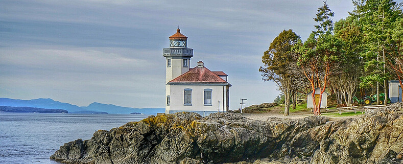
Lime Kiln Lighthouse

Lime Kiln Lighthouse on the west side of San Juan Island, Washington

Lime Kiln Lighthouse on the west side of San Juan Island, Washington

Lime Kiln Lighthouse on the west side of San Juan Island, Washington

Lime Kiln Lighthouse on the west side of San Juan Island, Washington

Lime Kiln Lighthouse on the west side of San Juan Island, Washington

Showing posts with label lake. Show all posts

Monday, March 31, 2014

No. 258 Hiram M. Chittenden Locks

Hiram Chittened Locks
3015 NW 54th St, Seattle, WA 98107
MAP IT


Hiram Chittened Locks
Looking west towards Puget Sound from the Small Lock
The Hiram Chittened Locks, named after Army Major Hirman Martin Chittenden, opened to boat traffic in 1917. The locks are located on the western corner of Salmon Bay along the Lake Washington Ship Canal. Locally they are also known as "Ballard Locks" although there is a pathway that connects Ballard with the Magnolia Neighborhood to south.
Built by the U.S. Army Corps of Engineers, the lock infrastructure stretches nearly 400 feet across one of the widest bodies of water along the ship canal. Lake Union freshwater table is 20 feet above the salt waters of the puget sound. To prevent saltwater intrusion from the tidal puget sound entering the fresh waters of Lake Union and Lake Washington and disturbing the freshwater ecosystem a 40 foot tall dam was installed. 
The purpose of the Hiram Locks is to maintain the freshwater table of Lake Union at or above 20 feet above the saltwater puget sound table. This main function is done by a 235 foot long spillway with 6 hydraulic gates that are 32 feet long and 12 feet tall. They can be open or closed depending on the amount of drainage required. The Lake Union and Lake Washington water table has to be maintained within certain tolerances because of infrastructures east of the locks such as floating bridges, moorings, channel markers, and vessel clearances under bridges need to be accurate. 
During the summer time the spillway openings are reduced to raise the lake levels for recreational boaters and also store fresh water in case of drought conditions. 
In order for boats to pass to and from the lakes into the puget sound there are 2 ship locks at the north end. The large lock is 80 feet wide and 825 feet in length, and the smaller lock is 30 feet wide by 150 feet in length. Both locks can raise or lower boats in under 15 minutes. Everything from canoes, kayaks, pleasure yachts, sailboats to commercial fishing boats and container ships pass through the locks transporting over 1 million tons of cargo, fuel and seafood.


Hiram Chittened Locks
Control Light for the Small Lock 
Hiram Chittened Locks
Large Spillway to control Lake Water 
Hiram Chittened Locks
Boat exit the large lock into Lake Union
Hiram Chittened Locks
Between the large and small locks
Hiram Chittened Locks
West Larg Lock Gate closed
Hiram Chittened Locks
Control Tower for the lock system 
Hiram Chittened Locks
Looking down the 825 foot long large lock
Hiram Chittened Locks
Spillway from Ballard side
Hiram Chittened Locks
Salmon Waves," artist Paul Sorey
Hiram Chittened Locks
Salmon Waves," artist Paul Sorey
Hiram Chittened Locks
USCG Crew prepares the 45 FRB for the lock
Hiram Chittened Locks
USCG 45' FRB takes a ride on the boat elevator


Washington State travel, Washington State travel, Washington Destinations, Photography, Photography spost, best things to do in Seattle, Best things to in Washington State, Washington Tourism Alliance, Washington State Tourism board, recommendations, recommendations for things to see in washington state, things to do in washington state, things to do in seattle, things to do in Tacoma washington, Washington Photographers, Washington nikon shooters, best seattle photography, washington exploration, experience washington, what to do while visiting seattle, seattle top attractions, seattle food, Washington State travel, Washington State travel, Washington Destinations, Photography, Photography spost, best things to do in Seattle, Best things to in Washington State, Washington Tourism Alliance, Washington State Tourism board, recommendations, recommendations for things to see in washington state, things to do in washington state, things to do in seattle, things to do in Tacoma washington, Washington Photographers, Washington nikon shooters, best seattle photography, washington exploration, experience washington, what to do while visiting seattle, seattle top attractions, seattle food, Hiram M. Chittenden Locks, Ballard, lake union, boat, locks, boating, boating on south lake union, puget sound boating, uscg, uscg seattle, united states coast guard seattle washington, 

Monday, February 3, 2014

No. 237 Lake Cassidy, Centennial Trail

Lake Cassidy lies 3 miles east of Marysville and is just a few minutes east of Highway 9. The lake covers over 123 acres of water and is a popular year round lake for fishing rainbow trout, largemouth bass, yellow perch, black crappie and brown bullhead catfish. This variety of fish attracts many species of wildlife to its shores. Hawks, Eagles, Heron and Bear can be scene all around the lake. On the east side of the lake there is a 2 mile section of the Centennial trail that leads to a boardwalk and dock that reach out into the waters of Lake Cassidy.
There are two options parking to start this 2 mile section.
1.4 miles North of the lake is the Getchell Road Trail head at 8318 Westlund Road
and a 0.6 miles to the south  10000 block of 105 Ave NE 


Lake Cassidy, Snohomish
Lake Cassidy Interpretive Center
Lake Cassidy, Snohomish
East Shore of Lake Cassidy 
Lake Cassidy, Snohomish
Boardwalk
Lake Cassidy, Snohomish
Mature American Bald Eagle near the Interpretive Center 


Washington State travel, Washington State travel, Washington Destinations, Photography, Photography spost, best things to do in Seattle, Best things to in Washington State, Washington Tourism Alliance, Washington State Tourism board, recommendations, recommendations for things to see in washington state, things to do in washington state, things to do in seattle, things to do in Tacoma washington, Washington Photographers, Washington nikon shooters, best seattle photography, washington exploration, experience washington, what to do while visiting seattle, seattle top attractions, seattle foodLake Cassidy marysville, marysville, wildlife photography in marysville, centennial trail information, snohomish county parks, walking in washington

Monday, October 28, 2013

No. 226 Mount Rainer Reflection Lakes


One of the most photographed areas of Mount Rainier is of its south face from Reflection Lakes. Anytime you can combine a mountain and wide spanning mountain lake you are bound to make a stunning landscape image. That is of course if the weather and clouds cooperate with the photographer. Thousands of snap shooters, smart phone photographers and amateur to pro photographers make the drive around the south side of Mount Rainier and stop at Reflection Lakes. 
During summer the lake shore and hills sides are covered in colorful blooms of wildflowers. Reflection Lakes is closed to swimming and Fishing but nearby Louise Lake is open to fishing and wading. 
For a successful image plan on shooting at sunrise and sunset during the summer and fall months.
 Mount Rainier is so large and tall that is has its own weather pattern. Which can make taking a photograph tricky. Fast moving high winds can blow in clouds and also clear the south face in just a few minutes. Most photographers make multiple trips up and down the national park. If you have the time to spend a few hours in the park take a notepad with you and write notes about places, mile markers, and description of the trail, area for your Scouting Tips. 
Mount Rainier National Park is so vast that you could spend years hiking the trails and revisiting spots during various times of the year and see Mount Rainier in different light every time. 
For current road conditions and closures visit the official Mount Rainier National Parks Page
Other useful websites to plan your visit


Mount Rainier National Park
Late summer view from Reflection Lakes
Two Mountains, One Shot
Fall Colors at Reflection Lakes - Mike Hoy
Reflection Lakes, Mount Rainier
Snow and Ice at Reflection Lakes - Steve Vought
Please Support Puget Exposure 

 We love to bring you guys the updates to best and greatest photography locations in and around Seattle and the greater Puget Sound area, photography tips and gear related stuff. However, we can’t keep doing that unless we have your continued support. If you would like to purchase any of images featured in an article, please do so by clicking HERE or on the Post Cards and Prints tab above in the header. You can also make secure donation to the travel fund via PayPal. If you frequently shop on Amazon.com, by clicking on the Amazon links listed below you can continue to browse Amazon and any purchase you make will give us a small portion of the sale to continue to run this website. Banner Links for PEP Gear Used:
 
lens rental Washington State travel, Washington State travel, Washington Destinations, Photography, Photography spots, best things to do in Seattle, Best things to in Washington State, Washington Tourism Alliance, Washington State Tourism board, recommendations, recommendations for things to see in washington state, things to do in washington state, things to do in seattle, things to do in Tacoma washington, Washington Photographers, Washington nikon shooters, best seattle photography, washington exploration, experience washington, what to do while visiting seattle, seattle top attractions, seattle food, Space Needle, Explore Washington State, Puget Exposure Photography, Puget Exposure, Road Trips through Washington State, Weird Washington, King County, Snohomish County, Seattle, Everett, Tacoma, Kent, Redmond, Kirkland, Washington Sunrises where and when, Washington State Weather,

Saturday, July 27, 2013

No. 207 Martha Lake Park

16300 East Shore Drive
Martha Lake, WA 98087

Martha Lake Park on south east corner of the lake is a popular urban get a way for local residents. The 6 acre community park features 2 play grounds with climbing structures popular with young children and for the larger kids there are three public fishing piers to try your luck at landing a lake fish. 3 picnic shelters, restrooms and a shallow swimming area make it attractive for family gatherings during hot summer days.


Martha Lake, Lynnwood Martha Lake, Lynnwood Martha Lake, Lynnwood Martha Lake, Lynnwood Martha Lake, Lynnwood Please Support Puget Exposure 

 We love to bring you guys the updates to best and greatest photography locations in and around Seattle and the greater Puget Sound area, photography tips and gear related stuff. However, we can’t keep doing that unless we have your continued support. If you would like to purchase any of images featured in an article, please do so by clicking HERE or on the Post Cards and Prints tab above in the header. You can also make secure donation to the travel fund via PayPal. If you frequently shop on Amazon.com, by clicking on the Amazon links listed below you can continue to browse Amazon and any purchase you make will give us a small portion of the sale to continue to run this website. Banner Links for PEP Gear Used:
 
lens rental Washington State travel, Washington State travel, Washington Destinations, Photography, Photography spots, best things to do in Seattle, Best things to in Washington State, Washington Tourism Alliance, Washington State Tourism board, recommendations, recommendations for things to see in washington state, things to do in washington state, things to do in seattle, things to do in Tacoma washington, Washington Photographers, Washington nikon shooters, best seattle photography, washington exploration, experience washington, what to do while visiting seattle, seattle top attractions, seattle food, Space Needle, Explore Washington State, Puget Exposure Photography, Puget Exposure, Road Trips through Washington State, Weird Washington, King County, Snohomish County, Seattle, Everett, Tacoma, Kent, Redmond, Kirkland, Washington Sunrises where and when, Washington State Weather,

Monday, February 4, 2013

No. 164 Cascade Lake, Orcas Island

Cascade Lake
Moran State Park
Orcas Island


Directions to Moran State Park: starting at the Orcas Island ferry terminal follow Orcas Road for 9 miles to Eastsound Village. Continue driving through town and after approximately 1 more mile take a right onto Olga road. The entrance to Moran State Park will be 3 miles ahead.


Cascade Lake is located on Orcas Island within Moran State Park. Covering an area of over 220 acres this fresh water lake is a popular destination in the summer for family and kids to col off on a hot day. There are plenty of trails that begin at the lake and lead off into all directions. The Cascade Loop trail is about 2.2 miles in length and stays along the shore line. Other trails will take you up the  the Rustic Falls and Cascade Falls


Cascade Lake Cascade Lake

Fishing: The fishing season starts on April 30th and fishing licenses ( about $8 ) can be purchased in Eastsound Village from Eastsound Sporting Goods. Cascade Lake is stocked yearly with rainbows, cutthroat, and kokanee trout. Cascade Lake as well as Mountain Lake and Twin Lakes ( Both just up the road from Cascade ) make for a decent day of fishing. Pick up a watercraft launching permit for $7 and launch your boat. No combustion engines are allowed on the lakes.


 Gear Used:
 
lens rental Learn Photography Online with the Pros Save $10 Now #KTCJQ12  Receive a FREE GIFT from Think Tank Photo Washington State travel, Washington State travel, Washington Destinations, Photography, Photography spost, best things to do in Seattle, Best things to in Washington State, Washington Tourism Alliance, Washington State Tourism boared, recommendations, recommendations for things to see in washington state, things to do in washington state, things to do in seattle, things to do in Tacoma washington, Washington Photographers, Washington nikon shooters, best seattle photography, washington exploration, experience washington, what to do while visiting seattle, seattle top attractions, seattle food, visiting orcas island, orcas island, san juan islands, visiting san juan islands, san juan, san juan de fuca, puget sound, how to expierience washington, washington state san juan islands, landscape photography in washington, landscape photography tips,

Monday, October 22, 2012

No. 132 Picture Lake

Picture Lake at Heather Meadows
Mount Baker Snoqualmie National Forest
Distance from Seattle: 135 miles (2hrs 45min()
MAP IT

Picture Lake at Heather Meadows The aptly named Picture Lake inside the Mount Baker Snoqualmie National Forest at Heather Meadows offers photographers of all skill levels memorable and stunning images of this nature scape. The 5 acres alpine lake at 4,200 elevation features 360 degree views of mountain back drops, wildflowers and colorful plant foliage and paved path that circles the lake making easily accessible for all visitors to enjoy.
The snow covered cap of Mount Shuksan to the east mirrored in Picture Lake is one of the most photographed mountain scenes in North America. In the morning light you get reflections of Mount Herman from the east side of the lake and in the evening light Mount Shuksan is the centerpiece to this strikingly beautiful landscape. You will find interpretive sign panels and a viewing scope installed during the summer months on a paved viewpoint. A platform on the edge of the lake provides a resting spot.
Bring extra batteries for your camera since the 90 min drive east of Interstate I-5 curves and ascends from the valley floor to the alpine area driving past flowing rivers, cascading  creeks and waterfalls just off of the road way. In colder temperatures battery performance is degraded, so by having extra battery and memory cards you will be able to capture the many vistas of the National Forest.

A recreation pass is required in the Heather Meadows Recreation Fee Area

Picture Lake at Heather Meadows
Reflection of Mount Shuksan
Picture Lake at Heather Meadows
Field and Wildflowers of Heather Meadows
Picture Lake at Heather Meadows
Wildflowers in Bloom
Picture Lake at Heather Meadows
Fall Colors at Heather Meadows
Picture Lake at Heather Meadows
Heather Meadows
Picture Lake at Heather Meadows
Mount Herman Reflection
Picture Lake at Heather Meadows
Boardwalk Pier at Picture Lake


Please Support Puget Exposure 

 We love to bring you guys the updates to best and greatest photography locations in and around Seattle and the greater Puget Sound area, photography tips and gear related stuff. However, we can’t keep doing that unless we have your continued support. If you would like to purchase any of images featured in an article, please do so by clicking HERE or on the Post Cards and Prints tab above in the header. You can also make secure donation to the travel fund via PayPal. If you frequently shop on Amazon.com, by clicking on the Amazon links listed below you can continue to browse Amazon and any purchase you make will give us a small portion of the sale to continue to run this website. Banner Links for PEP Gear Used:
 
lens rental Washington State travel, Washington State travel, Washington Destinations, Photography, Photography spots, best things to do in Seattle, Best things to in Washington State, Washington Tourism Alliance, Washington State Tourism board, recommendations, recommendations for things to see in washington state, things to do in washington state, things to do in seattle, things to do in Tacoma washington, Washington Photographers, Washington nikon shooters, best seattle photography, washington exploration, experience washington, what to do while visiting seattle, seattle top attractions, seattle food, Space Needle, Explore Washington State, Puget Exposure Photography, Puget Exposure, Road Trips through Washington State, Weird Washington, King County, Snohomish County, Seattle, Everett, Tacoma, Kent, Redmond, Kirkland, Washington Sunrises where and when, Washington State Weather, Picture Lake, North Cascade Highway, Artist Point, beat the heat, lake, mount shuskan

Wednesday, August 8, 2012

No. 88 Cascade Falls, Moran State Park

Where is Cascade Falls?
Cascade Falls is the second waterfall after Rustic Falls along the Cascade Creek, which runs between Mountain Lake and Cascade Lake in Moran State Park. Walk 0.9 miles from the trail head which is located on the east side of Cascade Lake in Moran State Park Orcas Island. From the small town of Eastsound head southeast on Olga Road and it will lead you right into the middle of the Park. After passing Cascade Lake keep left at the fork in the road for another 1/2 mile and you will see the parking lot and trail head for Rustic, Cascade, Canyon, Hidden and Rosario Falls.
    At about 40 feet tall, Cascade Falls is the largest waterfall in the San Juan Islands. Cascade Creek squiggles down a flume, dropping through a jumble of logs and branches before it veils out over a broad bulbous face into a small grotto lined with several old growth cedar trees. While I certainly don't think the waterfalls of Orcas Island are worth seeing alone (especially considering the cost of the ferry), should one find themselves on the island, the quick walk through the park is worth undertaking.

Cascade Falls
Click here to order a Print of Cascade Falls
Cascade Falls
Click here to order a Artwork Print

Checkout other Waterfall Images available as greeting cards and larger wall prints 

San Juan Island Artwork Gallery


What can I see and do at Cascade Falls?
The ancient and towering forests keep the Creek and Trail cool and shaded. The giant red cedars and other evergreens that make up the thick canopy are impressive throughout the year. Stroll along the creek side path that connects Mountain Lake to Cascade Lake and enjoy the quiet relaxation afforded by the deep forest.

When is Rustic Falls open?
The Park is open for day use all year long. The campsites and swimming area are open seasonally, as are the park offices. The Falls are at their most active in the winter and spring when the water volume is highest.
How much does Rustic Falls cost?
Moran State Park requires a Discover Pass. You can buy them on a daily basis for $10.00 or for $30.00 you receive an annual Pass. The nearby campgrounds also require an additional fee.
Who can I call if I have more questions?
The Moran State Park Rangers can help you with any questions you might have. (360) 376-2326. lens rental Learn Photography Online with the Pros Save $10 Now #KTCJQ12  Receive a FREE GIFT from Think Tank Photo Washington State travel, Washington State travel, Washington Destinations, Photography, Photography spost, best things to do in Seattle, Best things to in Washington State, Washington Tourism Alliance, Washington State Tourism board, recommendations, recommendations for things to see in washington state, things to do in washington state, things to do in seattle, things to do in Tacoma washington, Washington Photographers, Washington nikon shooters, best seattle photography, washington exploration, experience washington, what to do while visiting seattle, seattle top attractions, visiting the san juan islands, moran state park on orcas island, mount constitution orcas island, washington san juan islands, landscape photography of orcas island, hiking on orcas island, hikingin the san juan, hikingin the san juan islands, aerial view of orcas island, washington state road trips, washington state ferry, washington photography, washington state landscape photographers, washington state waterfalls, san juan island waterfalls, waterfall photography, what to see on orcas island, experience san juan county, travels through washington