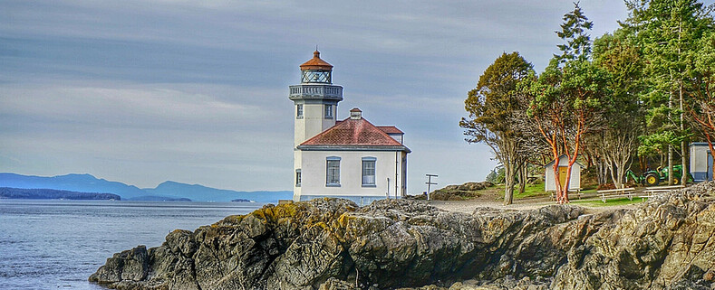
Lime Kiln Lighthouse

Lime Kiln Lighthouse on the west side of San Juan Island, Washington

Lime Kiln Lighthouse on the west side of San Juan Island, Washington

Lime Kiln Lighthouse on the west side of San Juan Island, Washington

Lime Kiln Lighthouse on the west side of San Juan Island, Washington

Lime Kiln Lighthouse on the west side of San Juan Island, Washington

Showing posts with label viewpoint. Show all posts

Tuesday, April 15, 2014

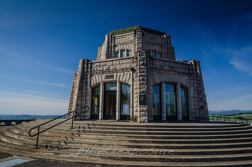
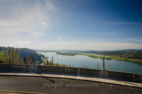
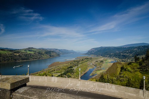
No. 264 Crown Point Vista House, Oregon

Vista House, Oregon Columbia River Gorge

Crown Point Vista House
40700 E Historic Columbia River Hwy
Corbett, OR 97019

MAP IT

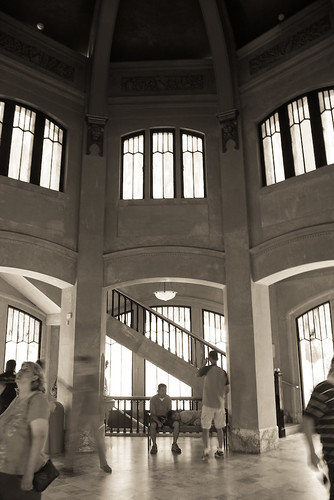
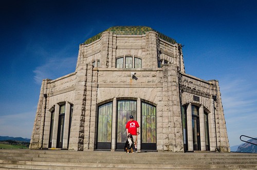
Crown Point Vista House was built between 1916 and 1918 by Multnomah County as a scenic viewpoint and rest area for early motorist traveling on the Historic Highway 30. Vista House octagonal stone structure sits 733 feet above the Columbia River. The domed rotunda is 44 feet wide and 55 feet tall with clerestory windows feature opalescent glass in a simple tracery pattern, with similar colored glass at the tops of the windows. Stairs lead from the rotunda to an elevated viewing platform at the base of the dome. The exterior is gray sandstone, with a green tile roof. The interior is extensively finished in marble, even in the toilets. The dome interior has bronze lining. 
Crown Point was designated a National Natural Landmark in 1971 and Vista House was later placed on the National Register of Historic Places in 1974. 


Vista House
Vista House Interior - Matthew Roberts 
Vista House, Oregon Columbia River Gorge
Taking a break along Historic Highway 30 
Vista House, Oregon Columbia River Gorge
Glass Windows of Vista House 
Vista House, Oregon Columbia River Gorge

Vista House, Oregon Columbia River Gorge
looking west down the Columbia River 
Vista House, Oregon Columbia River Gorge
Looking east down the Columbia River 

Sunday, July 14, 2013

No. 203 Mount Erie, Anacortes

Mount Erie
Heart Lake Road / Ray Auld Dr
Anacortes, WA
MAP IT 


Mount Erie View POI


Mt. Erie View Point  is on the highest mountain of Fidalgo Island in Skagit County. The 160 acre park is operated by the Anacortes Community Forest Lands and offers various adventure activities such as multiple rock face ascents, trails and a number of hill top viewing areas. At the intersection of Heart Lake Road and Ray Auld Dr. there is a parking area and trail heads that meander through the forest. Located at the south end of the parking lot is Erie Mountain Dr, a 1.5 mile one lane paved road that you can either hike, bike or drive to the main viewing areas. The drive takes about 10 minutes as it zig zags its way up 800 feet in elevation to the top.
The end of Erie Mountain Drive is at around 1200 feet and has multiple viewing areas that looks east, west, and south all are just a few minute walk from the parking lot. The south face of MT. Erie is a popular rock climbing location with its exposed rock face that extends 900 feet vertically down to Lake Campbell.


Mount Erie Overlook, Anactores Washington
Looking East towards Padilla Bay and Burlington, WA
Mount Erie Overlook, Anactores Washington
Looking South over Lake Campbell


Mount Erie Overlook, Anactores Washington
Lake Campbell, Deception Pass, Naval Air station Whidbey, and Whidbey Island

Mount Erie Overlook, Anactores Washington
Overlook Forest Trail

Mount Erie Overlook, Anactores Washington
Burrows Bay, Allen Island, Lopez Island


Washington State travel, Washington State travel, Washington Destinations, Photography, Photography spost, best things to do in Seattle, Best things to in Washington State, Washington Tourism Alliance, Washington State Tourism board, recommendations, recommendations for things to see in washington state, things to do in washington state, things to do in seattle, things to do in Tacoma washington, Washington Photographers, Washington nikon shooters, best seattle photography, washington exploration, experience washington, what to do while visiting seattle, seattle top attractions, seattle food, Mount Erie, Mount Erie Anacortes, Anactores washington state, Fidalgo Island, Things to do in anancortes

Friday, February 1, 2013

No. 162 Cap Sante Viewpoint

Cap Sante Park
1000 W Ave
Anacortes, WA

MAP IT

Cap Sante Park (1000 W Avenue) is a 37 acre forested promontory at the eastern edge of Anacortes. It is primarily a viewpoint overlooking the marina to the west, the downtown Anacortes, March Point, Fidalgo Bay and the Cascades to the east. 

Directions
Take Hwy 20 to Anacortes
Continue on Hwy 20 until it turns into Commercial Ave
Turn right onto 4th Street
Turn Right onto V Ave
Continue for a 1/4 mile until you reach the parking Lot over look

View from Above-Anacortes, Wa All images are copyrighted by © Pugetexposure Photography. Do NOT use my images on blogs, personal or professional websites, or any other digital media without my explicit permission.

Gear Used:
 
lens rental Learn Photography Online with the Pros Save $10 Now #KTCJQ12  Receive a FREE GIFT from Think Tank Photo Washington State travel, Washington State travel, Washington Destinations, Photography, Photography spost, best things to do in Seattle, Best things to in Washington State, Washington Tourism Alliance, Washington State Tourism boared, recommendations, recommendations for things to see in washington state, things to do in washington state, things to do in seattle, things to do in Tacoma washington, Washington Photographers, Washington nikon shooters, best seattle photography, washington exploration, experience washington, what to do while visiting seattle, seattle top attractions, seattle food, Anacortes Washington, What to do in Anacortes Washington, Anacortes Washington Photography, San Juan Islands, Washington State Ferry System

Thursday, January 24, 2013

No. 160 Pacific Hwy Bridge 370

Yellow Ribbon Hwy #370
WA-529 N, Bridge 370
Everett, WA
MAP IT 


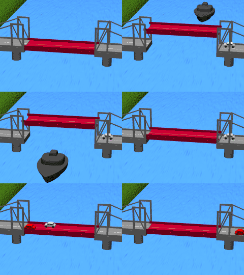
The Bridge 370, built in 1927 during Everett's growth years, spans the north and south banks of the Snohomish River and connects State Route 529 "Yellow Ribbon Highway" from Everett to Marysville and is a handsome 80-plus year old dual deck two-lane vertical cantilever bridge. It is eventually slated to be replaced with a four-lane non-movable bridge. It is easily seen from Interstate 5, which it parallels.


Bridge 370 at sunset Bridge 370 at sunset 529 Bridge


All images are copyrighted by © Pugetexposure Photography. Do NOT use my images on blogs, personal or professional websites, or any other digital media without my explicit permission.

Gear Used:
 
lens rental Learn Photography Online with the Pros Save $10 Now #KTCJQ12  Receive a FREE GIFT from Think Tank Photo Washington State travel, Washington State travel, Washington Destinations, Photography, Photography spost, best things to do in Seattle, Best things to in Washington State, Washington Tourism Alliance, Washington State Tourism boared, recommendations, recommendations for things to see in washington state, things to do in washington state, things to do in seattle, things to do in Tacoma washington, Washington Photographers, Washington nikon shooters, best seattle photography, washington exploration, experience washington, what to do while visiting seattle, seattle top attractions, seattle food, Everett Washington, what to do in Everett Washington, Everett Washington Photographers, Everett Photographers, Washington Photographers, downtown everett, experience everett, bridges in everett washington

Monday, January 21, 2013

No. 159 South Port Gardner Bay Viewpoint

Port Gardner, north of Everett Marina, is an inlet of Possession Sound on which the city of Everett, Washington is located. The Snohomish River flows into the bay to the north and is border on the west by Jetty Island. During low tide the water recedes revealing old wood pylons and sandy bottom. Plenty of wildlife can be scene here.
Remnants of Everett, Wa history as a "Mill Town" from the 20th century still dot the shoreline landscape were once lumber and shingle mills and floating log booms provided an econimical boom to the growing city, which saw its population triple from less than 8,000 in 1900 to nearly 25,000 in 1910. Everett gloried in its "Mill Town" reputation, which was further enhanced when the massive Weyerhaeuser Mill B opened on the river front in 1915.

 MAP IT

  south Port Gardener Bay south Port Gardener Bay south Port Gardener Bay


All images are copyrighted by © Pugetexposure Photography. Do NOT use my images on blogs, personal or professional websites, or any other digital media without my explicit permission.

Gear Used:
 
lens rental Learn Photography Online with the Pros Save $10 Now #KTCJQ12  Receive a FREE GIFT from Think Tank Photo Washington State travel, Washington State travel, Washington Destinations, Photography, Photography spost, best things to do in Seattle, Best things to in Washington State, Washington Tourism Alliance, Washington State Tourism boared, recommendations, recommendations for things to see in washington state, things to do in washington state, things to do in seattle, things to do in Tacoma washington, Washington Photographers, Washington nikon shooters, best seattle photography, washington exploration, experience washington, what to do while visiting seattle, seattle top attractions, seattle food things to do in Everett, Things to do in Everett washington, Everett Photographers, Everett wedding photographers, downtown everett, Everett waterfront, Everett Waterfront photography , everett washington marina, marina, everett boating, everett washington parks, port gardner bay, everett marina

Thursday, November 29, 2012

No. 140 Seattle 2nd most famous Black Hole

Volunteer Park
1247 15th Ave E
Seattle, WA

MAP IT

Located on the east side of the Volunteer Park reservoir stands "Black Sun" a sculpture made by prominent Japanese American artist Isamu Noguchi in 1968. The sculpture carved from black Brazilian granite stands 9 feet tall and features an opening in the middle that frames the Space Needle, Puget Sound and the Olympic Mountain Range.
This sculpture is reminiscent of the lyrics written by Seattle's Chris Cornell in 1994's "Black Hole Sun" off of Soundgarden - Superunknown Album.


Black Sun - Isamu Noguchi


Installing Black Sun at Volunteer Park, 1969
Installation of Black Sun at Volunteer Park 1969


Gear Used:
lens rental Learn Photography Online with the Pros Save $10 Now #KTCJQ12  Receive a FREE GIFT from Think Tank Photo Flatbooks - Clever eBooks for the Curious Mind

Tuesday, September 25, 2012

No. 117 Belvedere Park, West Seattle's Overlook with stunning views

Belvedere Park
3600 Southwest Admiral Way
Seattle, WA

MAP IT


This park has a stunning view across Elliott Bay to downtown Seattle, and on clear days to the Cascade Mountains and Mt. Rainier. Divided into two parts on the east and west sides of Admiral Way, the east section features a totem pole depicting stylized beavers, fish and frogs.
Belvedere Viewpoint is a popular spot for scenic photos and as a backdrop for wedding and other ceremonial photos.

Belvedere Viewpoint was named after the "Belvidere District" subdivision. It comes from the Italian words for "beautiful" and "to see."
The original 25-foot totem was a gift to the city in the 1930s from E. "Daddy" Standley, owner of Ye Olde Curiosity Shop on the downtown waterfront and a booster of the viewpoint, from his collection. It was carved by Bella-Bella Indians from the Queen Charlotte Islands.
It became famous from use on postcards and telephone directories. Deemed beyond repair in 1966, its replacement was carved from a cedar log cut from Schmitz Park. Robert Fleischman and Michael Morgan, both Boeing engineers, donated some 300 hours of work carving the new totem.

Belvedere Park
Looking across Elliot Bay at Seattle Skyline and Shipping Terminal
Belvedere Park
Looking south east for the morning sunrise


All images are copyrighted by © Pugetexposure Photography. Do NOT use my images on blogs, personal or professional websites, or any other digital media without my explicit permission.

Gear Used:
 
lens rental Learn Photography Online with the Pros Save $10 Now #KTCJQ12  Receive a FREE GIFT from Think Tank Photo

Tuesday, September 18, 2012

No. 110 Grand Avenue Park

Grand Avenue Park
Location
1800 Grand Ave.
Everett, WA 98201

Map IT

Grand Avenue Park sits on a bluff overlooking the Everett Marina. It is a 5 acres hill top park located on Grand Avenue between 19th Street and 16th Street. After a re-dedication in June of 2008 the park was upgraded with wider walkways, historical street lighting, public art installations, including a compass rose, and new planting beds. The park over looks the Everett Naval Base, and Port Gardner Bay.
Grand Avenue Park overlook
Looking down from Grand Avenue Park
Compass Rose ~ Grand Avenue Park overlook
Compass Rose at Grand Avenue Park

Park hours
6 a.m.-10 p.m. April 1-Oct. 31

6 a.m.-8 p.m. Nov. 1-March 31 Please Support Puget Exposure 

 We love to bring you guys the updates to best and greatest photography locations in and around Seattle and the greater Puget Sound area, photography tips and gear related stuff. However, we can’t keep doing that unless we have your continued support. If you would like to purchase any of images featured in an article, please do so by clicking HERE or on the Post Cards and Prints tab above in the header. You can also make secure donation to the travel fund via PayPal. If you frequently shop on Amazon.com, by clicking on the Amazon links listed below you can continue to browse Amazon and any purchase you make will give us a small portion of the sale to continue to run this website. Gear Used:
 
lens rental Washington State travel, Washington State travel, Washington Destinations, Photography, Photography spots, best things to do in Seattle, Best things to in Washington State, Washington Tourism Alliance, Washington State Tourism board, recommendations, recommendations for things to see in washington state, things to do in washington state, things to do in seattle, things to do in Tacoma washington, Washington Photographers, Washington nikon shooters, best seattle photography, washington exploration, experience washington, what to do while visiting seattle, seattle top attractions, seattle food, Space Needle, Explore Washington State, Puget Exposure Photography, Puget Exposure, Road Trips through Washington State, Weird Washington, King County, Snohomish County, Seattle, Everett, Tacoma, Kent, Redmond, Kirkland, Washington Sunrises where and when, Washington State Weather,