


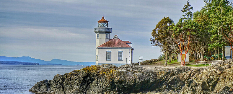


Grays Harbor Lighthouse
http://www.westportmaritimemuseum.com/pricing-hours/
MAP IT:
The Grays Harbor Inlet is one of the few along Washington State's coastline to allow ocean going vessels to enter without having to sail up a difficult river or channel. The towns of Hoquiam, Westport and Aberdeen saw increased growth and revenue from the booming timber industry in the late 1800s. By 1880s a number of ships had wreck near the entrance to Grays harbor and local representatives headed to Washington to ask law makers for funds to construct a lighthouse to aid in navigation and protect their lumbar industry.
After 14 years of funding issues and construction delays the 107 foot brick and mortar lighthouse was built on a tract of land 400 feet from the break water. Over the past 100 years storms and sediment accretion from the jetty protruding from the entrance to Grays Harbor have deposited nearly 3000 feet of sand in front of the lighthouse. Currently Grays Harbor Lighthouse sits 4 blocks from the ocean hidden amongst the trees with only its light tower rising above the tree line.
There are 135 metal stair bolted to the brick interior which take depending on your fitness level about 10 minutes to ascend.
There is no fee to lighthouse grounds or gift shop but it will cost you $5 and some sweat to get to the top of the lighthouse.

 Please Support Puget Exposure
We love to bring you guys the updates to best and greatest photography locations in and around Seattle and the greater Puget Sound area, photography tips and gear related stuff. However, we can’t keep doing that unless we have your continued support. If you would like to purchase any of images featured in an article, please do so by clicking HERE or on the Post Cards and Prints tab above in the header. You can also make secure donation to the travel fund via PayPal. If you frequently shop on Amazon.com, by clicking on the Amazon links listed below you can continue to browse Amazon and any purchase you make will give us a small portion of the sale to continue to run this website.
Banner Links for PEP
Gear Used:

 Washington State travel, Washington State travel, Washington Destinations, Photography, Photography spots, best things to do in Seattle, Best things to in Washington State, Washington Tourism Alliance, Washington State Tourism board, recommendations, recommendations for things to see in washington state, things to do in washington state, things to do in seattle, things to do in Tacoma washington, Washington Photographers, Washington nikon shooters, best seattle photography, washington exploration, experience washington, what to do while visiting seattle, seattle top attractions, seattle food, Space Needle, Explore Washington State, Puget Exposure Photography, Puget Exposure, Road Trips through Washington State, Weird Washington, King County, Snohomish County, Seattle, Everett, Tacoma, Kent, Redmond, Kirkland, Washington Sunrises where and when, Washington State Weather, Grays Harbor, Grays Harbor Lighthouse, Washington State Tallest Lighthouse, Westport, Washington, Lighthouses
1020 W Ocean Ave, Westport, WA 98595
Height: 107' (33 m)
First lit: 1898
MAP IT:
The Grays Harbor Inlet is one of the few along Washington State's coastline to allow ocean going vessels to enter without having to sail up a difficult river or channel. The towns of Hoquiam, Westport and Aberdeen saw increased growth and revenue from the booming timber industry in the late 1800s. By 1880s a number of ships had wreck near the entrance to Grays harbor and local representatives headed to Washington to ask law makers for funds to construct a lighthouse to aid in navigation and protect their lumbar industry.
After 14 years of funding issues and construction delays the 107 foot brick and mortar lighthouse was built on a tract of land 400 feet from the break water. Over the past 100 years storms and sediment accretion from the jetty protruding from the entrance to Grays Harbor have deposited nearly 3000 feet of sand in front of the lighthouse. Currently Grays Harbor Lighthouse sits 4 blocks from the ocean hidden amongst the trees with only its light tower rising above the tree line.
There are 135 metal stair bolted to the brick interior which take depending on your fitness level about 10 minutes to ascend.
There is no fee to lighthouse grounds or gift shop but it will cost you $5 and some sweat to get to the top of the lighthouse.
For more Details on Grays Harbor Lighthouse check out http://www.lighthousefriends.com/light.asp?ID=117
 | ||
|
 |
 |
Washington State travel, Washington State travel, Washington Destinations, Photography, Photography spots, best things to do in Seattle, Best things to in Washington State, Washington Tourism Alliance, Washington State Tourism board, recommendations, recommendations for things to see in washington state, things to do in washington state, things to do in seattle, things to do in Tacoma washington, Washington Photographers, Washington nikon shooters, best seattle photography, washington exploration, experience washington, what to do while visiting seattle, seattle top attractions, seattle food, Space Needle, Explore Washington State, Puget Exposure Photography, Puget Exposure, Road Trips through Washington State, Weird Washington, King County, Snohomish County, Seattle, Everett, Tacoma, Kent, Redmond, Kirkland, Washington Sunrises where and when, Washington State Weather, Grays Harbor, Grays Harbor Lighthouse, Washington State Tallest Lighthouse, Westport, Washington, Lighthouses


