


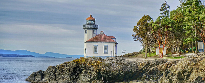


Bay View State Park
10901 Bay View-Edison Rd
Mt Vernon, WA 98273
MAP IT
Bay View State Park covers around 25 acres and has a play area, camp ground including yurts is located on the eastern shore of Padilla Bay in Skagit County and has 1200 feet of shoreline.
Padilla Bay is an estuary at the saltwater edge of the large delta of the Skagit River in the Salish Sea. It is about eight miles long (north to south) and three miles across. In 1980, this bay was selected to be included in the National Estuarine Research Reserve System. Because the bay is filled with sediment from the Skagit River, the bottom is very shallow, flat, and muddy. It is so shallow that almost the whole bay is intertidal. This means that it is flooded at high tide. When the tide goes out the whole bay empties out, exposing miles and miles of mud flats. This condition allows unusually large eelgrass meadows to grow. There are nearly 8,000 acres of eelgrass (Zostera marina and Z. japonica) in Padilla Bay.
Habitats in the Padilla Bay support herring, smelt, pink and chum salmon, flatfish, Dungeness crab, ducks including Black Brant, eagles, shorebirds, and peregrine falcons. Mammals found in Padilla Bay include harbor seals and river otters.


Gear Used:

 Washington State travel, Washington State travel, Washington Destinations, Photography, Photography spots, best things to do in Seattle, Best things to in Washington State, Washington Tourism Alliance, Washington State Tourism board, recommendations, recommendations for things to see in washington state, things to do in washington state, things to do in seattle, things to do in Tacoma washington, Washington Photographers, Washington nikon shooters, best seattle photography, washington exploration, experience washington, what to do while visiting seattle, seattle top attractions, seattle food, Space Needle, Explore Washington State, Puget Exposure Photography, Puget Exposure, Road Trips through Washington State, Weird Washington, King County, Snohomish County, Seattle, Everett, Tacoma, Kent, Redmond, Kirkland, Washington Sunrises where and when, Washington State Weather, Anacortes, Padilla Bay National Estuarine Research Reserve, Padilla Bay is located in Skagit County, Washington, in the northern reaches of greater Puget Sound, on the southeastern fringe of the San Juan Archipelago. The Padilla Bay National Estuarine Research Reserve (NERR) protects one of the largest continuous beds of eelgrass in the contiguous United States. The surrounding region is part of the Skagit Valley agricultural complex, one of the most fertile regions in the world. Padilla Bay covers more than 11,000 acres of a broad, flat intertidal embayment disconnected from normal flows of the Skagit River due to diking. Habitats within the reserve are predominately aquatic with most of its habitat dominated by eelgrass (Zostera marina and Z. japonica), with a smaller portion of its boundary including uplands, freshwater sloughs, and high salt marsh. Habitats in the Padilla Bay NERR support herring, smelt, pink and chum salmon, flatfish, Dungeness crab, ducks including Black Brant, eagles, shorebirds, and peregrine falcons. Mammals found in Padilla Bay include harbor seals and river otters.
10901 Bay View-Edison Rd
Mt Vernon, WA 98273
MAP IT
Bay View State Park covers around 25 acres and has a play area, camp ground including yurts is located on the eastern shore of Padilla Bay in Skagit County and has 1200 feet of shoreline.
Padilla Bay is an estuary at the saltwater edge of the large delta of the Skagit River in the Salish Sea. It is about eight miles long (north to south) and three miles across. In 1980, this bay was selected to be included in the National Estuarine Research Reserve System. Because the bay is filled with sediment from the Skagit River, the bottom is very shallow, flat, and muddy. It is so shallow that almost the whole bay is intertidal. This means that it is flooded at high tide. When the tide goes out the whole bay empties out, exposing miles and miles of mud flats. This condition allows unusually large eelgrass meadows to grow. There are nearly 8,000 acres of eelgrass (Zostera marina and Z. japonica) in Padilla Bay.
Habitats in the Padilla Bay support herring, smelt, pink and chum salmon, flatfish, Dungeness crab, ducks including Black Brant, eagles, shorebirds, and peregrine falcons. Mammals found in Padilla Bay include harbor seals and river otters.
Gear Used:
Washington State travel, Washington State travel, Washington Destinations, Photography, Photography spots, best things to do in Seattle, Best things to in Washington State, Washington Tourism Alliance, Washington State Tourism board, recommendations, recommendations for things to see in washington state, things to do in washington state, things to do in seattle, things to do in Tacoma washington, Washington Photographers, Washington nikon shooters, best seattle photography, washington exploration, experience washington, what to do while visiting seattle, seattle top attractions, seattle food, Space Needle, Explore Washington State, Puget Exposure Photography, Puget Exposure, Road Trips through Washington State, Weird Washington, King County, Snohomish County, Seattle, Everett, Tacoma, Kent, Redmond, Kirkland, Washington Sunrises where and when, Washington State Weather, Anacortes, Padilla Bay National Estuarine Research Reserve, Padilla Bay is located in Skagit County, Washington, in the northern reaches of greater Puget Sound, on the southeastern fringe of the San Juan Archipelago. The Padilla Bay National Estuarine Research Reserve (NERR) protects one of the largest continuous beds of eelgrass in the contiguous United States. The surrounding region is part of the Skagit Valley agricultural complex, one of the most fertile regions in the world. Padilla Bay covers more than 11,000 acres of a broad, flat intertidal embayment disconnected from normal flows of the Skagit River due to diking. Habitats within the reserve are predominately aquatic with most of its habitat dominated by eelgrass (Zostera marina and Z. japonica), with a smaller portion of its boundary including uplands, freshwater sloughs, and high salt marsh. Habitats in the Padilla Bay NERR support herring, smelt, pink and chum salmon, flatfish, Dungeness crab, ducks including Black Brant, eagles, shorebirds, and peregrine falcons. Mammals found in Padilla Bay include harbor seals and river otters. 


