3801 Discovery Park Blvd
Seattle, WA 98199
MAP IT
Discovery Park is a 534 acre natural area park operated by the Seattle Parks and Recreation. It is the largest city park in Seattle, and occupies most of the former Fort Lawton site.
The site is one of breathtaking majesty. Situated on Magnolia Bluff overlooking Puget Sound, Discovery Park offers spectacular view of both the Cascade and the Olympic Mountain ranges. The secluded site includes two miles of protected tidal beaches as well as open meadow lands, dramatic sea cliffs, forest groves, active sand dunes, thickets and streams.
Discovery Park offers over 11 miles of trails that can be combined up into infinite variations and lengths. You can make your visit as easy or difficult as you want.
Parking in the East Parking lot you can access the loop trail and start your way down a flat, maintained trail. You might not feel the grade drop however until you turn around and want to get back to your car. As you make your way on Loop Trail towards South Beach you will pass along a bluff where on clear days you can see across the puget sound and see Bainbridge Island. When you reach the dunes on the north side of the bluff your about 30 min into your hike and about half way down to the water. In order to get to the West Point Lighthouse you will want to continue north along the Loop Trail passing behind the Fort Lawton military housing and turn left down Utah Ave. Its a fairly steep roadway that goes for 1/4 mile until you reach the lighthouse. Keep in mind that you have to retrace your steps going uphill to get back to your car. If you or a family member has a handicapped parking permit you can drive all the way to the water via Washington Ave/Utah Ave. There is active parking enforcement and its a $47 fine if you get caught.
The North Park Lot along Illinois Ave attracts more of the cross country runner, jogger, Seattleite crowed. Not as many tourist make it this far into the park. Numerous trails can be accessed from the north end parking lot. Including the Loop Trail to North Beach. Its about 1.8 miles down to the water a good 35min-40 min hike down a series of stairs, unimproved trails. If your a cross country runner that loves leaping down stairs, running across creeks and gracing tree roots with your shoes this is the trail for you. Some parts are narrow for two hikers but just give way and you will be fine. Later in the afternoon more runners will appear so be ready to get passed a lot. Once you exit the lush forest and are at see level you will see Shoreline Marina off to your right and West Point Light House 1/2 mile to your left. There is a long flat trail that passes behind the water treatment facility. Least at this point 30 min in you can see the lighthouse and hear waves crashing against the rocks below you.
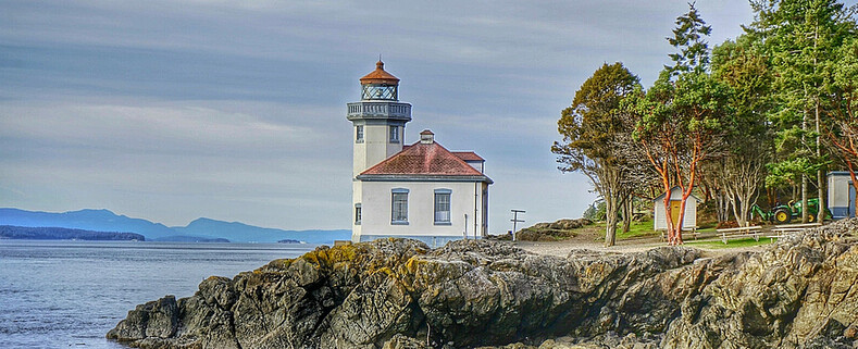
The West Point lighthouse is currently under a renovation status. The lighthouse and support building are not open to the public there is fence wrapping around the lighthouse grounds. Depending on the tide and your rock hopping skills you can make your way around the lighthouse and see it from both south and north.
Gear Used:
Washington State travel, Washington State travel, Washington Destinations, Photography, Photography spots, best things to do in Seattle, Best things to in Washington State, Washington Tourism Alliance, Washington State Tourism board, recommendations, recommendations for things to see in washington state, things to do in washington state, things to do in seattle, things to do in Tacoma washington, Washington Photographers, Washington nikon shooters, best seattle photography, washington exploration, experience washington, what to do while visiting seattle, seattle top attractions, seattle food, Space Needle, Explore Washington State, Puget Exposure Photography, Puget Exposure, Road Trips through Washington State, Weird Washington, King County, Snohomish County, Seattle, Everett, Tacoma, Kent, Redmond, Kirkland, Washington Sunrises where and when, Washington State Weather, Discovery Park, Point Wislon Lighthouse, Lighthouse Lovers