Lime Kiln Lighthouse

Lime Kiln Lighthouse on the west side of San Juan Island, Washington

Lime Kiln Lighthouse on the west side of San Juan Island, Washington

Lime Kiln Lighthouse on the west side of San Juan Island, Washington

Lime Kiln Lighthouse on the west side of San Juan Island, Washington

Lime Kiln Lighthouse on the west side of San Juan Island, Washington

Thursday, May 31, 2012

No. 41 Picnic Point, Edmonds

Picnic Point Park 12001 Picnic Point Road Edmonds, WA 98026 Located on the shores of Puget Sound, Picnic Point Park offers a tranquil and scenic setting for picnicking and beach activities. Tables and charcoal cookers are available for picnicking enjoyment. With its excellent views of Whidbey Island and the distant Olympic Mountain range, sunset viewing is always a popular pastime. With its large pedestrian overpass, the park provides convenient access to the beach, picnic areas, and restrooms. Those who are physically challenged may require assistance. As with all the beaches lining the Puget Sound area their accessability depends on the current tide levels. To get the most beach area make sure you visit the park during a low tide.


Low Tide @ Picnic Point
do not use my images on blogs or websites without my permission. If you would like to license a photo, please contact me.
Picnic Point Park decay docks
do not use my images on blogs or websites without my permission. If you would like to license a photo, please contact me.
Untitled
do not use my images on blogs or websites without my permission. If you would like to license a photo, please contact me.
Picnic Point foilage
do not use my images on blogs or websites without my permission. If you would like to license a photo, please contact me.
B&W Ped Bridge Picnic Point
do not use my images on blogs or websites without my permission. If you would like to license a photo, please contact me.
BNSF 4125, 4406 Freighter Picnic Point
do not use my images on blogs or websites without my permission. If you would like to license a photo, please contact me.
Driving Directions From the intersection of Hwy 99 and 128th Street SW, go south 2 miles; turn right onto Shelby Road; go west 1-1/3 miles to a Y intersection; bear right onto Picnic Point Road approximately 1-1/2 miles to park entrance. Learn Photography Online with the Pros Save $10 Now #KTCJQ12

No. 40 Mukilteo, WA [Beach, Ferry, Lighthouse]

Mukilteo Lighthouse Park


The small shore line town of Mukilteo is your gateway to Whidbey Island via the Washington State ferry system's Clinton-Mukilteo ferry run. You can board the ferry either on foot or by car. This ferry route is very popular both on the weekends for people taking trips to Whidbey Island and during the week for people living on Whidbey and commuting to work. You can expect delays up to 2 hrs during peak travel times:

Clinton Terminal                                           Mukilteo Terminal
Mon-Fri 5am-9am  4pm-8pm                       Mon-Fri  3pm-7pm
Sat / Sun 7am-6pm                                       Sat / Sun 8am-12pm

To the left of the ferry terminal is Mukilteo State Park. Recently undergone a renovation, this park boasts new playgrounds, new sidewalks and beach front. When the weather is nice hundreds of people flock to the beach to play in the water, fly kites, have BBQs and check out the boats rounding Mukilteo Lighthouse Park.  

do not use my images on blogs or websites without my permission. If you would like to license a photo, please contact me.


As you drive along Mukilteo Speed Way towards Mukilteo you will pass Paine Airport, off to your right, home of Boeing Aircraft manufacturing and vintage war bird museums. If your an aviation geek you can start you flying experience by visiting the Heritage Flight Foundation on the west side of the airport or the Flying Heritage Foundation on the east side of the airport.
At the north end of the airport is Boeing's Future of Flight Museum that takes you into the future of aviation. You can also catch the bus to the Boeing Factory tour here as well. All three destinations get you up close and personal to vintage and next generation aircraft.


Mukilteo Lighthouse Park
Post Cards and Prints available here


Mukilteo Lighthouse Park

Mukilteo Light House
Morning Low Low Tide Sunset Mukilteo Beach


Mukilteo Lighthouse Park Mukilteo Lighthouse Park Mukilteo Lighthouse Park

Mukilteo Shoreline at Sunset wintermukilteolighthouse Mukilteo Light Keepers Residence The Day and Night Handoff Light Rays


 Gear Used:
 
lens rental Washington State travel, Washington State travel, Washington Destinations, Photography, Photography spots, best things to do in Seattle, Best things to in Washington State, Washington Tourism Alliance, Washington State Tourism board, recommendations, recommendations for things to see in washington state, things to do in washington state, things to do in seattle, things to do in Tacoma washington, Washington Photographers, Washington nikon shooters, best seattle photography, washington exploration, experience washington, what to do while visiting seattle, seattle top attractions, seattle food, Mukilteo Washington, Lighthouses, Lighthouses in Washington Stae, Lighthouse on the Puget Sound, Lighthouses on the water, Mukilteo Lighthouse, Mukilteo Lighthouse Park, Washington State Ferry system, Whidbey Islan Ferry, Clinton Washington, Sunset, beach, landscape, City of Mukilteo, north of Seattle, Waterfront town, Snohomish County Beaches, Snohomish COunty Photographer, Lighthouse lovers, Mukilteo Endgament Photographer, Top Things to see in Washington, weird Washington, Sunset, Fine Art America Photography in Seattle, Fine Art America Landscape Photographer, Snohomish County Parks and Recreation

Tuesday, May 29, 2012

No. 39 Juanita Bay - Kirkland, Washington

Juanita Bay Park 
 2201 Market Street, Kirkland.


Image created with Snapseed

Juanita Bay Park is a 110 acre open area that features paved trails, raised boardwalks, open lawn areas with benches and picnic tables. The park is at the bottom of Kirkland's north hill and surrounds  the northeast shoreline of Lake Washington. Just steps away from Kirkland's Marke Street begins this Urban WIldlife Habitat. The seemless mix of tall trees, green space, wetlands, marsh, and lake water provide protection and large selection of food source to sustain a large variety of animals in cluding


Juanita Bay Park - Kirkland, WA
Photo & Text © 2012 Puget Exposure Photography. All rights reserved. No use, reproduction, alteration or republishing in any media.
Juanita Bay Park - Kirkland, WA
Photo & Text © 2012 Puget Exposure Photography. All rights reserved. No use, reproduction, alteration or republishing in any media.

Juanita Bay Park - Kirkland, WA
Photo & Text © 2012 Puget Exposure Photography. All rights reserved. No use, reproduction, alteration or republishing in any media.
More Images and Directions to Junaita Bay Park after the BREAK

Monday, May 28, 2012

No. 38 Log Boom Park, Kenmore Washington

Log Boom Park
61st Ave NE & NE 175th St
Kenmore, WA 98028


Log Boom Park is a 12-acre park with over 1200 feet of shorline located at the north end of Lake Washington. It features a public dock both used by fisherman and boaters and a children's play area on the west side. You can either park your car in the parking lot during open hours or walk, ride or skate along the burke gill man trail which and pause to catch your breath at the Tracey Owen Station at Log Boom Park. As you step onto the pier the first 30 feet or so has handrails but the rest of the pier is open with no handrails. So be careful where you step and keep an eye on small children and pets so they don't miss step and fall into the water. Walking out to the end of the pier is good place to watch Kenmore Air Floatplanes land & depart (you can read about Kenmore Air Harbor Here and book a flight on Kenmore Air HERE). Lots of birds including ducks, herands and eagles frequent the north shore of Lake Washington which you can all see from the shore or out on the pier. This spot is also a great place to fish or enjoy a dynamic sunset. 


Empty Slips
Morning Sunrise at Log Boom Park
Photo & Text © 2012 Puget Exposure Photography. All rights reserved. No use, reproduction, alteration or republishing in any media.

Arriving Snow Storm
Morning Sunrise at Log Boom Park
Photo & Text © 2012 Puget Exposure Photography. All rights reserved. No use, reproduction, alteration or republishing in any media.

Old Docks
Long Exposure, Log Boom Park
Photo & Text © 2012 Puget Exposure Photography. All rights reserved. No use, reproduction, alteration or republishing in any media.

Pink Skies
Kenmore Marina Sunrise
Photo & Text © 2012 Puget Exposure Photography. All rights reserved. No use, reproduction, alteration or republishing in any media.


Log Boom Park Google Maps aerial
Aerial View of Log Boom Park, Kenmore- Washington
Photo & Text © 2012 Puget Exposure Photography. All rights reserved. No use, reproduction, alteration or republishing in any media.


For more Photos and VIdeo Click Here to Read more

Sunday, May 27, 2012

No. 37 Pigeon Creek Trail Viewpoint


Pigeon Creek Trail & Viewpoint
Intersection of Bond St & Wall St

After parking your car along 2900 Block of Bond Street, walk south under the rail road bridge and keep left. The trail is a 10 foot wide, 0.6 mile paved asphalt walkway that runs along side Terminal Avenue. Along the trail one can view containers being unloaded from large cargo ships, view passing freight and passenger trains the run east of the walkway.

The Walkway is open from dawn till dusk and is secured by gate.
At the end of the trail there are 2 picnick benches but no facilities. The beach is tidal specific. When the tide is out you can walk along the BNSF rail road track to Howarth park (you can read about Howarth Park HERE)


Pigeon Creek Trail sign
Photo & Text © 2012 Puget Exposure Photography. All rights reserved. No use, reproduction, alteration or republishing in any media.

Wednesday, May 23, 2012

No. 36 B-17G Flying Fortress visits Seattle Area

A Boeing B-17G & a B-25 Mitchell 'Maid in the Shade' from the Arizona Wing of the Commemorative Airforce (www.azcaf.org/) came to Paine Field in Everett, Washington last week on its summer tour of the western United States. The B-17, called 'Sentimental Journey,' built in 1944 and one of only 12 fully restored flying machines, spent the week on display at the Flying Heritage Foundation and taking short flights over the Seattle area.

Here are my shots from of the B-17. 


B-17 Cockpit View

Front Gunner and Bombadier Positions


Thanks for looking. Please do not use my images on blogs or websites without my permission. Contact me if you would like to license an image. Thank you. Learn Photography Online with the Pros Save $10 Now #KTCJQ12

Tuesday, May 22, 2012

No. 35 2012 Paine Field Airport Day May 19th, 2012

Paine Field Aviation Day 2012
http://www.painefield.com/

May 19th, 2012
This past Saturday as the clouds burned off and the sun came out there was considerable amount of thunder to be heard. Not a stormy thunder but more like 1000's of radial engine horsepower coming from a large number of flying vintage radial engine powered aircraft based in the northwest and some transient visitors.

Here is a look back at Paine Aviation Day 2012 in images


Down the Centerline Series: Clowning Around "Can I get Your Number?" North American B-25J Mitchell "In The Mood" Rosewood Pinup Dames Rolling Thunder Series: North American T-28 Trojan

Slideshow and more photos after the break

Wednesday, May 16, 2012

No. 34 West Point Lighthouse- Discovery Park, Seattle


3801 Discovery Park Blvd
Seattle, WA 98199

MAP IT

Discovery Park is a 534 acre natural area park operated by the Seattle Parks and Recreation. It is the largest city park in Seattle, and occupies most of the former Fort Lawton site.

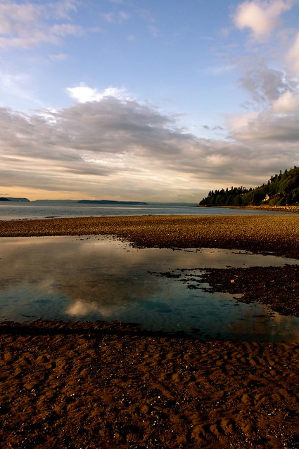
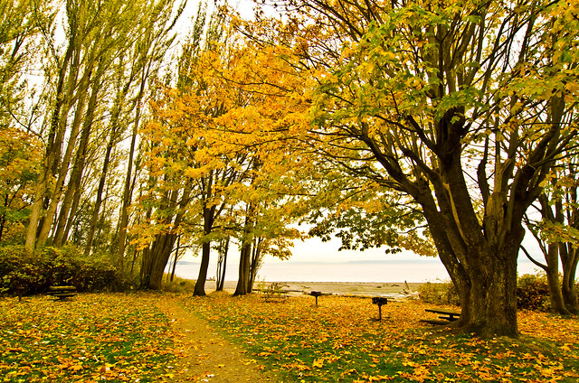
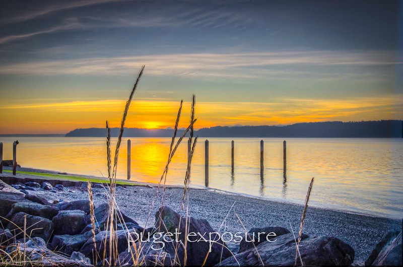
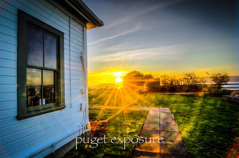
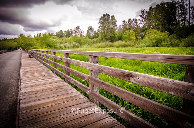
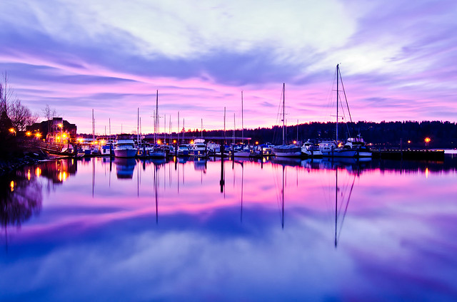
The site is one of breathtaking majesty. Situated on Magnolia Bluff overlooking Puget Sound, Discovery Park offers spectacular view of both the Cascade and the Olympic Mountain ranges. The secluded site includes two miles of protected tidal beaches as well as open meadow lands, dramatic sea cliffs, forest groves, active sand dunes, thickets and streams.


Discovery Park offers over 11 miles of trails that can be combined up into infinite variations and lengths. You can make your visit as easy or difficult as you want.

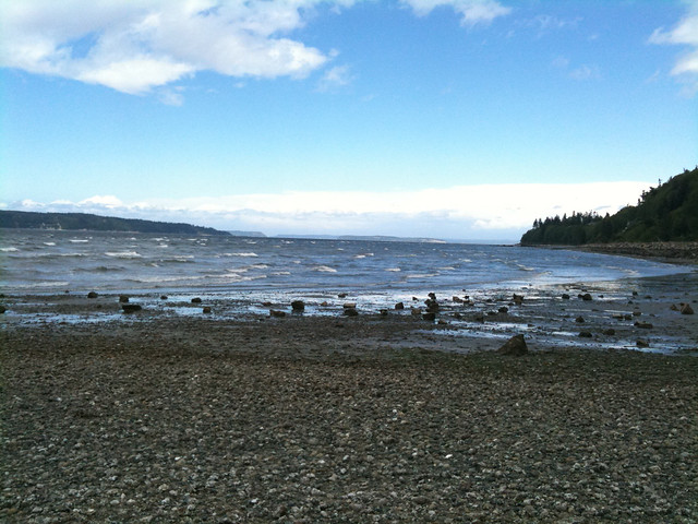
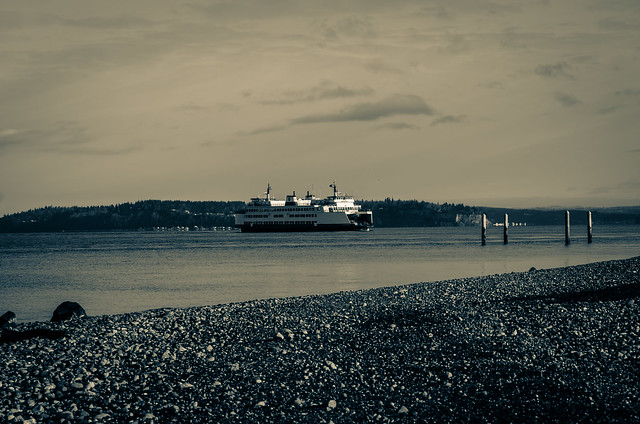
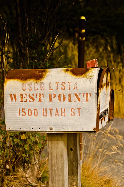
Parking in the East Parking lot you can access the loop trail and start your way down a flat, maintained trail.  You might not feel the grade drop however until you turn around and want to get back to your car. As you make your way on Loop Trail towards South Beach you will pass along a bluff where on clear days you can see across the puget sound and see Bainbridge Island. When you reach the dunes on the north side of the bluff your about 30 min into your hike and about half way down to the water. In order to get to the West Point Lighthouse you will want to continue north along the Loop Trail passing behind the Fort Lawton military housing and turn left down Utah Ave. Its a fairly steep roadway that goes for 1/4 mile until you reach the lighthouse. Keep in mind that you have to retrace your steps going uphill to get back to your car. If you or a family member has a handicapped parking permit you can drive all the way to the water via Washington Ave/Utah Ave. There is active parking enforcement and its a $47 fine if you get caught.

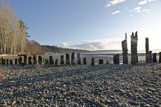
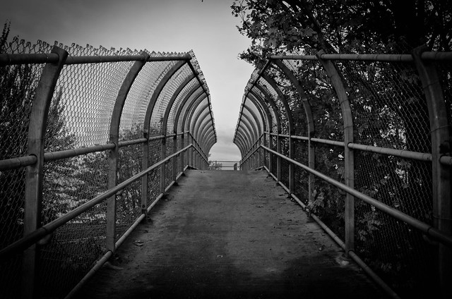
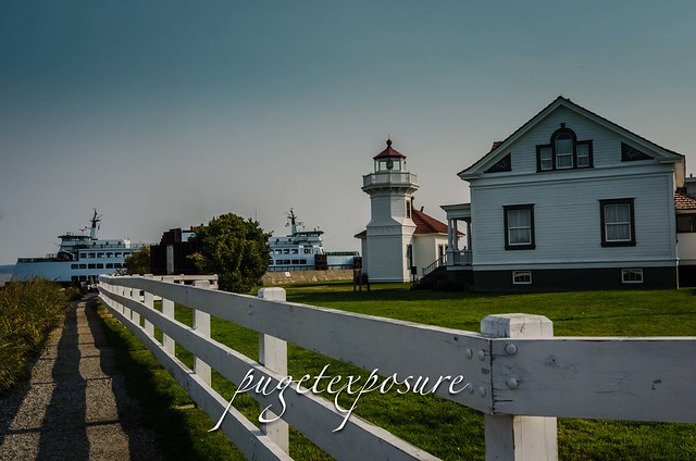
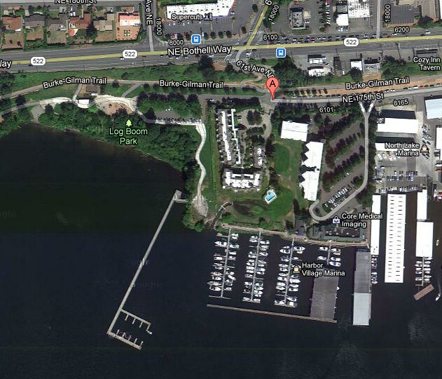
The North Park Lot along Illinois Ave attracts more of the cross country runner, jogger, Seattleite crowed. Not as many tourist make it this far into the park. Numerous trails can be accessed from the north end parking lot. Including the Loop Trail to North Beach. Its about 1.8 miles down to the water a good 35min-40 min hike down a series of stairs, unimproved trails. If your a cross country runner that loves leaping down stairs, running across creeks and gracing tree roots with your shoes this is the trail for you. Some parts are narrow for two hikers but just give way and you will be fine. Later in the afternoon more runners will appear so be ready to get passed a lot. Once you exit the lush forest and are at see level you will see Shoreline Marina off to your right and West Point Light House 1/2 mile to your left. There is a long flat trail that passes behind the water treatment facility. Least at this point 30 min in you can see the lighthouse and hear waves crashing against the rocks below you.

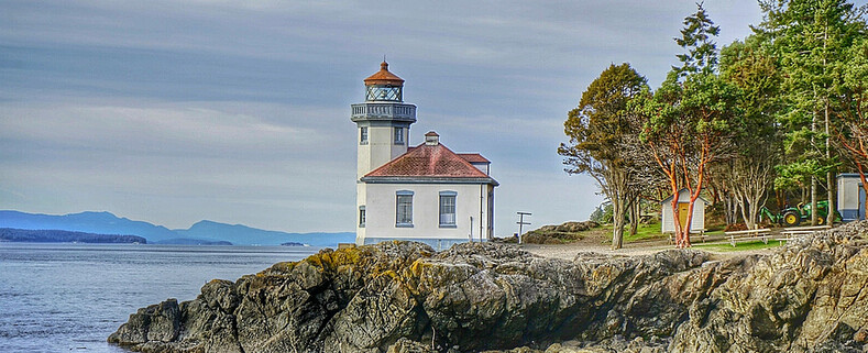
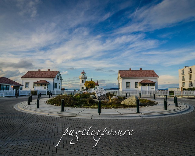
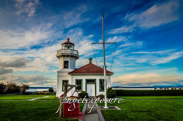
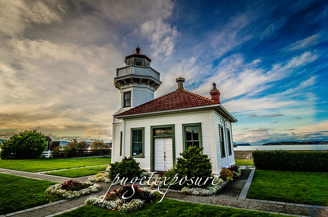
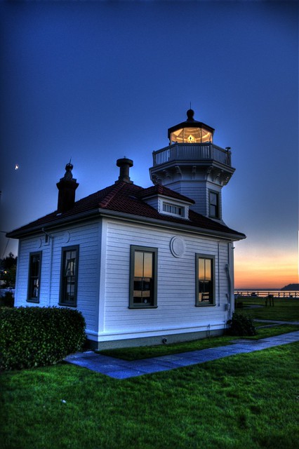
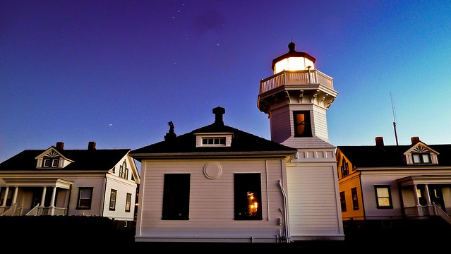
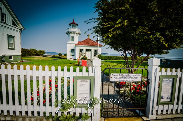
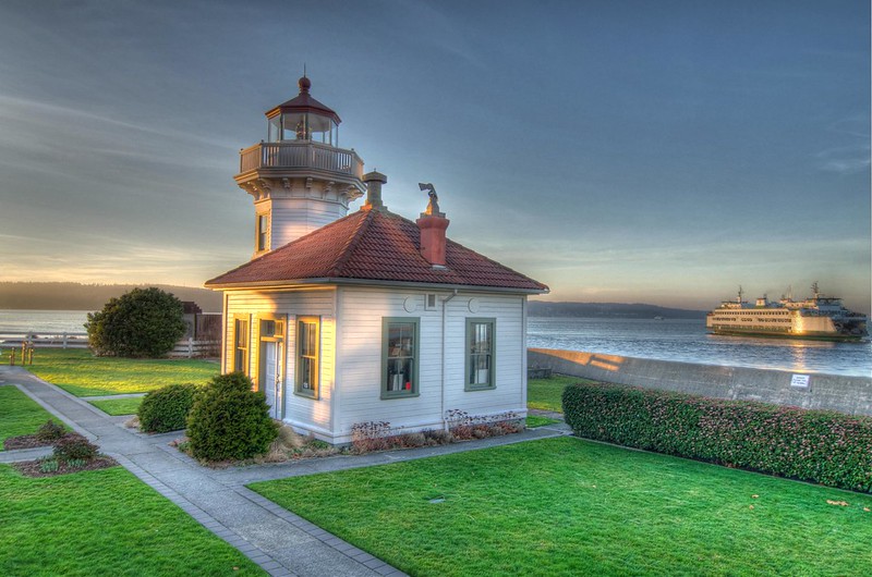
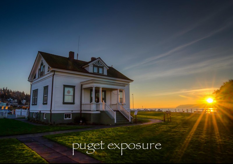
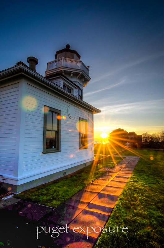
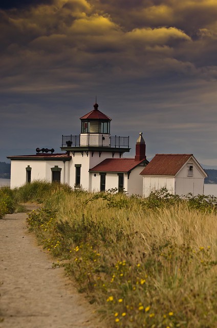
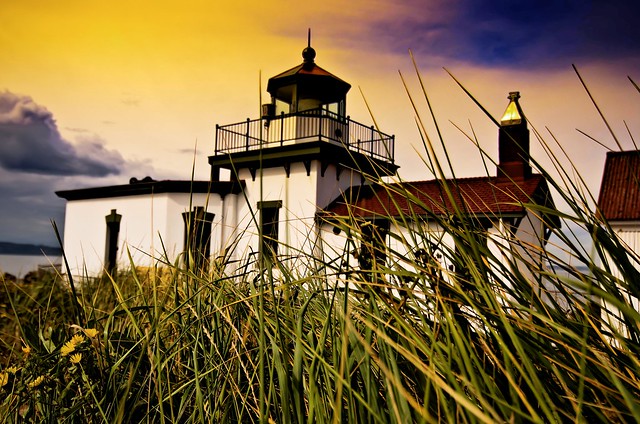
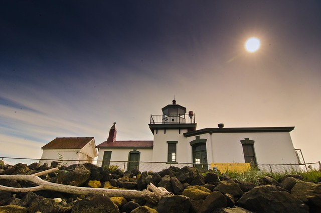
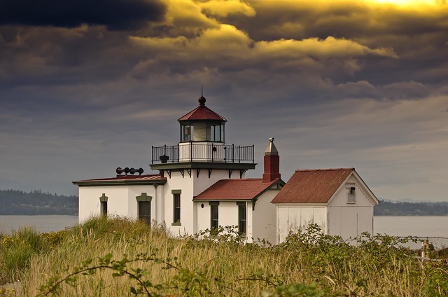
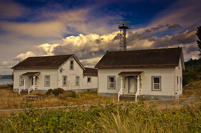
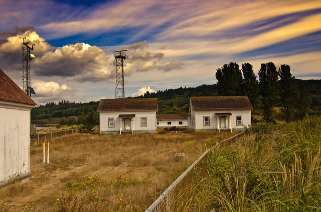
The West Point lighthouse is currently under a renovation status. The lighthouse and support building are not open to the public there is fence wrapping around the lighthouse grounds. Depending on the tide and your rock hopping skills you can make your way around the lighthouse and see it from both south and north.

West Point USCG Lighthouse - Discovery Park, Seattle, WA


West Point USCG Lighthouse - Discovery Park, Seattle, WA

West Point USCG Lighthouse - Discovery Park, Seattle, WA


West Point USCG Lighthouse - Discovery Park, Seattle, WA

West Point USCG Lighthouse - Discovery Park, Seattle, WA

West Point Lighthouse Buildings

West Point Lighthouse Buildings

USCG West Point - You've Got Mail


Gear Used:
 
lens rental Washington State travel, Washington State travel, Washington Destinations, Photography, Photography spots, best things to do in Seattle, Best things to in Washington State, Washington Tourism Alliance, Washington State Tourism board, recommendations, recommendations for things to see in washington state, things to do in washington state, things to do in seattle, things to do in Tacoma washington, Washington Photographers, Washington nikon shooters, best seattle photography, washington exploration, experience washington, what to do while visiting seattle, seattle top attractions, seattle food, Space Needle, Explore Washington State, Puget Exposure Photography, Puget Exposure, Road Trips through Washington State, Weird Washington, King County, Snohomish County, Seattle, Everett, Tacoma, Kent, Redmond, Kirkland, Washington Sunrises where and when, Washington State Weather, Discovery Park, Point Wislon Lighthouse, Lighthouse Lovers