


Walk: Little Mountain Park
Location: Mount Vernon, WA
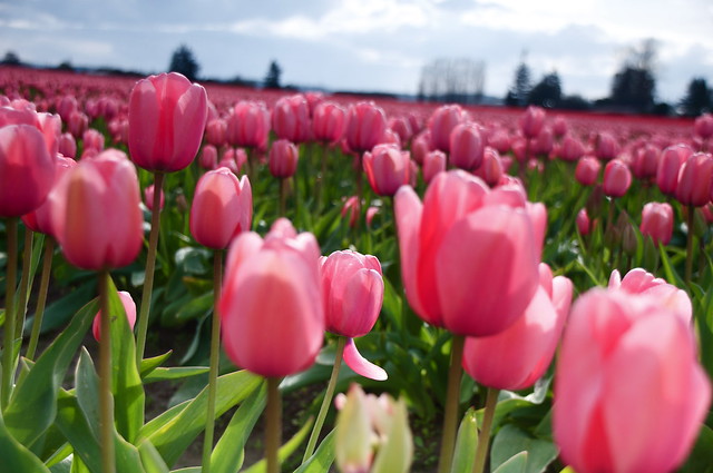
Why Visit? If your headed to the Tulips just down the road this spot will give you an aerial view of the fields and help you find the best spots to take pictures. Once on ground level it might be hard to find them. For more information on the Skagit Valley Tulips click here
Trail length: About four miles of trails; elevation gain 934 feet. Print out a trail map from the website at the end of this column; maps are not yet posted at the park.
Level of difficulty: Flat-to-moderate dirt/gravel trails (short paved path at parking lot to vault toilet and pavilion overlook).
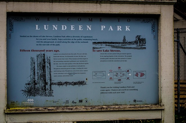
Setting: This aptly named park rises up from the Skagit Valley southeast of downtown Mount Vernon. Logged between 1914 and 1920, a portion of this park has been part of this park system since 1929, and trail and signage improvements are under way.
A narrow, paved road winds 1.5 miles up to the parking lot and two overlooks, while forested trails lace the park's 517 acres. Volunteers are giving the park's well-loved trails some TLC. For a good two-mile loop that traverses some of the reconditioned trails, park at the top, then walk down the road to the short paved path to the north viewpoint. From here, follow the path away from the road and take the first right onto the Sidewinder trail (per the trail map). Here you'll see signs of old shortcuts being blocked off by logs. Signs describe how shortcutting tramples plants and erodes hillsides. After about 0.75 mile, at the fork, go left, then immediately take the right branch (the Huff N Puff trail per the map; signed as a multipurpose trail). After a half-mile, you'll come out on the main road. You can walk back up the road (go right), or — if you have a map — take an older trail across the road that climbs back up to the parking lot.
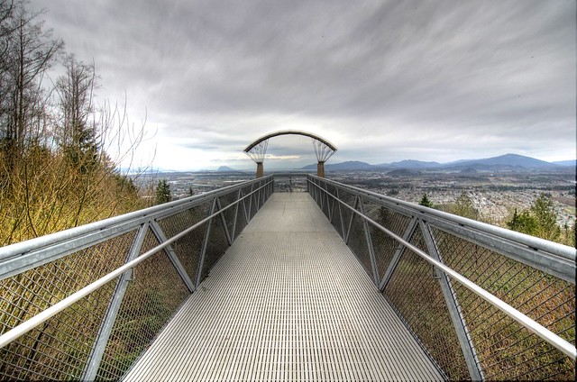
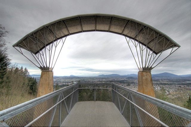
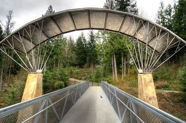
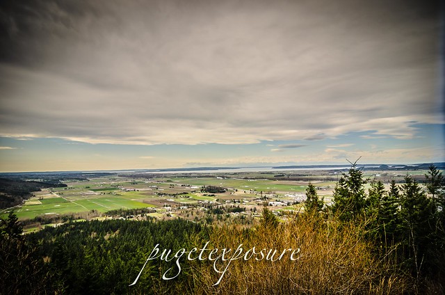
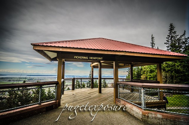
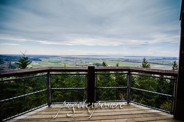
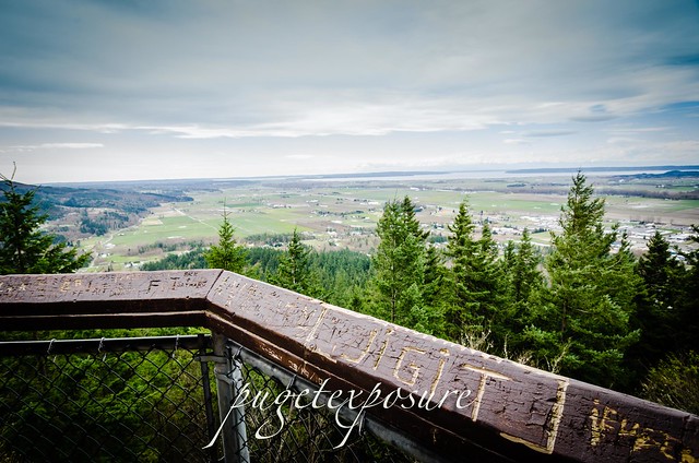
Highlights: If possible, time your visit for a clear day when you can see the stupendous views. (The Saturday farmers market in downtown Mount Vernon next to the river runs 9 a.m. to 1 p.m. through Oct. 16). The park's covered viewpoint looks out to the south and west over Skagit Valley fields, the Olympic Mountains, Puget Sound and the San Juan Islands. The north viewpoint, just below the parking lot, looks toward Mount Baker and sports a long ramp with a striking parasail-shaped arch.
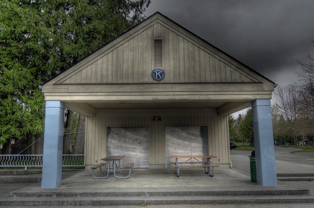
Facilities: Accessible vault toilet at parking lot; restrooms at Hillcrest Park off Blackburn Road.
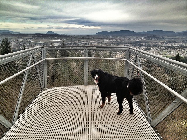
Restrictions: Leash and scoop laws in effect. Bikes not permitted on certain trails (marked). Watch for stinging nettles.
Directions: From Interstate 5, take Exit 225, and at the end of the exit ramp, turn east on Anderson Road. Immediately take the first left onto Cedarvale Road, which heads north alongside I-5. Turn right on Blackburn Road, go up the hill, and in 1.2 mile, get in the right turn lane and turn right on Little Mountain Road. In 0.5-mile, turn right into the well-marked park, and drive to the top
 Users may not manipulate or use this photo in commercial materials, advertisements, emails, products, or promotions without licensed permission
Gear Used:


Location: Mount Vernon, WA
Why Visit? If your headed to the Tulips just down the road this spot will give you an aerial view of the fields and help you find the best spots to take pictures. Once on ground level it might be hard to find them. For more information on the Skagit Valley Tulips click here
Trail length: About four miles of trails; elevation gain 934 feet. Print out a trail map from the website at the end of this column; maps are not yet posted at the park.
Level of difficulty: Flat-to-moderate dirt/gravel trails (short paved path at parking lot to vault toilet and pavilion overlook).
Setting: This aptly named park rises up from the Skagit Valley southeast of downtown Mount Vernon. Logged between 1914 and 1920, a portion of this park has been part of this park system since 1929, and trail and signage improvements are under way.
A narrow, paved road winds 1.5 miles up to the parking lot and two overlooks, while forested trails lace the park's 517 acres. Volunteers are giving the park's well-loved trails some TLC. For a good two-mile loop that traverses some of the reconditioned trails, park at the top, then walk down the road to the short paved path to the north viewpoint. From here, follow the path away from the road and take the first right onto the Sidewinder trail (per the trail map). Here you'll see signs of old shortcuts being blocked off by logs. Signs describe how shortcutting tramples plants and erodes hillsides. After about 0.75 mile, at the fork, go left, then immediately take the right branch (the Huff N Puff trail per the map; signed as a multipurpose trail). After a half-mile, you'll come out on the main road. You can walk back up the road (go right), or — if you have a map — take an older trail across the road that climbs back up to the parking lot.
Highlights: If possible, time your visit for a clear day when you can see the stupendous views. (The Saturday farmers market in downtown Mount Vernon next to the river runs 9 a.m. to 1 p.m. through Oct. 16). The park's covered viewpoint looks out to the south and west over Skagit Valley fields, the Olympic Mountains, Puget Sound and the San Juan Islands. The north viewpoint, just below the parking lot, looks toward Mount Baker and sports a long ramp with a striking parasail-shaped arch.
Facilities: Accessible vault toilet at parking lot; restrooms at Hillcrest Park off Blackburn Road.
Restrictions: Leash and scoop laws in effect. Bikes not permitted on certain trails (marked). Watch for stinging nettles.
Directions: From Interstate 5, take Exit 225, and at the end of the exit ramp, turn east on Anderson Road. Immediately take the first left onto Cedarvale Road, which heads north alongside I-5. Turn right on Blackburn Road, go up the hill, and in 1.2 mile, get in the right turn lane and turn right on Little Mountain Road. In 0.5-mile, turn right into the well-marked park, and drive to the top
Users may not manipulate or use this photo in commercial materials, advertisements, emails, products, or promotions without licensed permissionGear Used: